Old Maps of Cromwell, Connecticut
Explore 34 old maps of Cromwell, spanning from 1893 to today. These high-resolution historic maps reveal how streets, neighborhoods, landmarks, and natural features evolved over time — perfect for genealogy, metal detecting, research, and local history exploration.
What you can do with these maps:
- See how Cromwell changed over time: Compare historical maps to modern-day views to trace roads, homesites, rail lines & more.
- View detailed metadata: Each map includes creators, publishers, year, scale, and archive source.
- Overlay maps with satellite & LiDAR: Visualize the past alongside modern tools to explore terrain & human change.
- Trusted historical sources: Maps sourced from the USGS, Library of Congress, and other archives.
- Access maps your way: View online, download high-res files, or order prints for personal or research use.
Start exploring old maps of Cromwell to uncover forgotten places, hidden landmarks, and the deep history beneath your feet.
Cromwell, CT maps
(34)- 1893 Map of Middletown
 1893 Middletown1893 Print · USGSThe Connecticut River valley was a bustling corridor of industry and iron rails in the early 1890s. Genealogists and historians can trace the early streets of Middletown, the riverside docks at Portland, and the sprawling State Prison grounds in Wethersfield.10 unique versions available
 - 1906 Map of Farmington
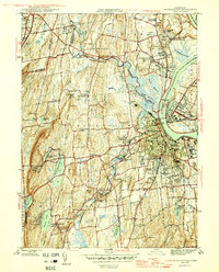
 1906 Farmington1906 Print · USGSCentral Connecticut at the turn of the century is a landscape of river-powered industry and rail-connected towns. Researchers can trace historic river crossings like Bissell Ferry and explore early village centers including Collinsville, Satans Kingdom, and Pine Meadow.2 unique versions available
 - 1928 Map of Cromwell
 1928 Cromwell1928 Print · USGSMiddlesex County emerges in high detail during the late Prohibition era as aerial photography began to modernize American cartography. Researchers can trace the rail lines of the New York New Haven and Hartford through Rockfall, Westfield, and the waterfront at Willow Island.
 - 1944 Map of Hartford South
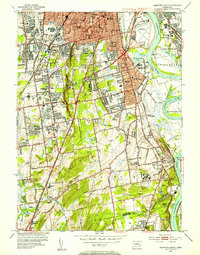
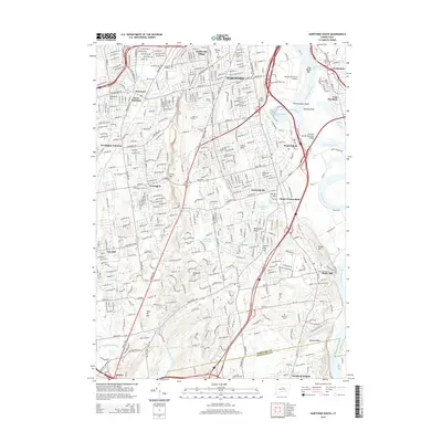
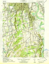 1944 Hartford South1944 Print · USGSThe southern Hartford suburbs and Wethersfield are mapped here during the mid-forties, capturing the region's dense institutional and rail network. Genealogists and local historians can trace family locations near Old South Cem or identify wartime landmarks like Bulkeley Stadium and the State Prison.3 unique versions available
 - 1945 Map of Middle Haddam
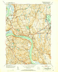
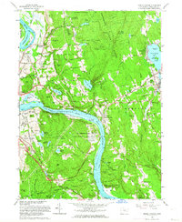
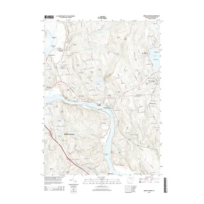
 1945 Middle Haddam1945 Print · USGSMiddlesex County life along the river comes into focus in the 1940s as the railroad connects riverside mill towns. Genealogists and historians can trace family roots through the Portland Burying Ground, Eureka Mill, and the riverside Middle Haddam.2 unique versions available
 - 1945 Map of Middletown
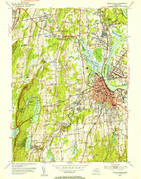
 1945 Middletown1945 Print · USGSThe industrial and academic heart of the Connecticut River valley is captured here in the mid-1940s. Genealogists and historians can trace the campuses of Wesleyan University, local institutions like the Swedish Orphanage, and neighborhood landmarks in South Farms.2 unique versions available
 - 1947 Map of Hartford, 1955 Print
 1947 Hartford1955 Print · USGSSouthern New England and the Hudson Valley are shown in detail during the post-war expansion era. Genealogists and researchers can trace local landmarks from the State Capitol and Yale University to the Stratford Lighthouse and Woodlawn Cem.2 unique versions available
 - 1948 Map of Hartford
 1948 Hartford1948 Print · USGSSouthern New England is captured here in the late 1940s, showcasing a landscape of thriving industrial cities and developing parkways. Genealogists and historians can trace the rail networks of the New York New Haven and Hartford RR or locate coastal defense sites like Fort Terry and Camp Shanks.2 unique versions available
 - 1952 Map of Middle Haddam, 1953 Print
 1952 Middle Haddam1953 Print · USGSMiddlesex County's riverfront communities are captured in the early 1950s as they balanced river-based industry with growing recreational areas. Researchers can trace family sites at Swedish Cem, Haddam Neck Ch, and landmarks like Eureka Mill.3 unique versions available
 - 1952 Map of Middletown, 1954 Print
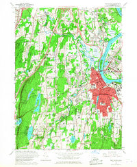
 1952 Middletown1954 Print · USGSThe Connecticut River valley thrives in the early fifties as Middletown and Portland expand around their industrial and academic roots. Genealogists and historians can locate Indian Hill Cemetery, the Swedish Orphanage, and the old Brazos Quarry.3 unique versions available
 - 1952 Map of Hartford South, 1954 Print
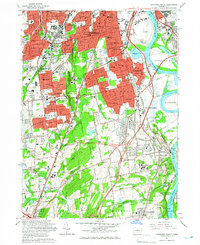
 1952 Hartford South1954 Print · USGSGreater Hartford and the Connecticut River valley are shown during a period of rapid suburban growth in the early fifties. Genealogists and historians can locate family landmarks like the Cedar Hill Cemetery, Trinity College, and the State Veterans Home.4 unique versions available
 - 1961 Map of Hartford
 1961 Hartford1961 Print · USGSSouthern New England and the Hudson Valley are shown here in the mid-fifties, capturing a landscape of booming coastal cities and interior hill towns. Researchers can trace the legacy of the New York New Haven and Hartford rail corridor and find strategic sites like Camp Shanks and Fort Michie.
 - 1961 Map of Middle Haddam, 1964 Print
 1961 Middle Haddam1964 Print · USGSMiddlesex County in the early sixties shows a landscape of deep river bends and growing valley towns. Genealogists can trace family names through the Portland Burying Ground, while historians can locate the Eureka Mill and the Atomic Energy Commission US Reservation.5 unique versions available
 - 1962 Map of Hartford, 1971 Print
 1962 Hartford1971 Print · USGSSouthern New England and the Hudson Valley are shown in the early sixties, as suburban growth reached into the foothills. Trace the path of the New York New Haven & Hartford RR and find landmarks like Camp Nathan Hale and Gillette Castle State Park.3 unique versions available
 - 1964 Map of Hartford South, 1966 Print
 1964 Hartford South1966 Print · USGSThe Hartford suburbs and Connecticut River valley are shown in detail during the mid-sixties growth period. Genealogists can trace family plots in Cedar Hill Cemetery and locate landmarks like Trinity College or the State Veterans Home.5 unique versions available
 - 1965 Map of Hartford
 1965 Hartford1965 Print · USGSSouthern New England and the Hudson Valley are shown here during the mid-sixties expansion of the Interstate era. Trace the path of the New York New Haven & Hartford RR or locate historic landmarks like West Point Military Reservation and the Merritt Parkway.2 unique versions available
 - 1965 Map of Middletown, 1968 Print
 1965 Middletown1968 Print · USGSMiddletown and its riverfront neighbors are captured here in the mid-sixties, showcasing a landscape of academic prestige and industrial legacy. Genealogists and historians can trace institutional roots at Wesleyan University or find family markers in Indian Hill Cemetery and St Johns Cem.5 unique versions available
 - 1986 Map of Hartford
 1986 Hartford1986 Print · USGSCentral Connecticut and the surrounding highlands were undergoing significant suburban growth and industrial transition during the mid-eighties. Researchers can trace the layout of regional landmarks including Bradley International Airport, the University of Connecticut, and the historic State Capitol.
 - 1994 Map of Hartford, 1995 Print
 1994 Hartford1995 Print · USGSGreater Hartford and the Connecticut River Valley are captured here in the mid-nineties, showing the dense intersection of industry and academia. Trace the urban footprint of the State Capitol and Trinity College or locate the sprawling grounds of the University of Connecticut.2 unique versions available
 - 2012 Map of Middle Haddam, 2012 Print
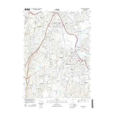
 2012 Middle Haddam2012 Print · USGSCovers Cromwell, including Middletown, East Hampton, and other nearby areas
 - 2012 Map of Middletown, 2012 Print
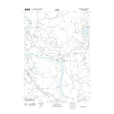
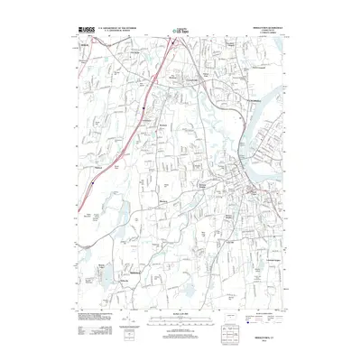 2012 Middletown2012 Print · USGSCovers Cromwell, including Meriden, Middletown, and other nearby areas
 - 2012 Map of Hartford South, 2012 Print
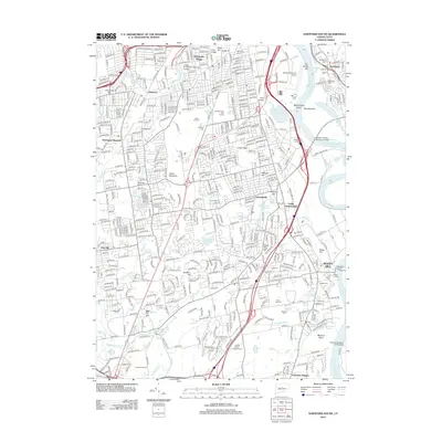 2012 Hartford South2012 Print · USGSCovers Cromwell, including Hartford, West Hartford, and other nearby areas
 - 2015 Map of Middletown, 2015 Print
 2015 Middletown2015 Print · USGSCovers Cromwell, including Meriden, Middletown, and other nearby areas
 - 2015 Map of Hartford South, 2015 Print
 2015 Hartford South2015 Print · USGSCovers Cromwell, including Hartford, West Hartford, and other nearby areas
 - 2015 Map of Middle Haddam, 2015 Print
 2015 Middle Haddam2015 Print · USGSCovers Cromwell, including Middletown, East Hampton, and other nearby areas
Showing maps 1-25 of 34
Top cities near Cromwell
- Hartford historical maps
- New Britain historical maps
- West Hartford historical maps
- Meriden historical maps
- Bristol historical maps
- Hamden historical maps
See more
Top neighborhoods of Cromwell
- North Cromwell historical maps
- Oxford Park historical maps
- Goodrich Heights historical maps
- Main Street Historic District historical maps
Frequently asked questions
- What are the different types of historical maps available for Cromwell?
- What is the oldest map of Cromwell?
- Where can I purchase historical maps of Cromwell for my home or office?
- Where can I download high-res historical maps of Cromwell?
- Are there historical topographic maps available for Cromwell?
- Is there historical aerial imagery available for Cromwell?
- Where are historical maps of Cromwell sourced from?