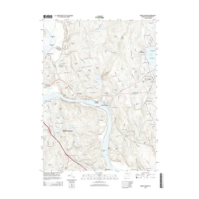
2015 Map of Middle Haddam
USGS Topo · Published 2015About this map
The Connecticut River defines this landscape, carving through the valley past the riverfront communities of Middletown, Portland, and Middle Haddam. This era shows the developed riverbanks near Pistol Point Bar and Gildersleeve Island, where the water transitions into the narrow channel of The Straits. Higher elevations are marked by historical landmarks like Strickland Hill and the Bald Hill Range, with numerous cemeteries such as the Portland Burying Ground and Saint Patricks Cem serving as markers of the area's long settlement history.
Find a feature on this map
113 named features on this map. Tap any name to fly to it.
Don’t see what you’re looking for? This feature index may not catch every label — zoom into the map to look around manually.
Map Details
Editions of this 2015 Middle Haddam Map
This is the sole edition of this map. No revisions or reprints were ever made.
Other maps of this area

1892 · Gilead
USGS Topo · 1:62,500

1893 · Guilford
USGS Topo · 1:62,500

1893 · Middletown
USGS Topo · 1:62,500

1893 · Saybrook
USGS Topo · 1:62,500

1906 · Farmington
USGS Topo · 1:125,000

1928 · Cromwell
USGS Topo · 1:24,000

1928 · Glastonbury
USGS Topo · 1:24,000

1943 · Durham
USGS Topo · 1:25,000

1944 · Hartford South
USGS Topo · 1:31,680

1944 · Marlboro
USGS Topo · 1:31,680