
1944 Map of Hartford South
USGS Topo · Published 1944About this map
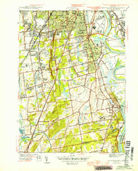
Hartford and its southern suburbs appear during the height of the Second World War, showing a landscape defined by institutional development and a densely settled river corridor. The eastern edge of the map follows the Connecticut River, where the Keeney Point area and The Cove separate the residential centers from the floodplain. The interior is heavily marked by state and local institutions, including the State Prison in Wethersfield, the Cedar Hill Cem, and the State Institute for Blind.
Find a feature on this map
86 named features on this map. Tap any name to fly to it.
Don’t see what you’re looking for? This feature index may not catch every label — zoom into the map to look around manually.
Map Details
Editions of this 1944 Hartford South Map
3 editions found
Other maps of this area

1892 · Hartford
USGS Topo · 1:62,500

1892 · Meriden
USGS Topo · 1:62,500

1892 · Granby
USGS Topo · 1:62,500

1893 · Middletown
USGS Topo · 1:62,500

1893 · Meriden
USGS Topo · 1:62,500

1906 · Farmington
USGS Topo · 1:125,000

1928 · Cromwell
USGS Topo · 1:24,000

1928 · Windsor
USGS Topo · 1:24,000

1928 · Glastonbury
USGS Topo · 1:24,000

1928 · Manchester
USGS Topo · 1:24,000