Old Maps of Naugatuck, Connecticut for Genealogy
Trace your family roots with 30 historic maps of Naugatuck. These high-res maps reveal old neighborhoods, homesites, landmarks, and streets — helping you uncover where your ancestors lived and how the area evolved over time.
- Explore historic neighborhoods: Identify where your relatives may have lived in the 1800s or 1900s.
- Compare maps over time: Trace the changes in streets, buildings, and landmarks for multi-generational research.
- Perfect for genealogy & ancestry research: Used by family historians and researchers to map out lineage and migration.
These maps are an incredible resource for exploring your personal connection to Naugatuck's past.
Naugatuck, CT maps
(30)- 1889 Map of Derby
 1889 Derby1889 Print · USGSThe industrial Naugatuck Valley hums with activity in the late Victorian era as railroads and river power drive the growth of Connecticut's mill towns. Genealogists can trace family holdings near John Johnson Hill or explore the early street layouts of BIRMINGHAM, ANSONIA, and SEYMOUR.
 - 1891 Map of Derby
 1891 Derby1891 Print · USGSThe industrial Naugatuck Valley and the rural hills of Oxford come to life in the late nineteenth century. Genealogists and historians can trace the early footprints of Birmingham, Ansonia, and Derby or locate outlying hamlets like Quaker Farms and Red City.
 - 1893 Map of Waterbury
 1893 Waterbury1893 Print · USGSWestern Connecticut in the late nineteenth century was defined by the industrial pulse of the Naugatuck valley and the quiet hills to its west. Genealogists and historians can trace the early rail alignments of the Northern R. R. and locate family landmarks like White Deer Rocks or the village of Hotchkissville.2 unique versions available
 - 1893 Map of Derby, 1898 Print
 1893 Derby1898 Print · USGSLower Naugatuck Valley industry and rural hill towns are captured in detail during the 1890s as the rail network reached its peak. Researchers can trace the industrial hearts of Birmingham and Derby or locate old crossings like Zoar Bridge and Pines Bridge.9 unique versions available
 - 1904 Map of Waterbury
 1904 Waterbury1904 Print · USGSThe Naugatuck River valley's industrial peak and the surrounding Litchfield Hills are captured here at the start of the twentieth century. Researchers can trace the early rail networks of the Naugatuck Division and find old local landmarks like Reynolds Bridge, Quassapaug Pond, and Hotchkissville.8 unique versions available
 - 1904 Map of Litchfield
 1904 Litchfield1904 Print · USGSThe Litchfield Hills at the turn of the century are shown here as a landscape of iron heritage and river-powered industry. Genealogists and historians can locate old industrial sites like Kent Furnace, ancestral homes near Sharon Valley, and early rail stops at Limerock Sta..3 unique versions available
 - 1943 Map of Naugatuck, 1947 Print
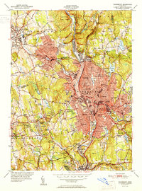
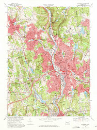
 1943 Naugatuck1947 Print · USGSThe Naugatuck Valley at the height of its industrial era is captured here, tracing the river's path through the high hills of New Haven County. Researchers can locate family landmarks near Straitsville, the Seymour Reservoirs, and along the New York New Haven and Hartford rail line.2 unique versions available
 - 1947 Map of Hartford, 1955 Print
 1947 Hartford1955 Print · USGSSouthern New England and the Hudson Valley are shown in detail during the post-war expansion era. Genealogists and researchers can trace local landmarks from the State Capitol and Yale University to the Stratford Lighthouse and Woodlawn Cem.2 unique versions available
 - 1948 Map of Hartford
 1948 Hartford1948 Print · USGSSouthern New England is captured here in the late 1940s, showcasing a landscape of thriving industrial cities and developing parkways. Genealogists and historians can trace the rail networks of the New York New Haven and Hartford RR or locate coastal defense sites like Fort Terry and Camp Shanks.2 unique versions available
 - 1951 Map of Waterbury
 1951 Waterbury1951 Print · USGSMid-century New Haven County is captured here at a moment of dense urban growth and industrial activity along the Naugatuck River. Genealogists and researchers can pinpoint family landmarks from Riverside Cemetery to the Brookside Home for the Aged and numerous parochial and public schools.2 unique versions available
 - 1954 Map of Naugatuck, 1956 Print
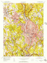
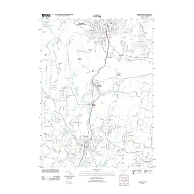
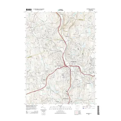
 1954 Naugatuck1956 Print · USGSThe Naugatuck Valley is shown at a mid-century industrial peak, with neighborhoods and factories clustered along the Naugatuck River. Genealogists can trace family footprints through numerous local institutions like Tuttle Sch, St James Cem, and the old rail stops at Union City.3 unique versions available
 - 1955 Map of Waterbury, 1957 Print
 1955 Waterbury1957 Print · USGSWaterbury and the Naugatuck Valley are shown here during a period of significant post-war growth and industrial activity. Researchers can trace historic institutions and neighborhoods from Riverside Cemetery to the Taft Sch and the New York New Haven and Hartford RR corridor.2 unique versions available
 - 1961 Map of Hartford
 1961 Hartford1961 Print · USGSSouthern New England and the Hudson Valley are shown here in the mid-fifties, capturing a landscape of booming coastal cities and interior hill towns. Researchers can trace the legacy of the New York New Haven and Hartford rail corridor and find strategic sites like Camp Shanks and Fort Michie.
 - 1962 Map of Hartford, 1971 Print
 1962 Hartford1971 Print · USGSSouthern New England and the Hudson Valley are shown in the early sixties, as suburban growth reached into the foothills. Trace the path of the New York New Haven & Hartford RR and find landmarks like Camp Nathan Hale and Gillette Castle State Park.3 unique versions available
 - 1964 Map of Naugatuck, 1967 Print
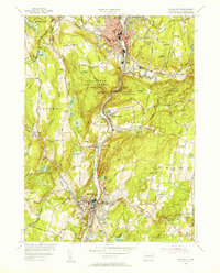
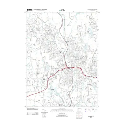
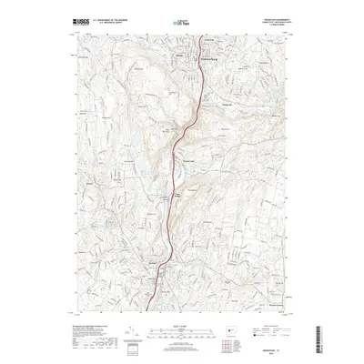
 1964 Naugatuck1967 Print · USGSThe Naugatuck Valley in the mid-1960s shows a landscape of dense riverside industry and steep wooded hills. Genealogists and historians can trace neighborhood landmarks like St Francis Ch, old burial grounds like St James Cem, and the path of the New Haven RR.6 unique versions available
 - 1965 Map of Hartford
 1965 Hartford1965 Print · USGSSouthern New England and the Hudson Valley are shown here during the mid-sixties expansion of the Interstate era. Trace the path of the New York New Haven & Hartford RR or locate historic landmarks like West Point Military Reservation and the Merritt Parkway.2 unique versions available
 - 1968 Map of Waterbury, 1971 Print
 1968 Waterbury1971 Print · USGSWaterbury and Watertown appear here during a period of significant suburban expansion and highway development in the late sixties. Genealogists and local historians can trace family plots in Riverside Cemetery or locate historic institutions like the Taft School and Waterbury State Technical Institute.4 unique versions available
 - 1985 Map of Waterbury, 1986 Print
 1985 Waterbury1986 Print · USGSThe Western Connecticut highlands and the Hudson Valley are captured in the mid-1980s, showing a landscape of deep forests and industrial river towns. Genealogists can trace family connections from Waterbury up through Litchfield and Torrington, while exploring the vast Barkhamsted Reservoir and Candlewood Lake basins.
 - 1986 Map of Bridgeport
 1986 Bridgeport1986 Print · USGSSpanning the New York and Connecticut border in the mid-eighties, this survey shows the dense rail and parkway network connecting the Hudson to the Sound. Researchers can trace the massive New Croton Reservoir system or locate landmarks like the West Point U.S. Military Academy.3 unique versions available
 - 1993 Map of Waterbury
 1993 Waterbury1993 Print · USGSWestern Connecticut and the Hudson Valley appear in the early nineties as a landscape of established industrial cities and deep forest preserves. Researchers can trace the rail corridors of the Metro-North Railroad or locate family sites near the Taft School and Riverside Cemetery.
 - 2012 Map of Naugatuck, 2012 Print
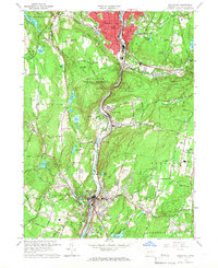
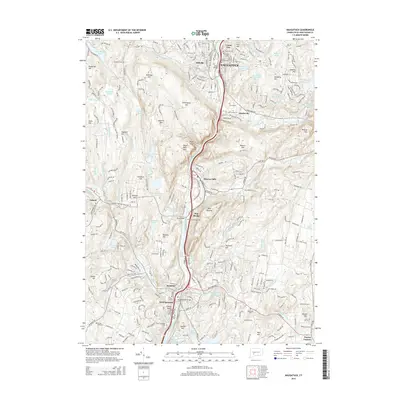
 2012 Naugatuck2012 Print · USGSCovers Naugatuck, including Seymour, Oxford, and other nearby areas
 - 2012 Map of Waterbury, 2012 Print
 2012 Waterbury2012 Print · USGSCovers Naugatuck, including Waterbury, Watertown, and other nearby areas
 - 2015 Map of Naugatuck, 2015 Print
 2015 Naugatuck2015 Print · USGSCovers Naugatuck, including Seymour, Oxford, and other nearby areas
 - 2015 Map of Waterbury, 2015 Print
 2015 Waterbury2015 Print · USGSCovers Naugatuck, including Waterbury, Watertown, and other nearby areas
 - 2018 Map of Naugatuck, 2018 Print
 2018 Naugatuck2018 Print · USGSCovers Naugatuck, including Seymour, Oxford, and other nearby areas
Showing maps 1-25 of 30
Top cities near Naugatuck
- New Haven historical maps
- Waterbury historical maps
- Meriden historical maps
- Bristol historical maps
- Hamden historical maps
- West Haven historical maps
See more
Top neighborhoods of Naugatuck
- Millville historical maps
- Straitsville historical maps
- Union City historical maps
- Glen Ridge historical maps
- Platts Mills historical maps
Frequently asked questions
- What are the different types of historical maps available for Naugatuck?
- What is the oldest map of Naugatuck?
- Where can I purchase historical maps of Naugatuck for my home or office?
- Where can I download high-res historical maps of Naugatuck?
- Are there historical topographic maps available for Naugatuck?
- Is there historical aerial imagery available for Naugatuck?
- Where are historical maps of Naugatuck sourced from?