Old Maps of Bethel, Connecticut for Metal Detecting
Plan your next treasure hunt with 39 historic maps of Bethel. Find old homesites, ghost towns, trails, and gathering spots that may be lost to time — perfect for identifying promising metal detecting locations.
- Locate forgotten sites: Uncover places like long-lost settlements, abandoned rail lines, or gathering spots.
- Plan better hunts: Use map overlays combined with LiDAR or satellite views to narrow in on historically rich areas.
- Made for detectorists: Thousands of hobbyists use these maps to discover relics, coins, and hidden history.
Use these historic maps to boost your research and find new opportunities beneath the surface of Bethel.
Bethel, CT maps
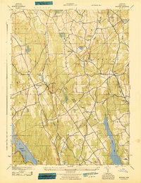
(39)- 1892 Map of Danbury
 1892 Danbury1892 Print · USGSFairfield County thrived as a railroad and industrial hub in the late nineteenth century. Genealogists and researchers can trace old neighborhoods in Danbury and Bethel, or locate landmarks like the Putnam Monument and Sandy Hook Station.11 unique versions available
 - 1915 Map of Danbury, 1921 Print
 1915 Danbury1921 Print · USGSFairfield County in the early twentieth century was a hub of railway activity and village life. Genealogists and historians can trace the tracks of the Housatonic Railroad and locate local landmarks like the Fair Grounds or the Putnam Monument.
 - 1943 Map of Botsford
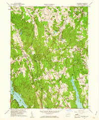
 1943 Botsford1943 Print · USGSFairfield County towns like Botsford and Stepney appear here during the early years of the war, showcasing a landscape of ridge-top villages and new reservoirs. Genealogists and historians can trace rail connections at Botsford Sta or locate family sites near Hattertown and Redding Ridge.
 - 1947 Map of Hartford, 1955 Print
 1947 Hartford1955 Print · USGSSouthern New England and the Hudson Valley are shown in detail during the post-war expansion era. Genealogists and researchers can trace local landmarks from the State Capitol and Yale University to the Stratford Lighthouse and Woodlawn Cem.2 unique versions available
 - 1948 Map of Hartford
 1948 Hartford1948 Print · USGSSouthern New England is captured here in the late 1940s, showcasing a landscape of thriving industrial cities and developing parkways. Genealogists and historians can trace the rail networks of the New York New Haven and Hartford RR or locate coastal defense sites like Fort Terry and Camp Shanks.2 unique versions available
 - 1951 Map of Botsford, 1953 Print
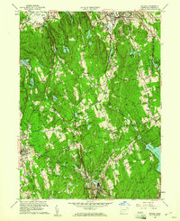
 1951 Botsford1953 Print · USGSFairfield County towns like Botsford and Easton appear in the early fifties as a landscape of traditional villages and vital water infrastructure. Genealogists and historians can trace family-named landmarks like Codfish Hill or locate old community hubs such as Hopewell School and St Patricks Ch.3 unique versions available
 - 1951 Map of Bethel, 1953 Print
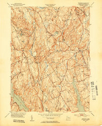
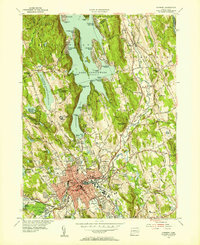
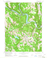
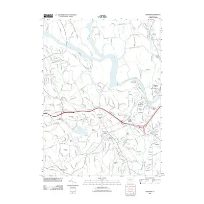
 1951 Bethel1953 Print · USGSFairfield County towns like Bethel and Redding are shown in the early fifties during a period of steady growth along the New York New Haven and Hartford rail line. Researchers can trace historic local sites such as the Putnam Memorial Camp Grounds, St Marys Cem, and the old New Redding Sch.2 unique versions available
 - 1953 Map of Newtown, 1955 Print
 1953 Newtown1955 Print · USGSFairfield and New Haven Counties appear here in the early fifties, showing a region defined by river valleys and institutional growth. Researchers can locate family sites at Saint Rose Cem, trace the rail lines through Hawleyville, or explore the grounds of the Fairfield State Hospital.3 unique versions available
 - 1953 Map of Danbury, 1955 Print
 1953 Danbury1955 Print · USGSMid-century Danbury and its surrounding hills show a landscape shaped by the waters of Lake Candlewood and the Still River. Trace the early development of Candlewood Isle, the historic Danbury Fairgrounds, and the State Teachers College.2 unique versions available
 - 1959 Map of Botsford, 1961 Print
 1959 Botsford1961 Print · USGSFairfield County in the late fifties shows a landscape of growing reservoirs and historic hill settlements. Genealogists and historians can locate family landmarks like Morgan Cem and Huntingtown Cem or trace the early paths of Limekiln Road and Sport Hill Road.2 unique versions available
 - 1959 Map of Bethel, 1961 Print
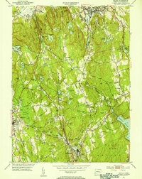
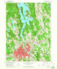
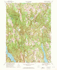
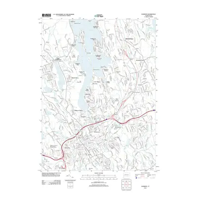
 1959 Bethel1961 Print · USGSFairfield County towns like Bethel and Ridgefield are shown during the late fifties as suburban growth began to meet the older rail corridors. Researchers can trace historic property lines and community landmarks including Putnam Memorial State Park, the Redding School, and Nod Hill.2 unique versions available
 - 1961 Map of Hartford
 1961 Hartford1961 Print · USGSSouthern New England and the Hudson Valley are shown here in the mid-fifties, capturing a landscape of booming coastal cities and interior hill towns. Researchers can trace the legacy of the New York New Haven and Hartford rail corridor and find strategic sites like Camp Shanks and Fort Michie.
 - 1962 Map of Hartford, 1971 Print
 1962 Hartford1971 Print · USGSSouthern New England and the Hudson Valley are shown in the early sixties, as suburban growth reached into the foothills. Trace the path of the New York New Haven & Hartford RR and find landmarks like Camp Nathan Hale and Gillette Castle State Park.3 unique versions available
 - 1963 Map of Danbury, 1965 Print
 1963 Danbury1965 Print · USGSMid-century Danbury and its surrounding lakefront communities are caught here at a peak of postwar growth. Genealogists and local historians can trace the development of Candlewood Isle, locate the historic Old Main St Cem, or study the grounds of the Danbury Fairgrounds.4 unique versions available
 - 1963 Map of Newtown, 1965 Print
 1963 Newtown1965 Print · USGSFairfield and New Haven Counties appear here in the early sixties, as the river valleys and rail lines continued to shape local industry and institutional life. Researchers can trace the grounds of the Fairfield State Hospital and find family sites at Lands End Cem or Newtown Village Cem.4 unique versions available
 - 1965 Map of Hartford
 1965 Hartford1965 Print · USGSSouthern New England and the Hudson Valley are shown here during the mid-sixties expansion of the Interstate era. Trace the path of the New York New Haven & Hartford RR or locate historic landmarks like West Point Military Reservation and the Merritt Parkway.2 unique versions available
 - 1969 Map of Botsford, 1971 Print
 1969 Botsford1971 Print · USGSFairfield County's rolling hills and watersheds are captured here in the late sixties as suburban growth met long-standing rural hamlets. Trace the legacy of early families and infrastructure at Tashua Burial Ground, the Penn Central line, and Redding Ridge.4 unique versions available
 - 1970 Map of Bethel, 1973 Print
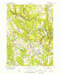
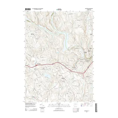
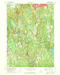 1970 Bethel1973 Print · USGSFairfield County towns like Bethel and Redding are shown in the early seventies, balancing industrial roots with growing suburban neighborhoods. Genealogists can trace family landmarks and sites like Umpawaug Cemetery, St Andrews Ch, and the Penn Central rail line.3 unique versions available
 - 1986 Map of Bridgeport
 1986 Bridgeport1986 Print · USGSSpanning the New York and Connecticut border in the mid-eighties, this survey shows the dense rail and parkway network connecting the Hudson to the Sound. Researchers can trace the massive New Croton Reservoir system or locate landmarks like the West Point U.S. Military Academy.3 unique versions available
 - 2012 Map of Botsford, 2012 Print
 2012 Botsford2012 Print · USGSCovers Bethel, including Trumbull, Monroe, and other nearby areas
 - 2012 Map of Newtown, 2012 Print
 2012 Newtown2012 Print · USGSCovers Bethel, including Southbury, Brookfield, and other nearby areas
 - 2012 Map of Danbury, 2012 Print
 2012 Danbury2012 Print · USGSCovers Bethel, including Danbury, Brookfield, and other nearby areas
 - 2012 Map of Bethel, 2012 Print
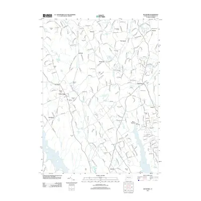
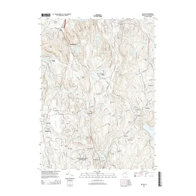
 2012 Bethel2012 Print · USGSCovers Bethel, including Danbury, Wilton, and other nearby areas
 - 2015 Map of Newtown, 2015 Print
 2015 Newtown2015 Print · USGSCovers Bethel, including Southbury, Brookfield, and other nearby areas
 - 2015 Map of Bethel, 2015 Print
 2015 Bethel2015 Print · USGSCovers Bethel, including Danbury, Wilton, and other nearby areas
Showing maps 1-25 of 39
Top cities near Bethel
- Bridgeport historical maps
- Stamford historical maps
- Norwalk historical maps
- Danbury historical maps
- Fairfield historical maps
- Shelton historical maps
See more
Top neighborhoods of Bethel
Frequently asked questions
- What are the different types of historical maps available for Bethel?
- What is the oldest map of Bethel?
- Where can I purchase historical maps of Bethel for my home or office?
- Where can I download high-res historical maps of Bethel?
- Are there historical topographic maps available for Bethel?
- Is there historical aerial imagery available for Bethel?
- Where are historical maps of Bethel sourced from?