Old Maps of Ward 5, Washington
Explore 26 old maps of Ward 5, spanning from 1890 to today. These high-resolution historic maps reveal how streets, neighborhoods, landmarks, and natural features evolved over time — perfect for genealogy, metal detecting, research, and local history exploration.
What you can do with these maps:
- See how Ward 5 changed over time: Compare historical maps to modern-day views to trace roads, homesites, rail lines & more.
- View detailed metadata: Each map includes creators, publishers, year, scale, and archive source.
- Overlay maps with satellite & LiDAR: Visualize the past alongside modern tools to explore terrain & human change.
- Trusted historical sources: Maps sourced from the USGS, Library of Congress, and other archives.
- Access maps your way: View online, download high-res files, or order prints for personal or research use.
Start exploring old maps of Ward 5 to uncover forgotten places, hidden landmarks, and the deep history beneath your feet.
Ward 5, Washington maps
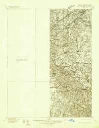
(26)- 1890 Map of Mt. Vernon
 1890 Mt. Vernon1890 Print · USGSCovers Ward 5, including Washington, Arlington, and other nearby areas
 - 1891 Map of Mt. Vernon
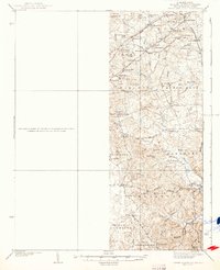
 1891 Mt. Vernon1891 Print · USGSCovers Ward 5, including Washington, Arlington, and other nearby areas
 - 1894 Map of Mt. Vernon, 1904 Print
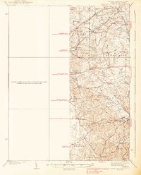
 1894 Mt. Vernon1904 Print · USGSCovers Ward 5, including Washington, Arlington, and other nearby areas6 unique versions available
 - 1897 Map of Mt. Vernon
 1897 Mt. Vernon1897 Print · USGSCovers Ward 5, including Washington, Arlington, and other nearby areas2 unique versions available
 - 1899 Map of Patuxent
 1899 Patuxent1899 Print · USGSCovers Ward 5, including Washington, Waldorf, and other nearby areas3 unique versions available
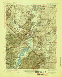
 - 1900 Map of Washington
 1900 Washington1900 Print · USGSCovers Ward 5, including Washington, Arlington, and other nearby areas2 unique versions available
 - 1906 Map of Patuxent
 1906 Patuxent1906 Print · USGSCovers Ward 5, including Washington, Waldorf, and other nearby areas4 unique versions available
 - 1934 Map of Upper Marlboro (east half)
 1934 Upper Marlboro (east half)1934 Print · USGSCovers Ward 5, including Washington, Silver Spring, and other nearby areas2 unique versions available
 - 1937 Map of Upper Marlboro
 1937 Upper Marlboro1937 Print · USGSCovers Ward 5, including Washington, Silver Spring, and other nearby areas
 - 1938 Map of Upper Marlboro
 1938 Upper Marlboro1938 Print · USGSCovers Ward 5, including Washington, Silver Spring, and other nearby areas3 unique versions available
 - 1945 Map of Washington West
 1945 Washington West1945 Print · USGSCovers Ward 5, including Washington, Arlington, and other nearby areas
 - 1945 Map of Washington East
 1945 Washington East1945 Print · USGSCovers Ward 5, including Washington, Silver Spring, and other nearby areas
 - 1948 Map of Washington
 1948 Washington1948 Print · USGSCovers Ward 5, including Washington, Arlington, and other nearby areas2 unique versions available
 - 1951 Map of Washington East
 1951 Washington East1951 Print · USGSCovers Ward 5, including Washington, Silver Spring, and other nearby areas
 - 1951 Map of Washington West
 1951 Washington West1951 Print · USGSCovers Ward 5, including Washington, Arlington, and other nearby areas
 - 1956 Map of Washington West, 1958 Print
 1956 Washington West1958 Print · USGSCovers Ward 5, including Washington, Arlington, and other nearby areas
 - 1956 Map of Washington East, 1959 Print
 1956 Washington East1959 Print · USGSCovers Ward 5, including Washington, Silver Spring, and other nearby areas
 - 1957 Map of Washington East, 1962 Print
 1957 Washington East1962 Print · USGSCovers Ward 5, including Washington, Silver Spring, and other nearby areas
 - 1957 Map of Washington, 1966 Print
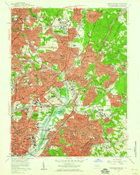
 1957 Washington1966 Print · USGSCovers Ward 5, including Washington, Arlington, and other nearby areas5 unique versions available
 - 1961 Map of Washington
 1961 Washington1961 Print · USGSCovers Ward 5, including Washington, Arlington, and other nearby areas2 unique versions available
 - 1965 Map of Washington East, 1966 Print
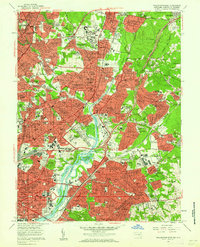
 1965 Washington East1966 Print · USGSCovers Ward 5, including Washington, Silver Spring, and other nearby areas5 unique versions available
 - 1965 Map of Washington West, 1966 Print
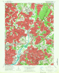
 1965 Washington West1966 Print · USGSCovers Ward 5, including Washington, Arlington, and other nearby areas4 unique versions available
 - 1982 Map of Washington West, 1983 Print
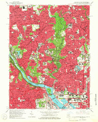
 1982 Washington West1983 Print · USGSCovers Ward 5, including Washington, Arlington, and other nearby areas
 - 1983 Map of Washington East, 1984 Print
 1983 Washington East1984 Print · USGSCovers Ward 5, including Washington, Waldorf, and other nearby areas2 unique versions available
 - 1986 Map of Washington West
 1986 Washington West1986 Print · USGSCovers Ward 5, including Washington, Arlington, and other nearby areas2 unique versions available
Showing maps 1-25 of 26
Frequently asked questions
- What are the different types of historical maps available for Ward 5?
- What is the oldest map of Ward 5?
- Where can I purchase historical maps of Ward 5 for my home or office?
- Where can I download high-res historical maps of Ward 5?
- Are there historical topographic maps available for Ward 5?
- Is there historical aerial imagery available for Ward 5?
- Where are historical maps of Ward 5 sourced from?