Old Maps of Gainesville, Florida
Explore 18 old maps of Gainesville, spanning from 1890 to today. These high-resolution historic maps reveal how streets, neighborhoods, landmarks, and natural features evolved over time — perfect for genealogy, metal detecting, research, and local history exploration.
What you can do with these maps:
- See how Gainesville changed over time: Compare historical maps to modern-day views to trace roads, homesites, rail lines & more.
- View detailed metadata: Each map includes creators, publishers, year, scale, and archive source.
- Overlay maps with satellite & LiDAR: Visualize the past alongside modern tools to explore terrain & human change.
- Trusted historical sources: Maps sourced from the USGS, Library of Congress, and other archives.
- Access maps your way: View online, download high-res files, or order prints for personal or research use.
Start exploring old maps of Gainesville to uncover forgotten places, hidden landmarks, and the deep history beneath your feet.
Gainesville, FL maps
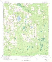
(18)- 1890 Map of Arredondo, 1955 Print
 1890 Arredondo1955 Print · USGSCovers Gainesville, including Alachua, Archer, and other nearby areas2 unique versions available
 - 1892 Map of Arredondo
 1892 Arredondo1892 Print · USGSCovers Gainesville, including Alachua, Archer, and other nearby areas
 - 1894 Map of Arredondo
 1894 Arredondo1894 Print · USGSCovers Gainesville, including Alachua, Archer, and other nearby areas6 unique versions available
 - 1938 Map of Hawthorn
 1938 Hawthorn1938 Print · USGSCovers Gainesville, including Hawthorne, McMeekin, and other nearby areas
 - 1943 Map of Hawthorn, 1963 Print
 1943 Hawthorn1963 Print · USGSCovers Gainesville, including Hawthorne, McMeekin, and other nearby areas
 - 1954 Map of Gainesville, 1965 Print
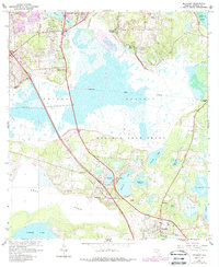
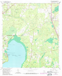
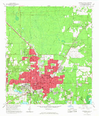
 1954 Gainesville1965 Print · USGSCovers Gainesville, including Ocala, Alachua, and other nearby areas3 unique versions available
 - 1958 Map of Gainesville
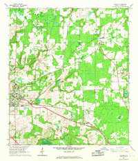
 1958 Gainesville1958 Print · USGSCovers Gainesville, including Ocala, Alachua, and other nearby areas
 - 1959 Map of Gainesville
 1959 Gainesville1959 Print · USGSCovers Gainesville, including Ocala, Alachua, and other nearby areas
 - 1966 Map of Micanopy
 1966 Micanopy1966 Print · USGSCovers Gainesville, including Micanopy, Kirkwood, and other nearby areas3 unique versions available
 - 1966 Map of Orange Heights
 1966 Orange Heights1966 Print · USGSCovers Gainesville, including Orange Heights, Windsor, and other nearby areas4 unique versions available
 - 1966 Map of Gainesville West, 1967 Print
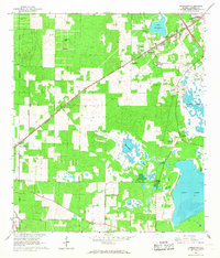
 1966 Gainesville West1967 Print · USGSCovers Gainesville, including Alachua, Los Trancos Woods, and other nearby areas6 unique versions available
 - 1966 Map of Arredondo, 1967 Print
 1966 Arredondo1967 Print · USGSCovers Gainesville, including Archer, Wacahoota, and other nearby areas3 unique versions available
 - 1966 Map of Monteocha, 1967 Print
 1966 Monteocha1967 Print · USGSCovers Gainesville, including La Crosse, Monteocha, and other nearby areas3 unique versions available
 - 1966 Map of Gainesville East, 1967 Print
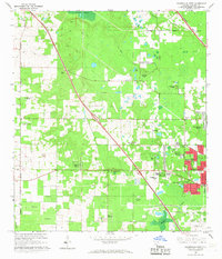
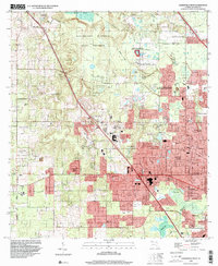
 1966 Gainesville East1967 Print · USGSCovers Gainesville, including Lakeview Estates, Keys Residential Complex, and other nearby areas5 unique versions available
 - 1966 Map of Alachua, 1967 Print
 1966 Alachua1967 Print · USGSCovers Gainesville, including Alachua, La Crosse, and other nearby areas4 unique versions available
 - 1981 Map of Gainesville, 1982 Print
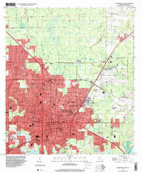
 1981 Gainesville1982 Print · USGSCovers Gainesville, including Alachua, Starke, and other nearby areas2 unique versions available
 - 1994 Map of Gainesville East, 2000 Print
 1994 Gainesville East2000 Print · USGSCovers Gainesville, including Lakeview Estates, Keys Residential Complex, and other nearby areas
 - 1994 Map of Gainesville West, 2000 Print
 1994 Gainesville West2000 Print · USGSCovers Gainesville, including Alachua, Los Trancos Woods, and other nearby areas
End of results
Showing maps 1-18 of 18
Top cities near Gainesville
- Alachua historical maps
- High Springs historical maps
- Newberry historical maps
- Hawthorne historical maps
- Archer historical maps
- Waldo historical maps
See more
Top neighborhoods of Gainesville
- Keys Residential Complex historical maps
- Yardley Courtyard historical maps
- Warrington Courtyard historical maps
- Emerson Courtyard historical maps
- Ustler Hall Courtyard historical maps
- Fraternity Row historical maps
See more
Frequently asked questions
- What are the different types of historical maps available for Gainesville?
- What is the oldest map of Gainesville?
- Where can I purchase historical maps of Gainesville for my home or office?
- Where can I download high-res historical maps of Gainesville?
- Are there historical topographic maps available for Gainesville?
- Is there historical aerial imagery available for Gainesville?
- Where are historical maps of Gainesville sourced from?