Old Maps of Miramar, Broward County
Explore 30 old maps of Miramar, spanning from 1947 to today. These high-resolution historic maps reveal how streets, neighborhoods, landmarks, and natural features evolved over time — perfect for genealogy, metal detecting, research, and local history exploration.
What you can do with these maps:
- See how Miramar changed over time: Compare historical maps to modern-day views to trace roads, homesites, rail lines & more.
- View detailed metadata: Each map includes creators, publishers, year, scale, and archive source.
- Overlay maps with satellite & LiDAR: Visualize the past alongside modern tools to explore terrain & human change.
- Trusted historical sources: Maps sourced from the USGS, Library of Congress, and other archives.
- Access maps your way: View online, download high-res files, or order prints for personal or research use.
Start exploring old maps of Miramar to uncover forgotten places, hidden landmarks, and the deep history beneath your feet.
Miramar, Broward County maps
(30)- 1947 Map of North Miami, 1959 Print
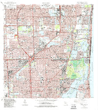
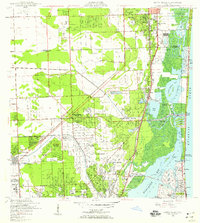 1947 North Miami1959 Print · USGSCoastal Florida is shown in a period of significant post-war expansion between Hollywood and Miami Shores. Researchers can trace the layout of early communities and landmarks like the U S Naval Air Station, MacArthur Airport, and the Hollywood Kennel Club.
 - 1949 Map of Opalocka
 1949 Opalocka1949 Print · USGSNorth Miami-Dade was a hub of military aviation and early suburban expansion in the years following World War II. Researchers can trace the layout of the U S Naval Air Station and several regional airfields like Master Field and Municipal Field.2 unique versions available
 - 1950 Map of North Miami
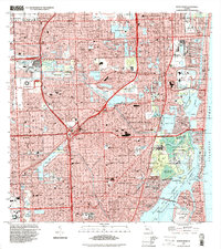
 1950 North Miami1950 Print · USGSMid-century Miami-Dade County comes to life as coastal settlements like Bal Harbour and Surfside begin to take shape. Genealogists and historians can trace the foundations of Opa-locka and the sprawling U S Naval Air Station during this era of rapid growth.
 - 1956 Map of Miami, 1963 Print
 1956 Miami1963 Print · USGSSouthern Florida experiences post-war expansion in the 1950s, even as the wilderness remains dominant across the southern peninsula. Genealogists and historians can trace suburban growth in Opa-locka and Perrine or locate remote sites like the Tamiami Ranger Station.5 unique versions available
 - 1958 Map of Miami
 1958 Miami1958 Print · USGSSoutheast Florida in the late fifties reveals a coastal boom held in balance with the wild sawgrass and mangroves of Everglades National Park. Trace the paths of the Florida East Coast RR through Homestead or locate the U S Marine Corps Air Station during the height of the Cold War.
 - 1962 Map of Opa-locka, 1964 Print
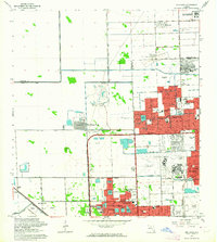 1962 Opa-locka1964 Print · USGSNorth Dade County was undergoing a massive suburban transformation in the early sixties as new subdivisions began to border the Everglades. Researchers can trace early street layouts in Carol City and locate local landmarks like Biscayne College and the South Florida State Hospital.4 unique versions available
 - 1962 Map of North Miami, 1965 Print
 1962 North Miami1965 Print · USGSCoastal development and suburban growth characterize the North Miami area in the early sixties. Genealogists and local historians can trace family roots through numerous neighborhood schools and landmarks like Dade Memorial Park or the Biscayne Seaplane Base.3 unique versions available
 - 1963 Map of Pennsuco, 1964 Print
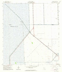 1963 Pennsuco1964 Print · USGSThe Florida Everglades meet industrial development in the early sixties as water management projects reshape the Dade and Broward County border. Trace the intersection of the Miami Canal and Pennsuco Canal near the Quarry and Pennsuco settlement.4 unique versions available
 - 1981 Map of Miami, 1982 Print
 1981 Miami1982 Print · USGSThe Miami metropolitan corridor and the vast marshlands of the interior are seen here in the early 1980s. Trace the reach of Florida's Turnpike and the Florida East Coast Railway past Opa-locka, Coral Gables, and the Miami International Airport.
 - 1988 Map of Pennsuco
 1988 Pennsuco1988 Print · USGSThe Florida Everglades meet the growing suburban edge of Broward and Dade Counties in the late eighties. Researchers can trace water management history and local industry through features like the Miami Canal No C-6, the Opa-Locka West Airport, and the industrial quarries near Pennsuco.2 unique versions available
 - 1988 Map of Miami
 1988 Miami1988 Print · USGSSouth Florida in the late eighties shows the sharp edge between the growing urban Atlantic coast and the vast wetlands of Everglades National Park. Researchers can trace the path of the Tamiami Trail and locate coastal settlements like Ochopee or Chokoloskee.
 - 1988 Map of Opa-Locka
 1988 Opa-Locka1988 Print · USGSNorth Dade and South Broward counties come into focus during a period of rapid suburban maturation in the late eighties. Genealogists and local historians can trace the development of Miami Lakes and Carol City, identifying neighborhood landmarks like Florida Memorial College and Vista Memorial Gardens.
 - 1988 Map of North Miami
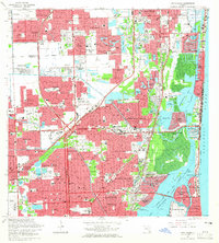
 1988 North Miami1988 Print · USGSNorth Miami and the surrounding Broward-Dade borderlands are shown here in the late eighties during a period of massive residential and commercial growth. Researchers can trace the development of Ives Estates and Carol City or locate landmarks like Joe Robbie Stadium and Barry University.
 - 1994 Map of North Miami, 2000 Print
 1994 North Miami2000 Print · USGSGreater Miami is captured here in the mid-nineties, showing a sprawling coastal landscape defined by luxury waterfront living and major sports venues. Researchers can trace the layout of Golden Beach and Ives Estates or locate landmarks like Joe Robbie Stadium and Aventura Mall.
 - 1994 Map of Pennsuco, 2000 Print
 1994 Pennsuco2000 Print · USGSFlorida's edge at the turn of the millennium shows the intersection of massive water management and suburban expansion. Trace the engineering of the Miami Canal and find local landmarks like the Opa-Locka West Airport and the Pennsuco Footbridge.
 - 2012 Map of Opa-locka, 2012 Print
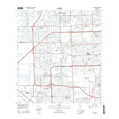
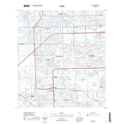
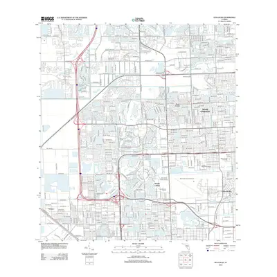 2012 Opa-locka2012 Print · USGSCovers Miramar, including Miami Lakes, Opa-locka, and other nearby areas
 - 2012 Map of North Miami, 2012 Print
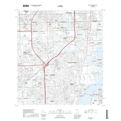
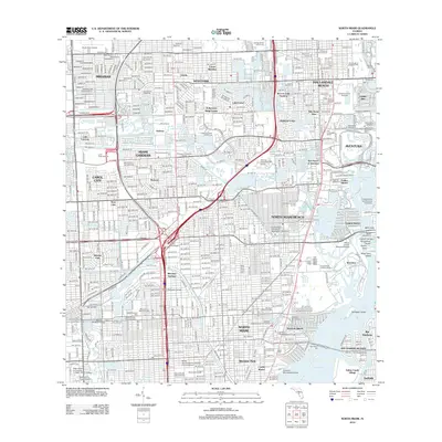 2012 North Miami2012 Print · USGSCovers Miramar, including Miami Gardens, North Miami, and other nearby areas
 - 2012 Map of Pennsuco, 2012 Print
 2012 Pennsuco2012 Print · USGSCovers Miramar, including Medley, Pennsuco, and other nearby areas
 - 2015 Map of Opa-locka, 2015 Print
 2015 Opa-locka2015 Print · USGSCovers Miramar, including Miami Lakes, Opa-locka, and other nearby areas
 - 2015 Map of North Miami, 2015 Print
 2015 North Miami2015 Print · USGSCovers Miramar, including Miami Gardens, North Miami, and other nearby areas
 - 2015 Map of Pennsuco, 2015 Print
 2015 Pennsuco2015 Print · USGSCovers Miramar, including Medley, Pennsuco, and other nearby areas
 - 2018 Map of Pennsuco, 2018 Print
 2018 Pennsuco2018 Print · USGSCovers Miramar, including Medley, Pennsuco, and other nearby areas
 - 2018 Map of North Miami, 2018 Print
 2018 North Miami2018 Print · USGSCovers Miramar, including Miami Gardens, North Miami, and other nearby areas
 - 2018 Map of Opa-locka, 2018 Print
 2018 Opa-locka2018 Print · USGSCovers Miramar, including Miami Lakes, Opa-locka, and other nearby areas
 - 2021 Map of Pennsuco, 2021 Print
 2021 Pennsuco2021 Print · USGSCovers Miramar, including Medley, Pennsuco, and other nearby areas
Showing maps 1-25 of 30
Frequently asked questions
- What are the different types of historical maps available for Miramar?
- What is the oldest map of Miramar?
- Where can I purchase historical maps of Miramar for my home or office?
- Where can I download high-res historical maps of Miramar?
- Are there historical topographic maps available for Miramar?
- Is there historical aerial imagery available for Miramar?
- Where are historical maps of Miramar sourced from?