Old Maps of Alexander Pointe, Clay County for Hiking & Exploration
Hike through history with 19 historic maps of Alexander Pointe. Explore old trails, ghost towns, and forgotten backroads — perfect for outdoor adventurers and local explorers.
- Rediscover forgotten places: Map out old mining camps, roads, and footpaths that no longer exist on modern maps.
- Layer with modern tools: Combine with LiDAR or satellite views to plan hikes through historical terrain.
- Made for exploration: Popular among hikers, overlanders, and local history lovers.
Use these maps to find adventure and explore the hidden past of Alexander Pointe.
Alexander Pointe, Clay County maps
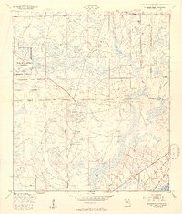
(19)- 1918 Map of Middleburg
 1918 Middleburg1918 Print · USGSClay County near the end of the Great War reveals a landscape of isolated settlements and vital creek crossings. Genealogists and historians can trace the foundations of local communities through the locations of Rideout Ferry, Black Creek Church, and several namesake institutions like the Bell School.4 unique versions available
 - 1941 Map of Middleburg, 1943 Print
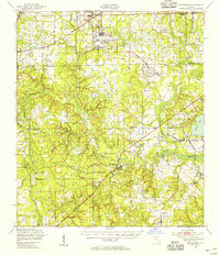
 1941 Middleburg1943 Print · USGSClay County at the dawn of the motorized era reveals a landscape of ferry crossings and rural schoolhouses connected by early roads. Researchers can trace the legacy of the Middleburg area through sites like the Rideout Ferry, Black Creek Church, and several named family schools.
 - 1948 Map of Jacksonville
 1948 Jacksonville1948 Print · USGSNortheast Florida and Southeast Georgia's coastal waterways and railroad towns are captured here in the years following the war. Genealogists can trace family connections through river towns like St Marys or identify long-standing military landmarks like Jacksonville NAS.
 - 1949 Map of Jacksonville Heights, 1953 Print
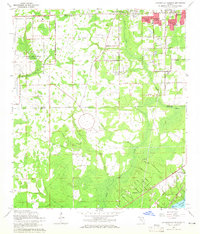
 1949 Jacksonville Heights1953 Print · USGSIn the late 1940s, the rural border of Duval and Clay Counties was being reshaped by naval aviation. Researchers can trace the massive footprints of the Cecil Naval Auxiliary Air Station and Branan Outlying Air Field alongside the Atlantic Coast Line.2 unique versions available
 - 1949 Map of Middleburg, 1955 Print
 1949 Middleburg1955 Print · USGSClay County at mid-century shows a landscape of deep-rooted river settlements and emerging Cold War aviation. Genealogists and historians can trace the foundations of Middleburg and Doctors Inlet, alongside notable sites like Rideout Ferry and Peoria Ch.
 - 1957 Map of Jacksonville, 1967 Print
 1957 Jacksonville1967 Print · USGSCoastal Florida and Georgia meet in the late fifties, showcasing a landscape of naval aviation, deep-water terminals, and barrier island communities. Researchers can trace the mid-century footprints of NAS Jacksonville, find small communities like Franklintown, and locate the historic Fort Clinch State Park.3 unique versions available
 - 1959 Map of Jacksonville
 1959 Jacksonville1959 Print · USGSNortheast Florida and Southeast Georgia are seen here in the late fifties, dominated by the maritime activity of the St Johns River and the Atlantic coast. Researchers can trace the mid-century layout of Jacksonville and identify sprawling military sites like Camp Blanding Military Reservation and Kings Bay Ammunition Terminal.
 - 1960 Map of Jacksonville
 1960 Jacksonville1960 Print · USGSCoastal Florida and Georgia meet in this mid-century portrait of a region shaped by naval power and the winding St Johns River. Researchers can trace the development of military sites like Cecil Field or locate historic rural landmarks such as Jerusalem Ch and Kings Ferry.
 - 1964 Map of Jacksonville Heights, 1965 Print
 1964 Jacksonville Heights1965 Print · USGSThe Florida-Duval county border comes alive in the mid-1960s as suburban subdivisions like Oak Hill and Ridgewood expand near the U S Naval Air Station (Cecil Field). Genealogists and historians can trace the development of local congregations at Oak Crest Ch or explore the drainage of the Ortega River.4 unique versions available
 - 1977 Map of Jacksonville, 1983 Print
 1977 Jacksonville1983 Print · USGSNortheast Florida during the late seventies shows a region defined by its deep-water naval bases and burgeoning riverfront suburbs. You can trace the rail networks of the Seaboard Coast Line, locate the Kingsley Plantation, and study the sprawling grounds of Cecil Field Naval Air Station.
 - 1980 Map of Jacksonville, 1984 Print
 1980 Jacksonville1984 Print · USGSThe Jacksonville metropolitan area and the Atlantic coast are captured here during a period of significant late-century growth. Researchers can trace the massive military footprints of Cecil Field and Mayport Naval Station alongside historic communities like Mandarin and Switzerland.
 - 1988 Map of Jacksonville
 1988 Jacksonville1988 Print · USGSCoastal Florida and Georgia are captured here during the late eighties, documenting the rapid growth of the First Coast and its vital military installations. Researchers can trace the development of beach communities like Fernandina Beach and Atlantic Beach or locate family landmarks near Mickler Landing and Orange Park.
 - 1993 Map of Jacksonville Heights
 1993 Jacksonville Heights1993 Print · USGSGreater Jacksonville is captured in a moment of rapid suburban expansion in the early nineties, as military facilities met growing neighborhoods. Genealogists and historians can trace the foundations of Jacksonville Heights, locate the Federal Hill Cem, and see the extent of US Naval Air Station (Cecil Field).2 unique versions available
 - 1994 Map of Jacksonville Heights, 2002 Print
 1994 Jacksonville Heights2002 Print · USGSWestern Jacksonville and northern Clay County appear in the mid-nineties during a phase of rapid suburban growth near military installations. Genealogists and local historians can trace family locations near Federal Hill Cem, Branan Field Ch, and the sprawling US Naval Air Station (Cecil Field).
 - 2012 Map of Jacksonville Heights, 2012 Print
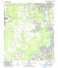
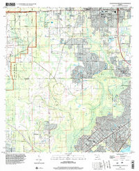
 2012 Jacksonville Heights2012 Print · USGSCovers Alexander Pointe, including Jacksonville, North Meadowbrook Terrace, and other nearby areas
 - 2015 Map of Jacksonville Heights, 2015 Print
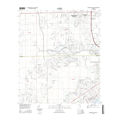 2015 Jacksonville Heights2015 Print · USGSCovers Alexander Pointe, including Jacksonville, North Meadowbrook Terrace, and other nearby areas
 - 2018 Map of Jacksonville Heights, 2018 Print
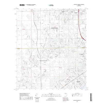 2018 Jacksonville Heights2018 Print · USGSCovers Alexander Pointe, including Jacksonville, North Meadowbrook Terrace, and other nearby areas
 - 2021 Map of Jacksonville Heights, 2021 Print
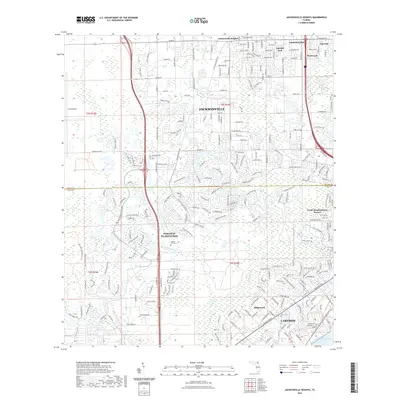 2021 Jacksonville Heights2021 Print · USGSCovers Alexander Pointe, including Jacksonville, North Meadowbrook Terrace, and other nearby areas
 - 2024 Map of Jacksonville Heights, 2024 Print
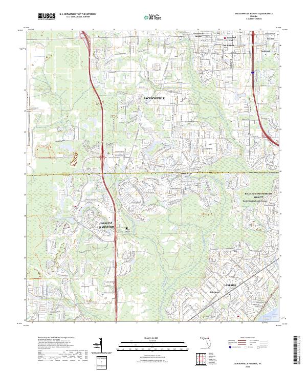 2024 Jacksonville Heights2024 Print · USGSClay and Duval counties show a landscape of rapid suburban growth in the early twenty-first century as modern neighborhoods expand toward the Ortega River. Researchers can trace the development of Oakleaf Plantation, Lakeside, and local landmarks like Federal Hill Cem.
End of results
Showing maps 1-19 of 19
Frequently asked questions
- What are the different types of historical maps available for Alexander Pointe?
- What is the oldest map of Alexander Pointe?
- Where can I purchase historical maps of Alexander Pointe for my home or office?
- Where can I download high-res historical maps of Alexander Pointe?
- Are there historical topographic maps available for Alexander Pointe?
- Is there historical aerial imagery available for Alexander Pointe?
- Where are historical maps of Alexander Pointe sourced from?