Old Maps of Horseshoe Beach, Florida
Explore 11 old maps of Horseshoe Beach, spanning from 1954 to today. These high-resolution historic maps reveal how streets, neighborhoods, landmarks, and natural features evolved over time — perfect for genealogy, metal detecting, research, and local history exploration.
What you can do with these maps:
- See how Horseshoe Beach changed over time: Compare historical maps to modern-day views to trace roads, homesites, rail lines & more.
- View detailed metadata: Each map includes creators, publishers, year, scale, and archive source.
- Overlay maps with satellite & LiDAR: Visualize the past alongside modern tools to explore terrain & human change.
- Trusted historical sources: Maps sourced from the USGS, Library of Congress, and other archives.
- Access maps your way: View online, download high-res files, or order prints for personal or research use.
Start exploring old maps of Horseshoe Beach to uncover forgotten places, hidden landmarks, and the deep history beneath your feet.
Horseshoe Beach, FL maps
(11)- 1954 Map of Horseshoe Beach, 1956 Print
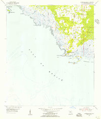 1954 Horseshoe Beach1956 Print · USGSThe Dixie County shoreline in the mid-1950s is centered around the growing coastal settlement of Horseshoe Beach. Researchers can trace the path of the Old Railroad Grade and locate coastal landmarks like Butler Island and the Pepperfish Keys.3 unique versions available
 - 1954 Map of Gainesville, 1965 Print
 1954 Gainesville1965 Print · USGSMid-century North Central Florida comes into focus as a landscape of timber, rails, and river towns along the Gulf. Trace family roots in established centers like Gainesville or follow the path of the Suwannee River to the coastal docks of Cedar Key.3 unique versions available
 - 1958 Map of Gainesville
 1958 Gainesville1958 Print · USGSNorth Central Florida’s rail and river networks are frozen in time just before the interstate era. Genealogists and historians can trace the paths of the Atlantic Coast Line through Gainesville or locate coastal settlements like Steinhatchee and Cedar Key.
 - 1959 Map of Gainesville
 1959 Gainesville1959 Print · USGSNorth Florida in the mid-fifties is seen here from the Gulf coast to the inland lakes, showing the rail-and-river network before modern highways dominated. Researchers can trace the paths of the Seaboard Air Line through towns like Chiefland and Micanopy, or explore the coastal inlets of Waccasassa Bay.
 - 1978 Map of Cedar Keys, 1980 Print
 1978 Cedar Keys1980 Print · USGSThe Florida Gulf Coast in the late seventies reveals a landscape of isolated fishing villages and dense coastal wetlands. Genealogists and historians can trace the intricate shoreline from Horseshoe Beach down to Suwannee and the wooded tracts of Gulf Hammock.3 unique versions available
 - 2012 Map of Horseshoe Beach, 2012 Print
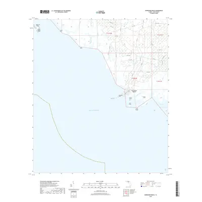
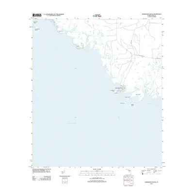 2012 Horseshoe Beach2012 Print · USGSCovers Horseshoe Beach, including Dixie County, United States, and other nearby areas
 - 2015 Map of Horseshoe Beach, 2015 Print
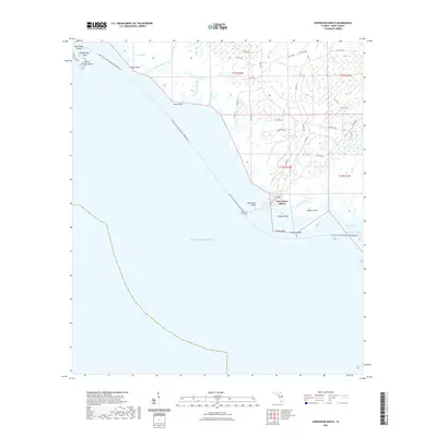
 2015 Horseshoe Beach2015 Print · USGSCovers Horseshoe Beach, including Dixie County, United States, and other nearby areas
 - 2018 Map of Horseshoe Beach, 2018 Print
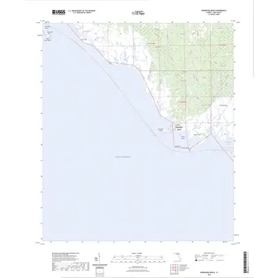
 2018 Horseshoe Beach2018 Print · USGSCovers Horseshoe Beach, including Dixie County, United States, and other nearby areas
 - 2021 Map of Horseshoe Beach, 2021 Print
 2021 Horseshoe Beach2021 Print · USGSCovers Horseshoe Beach, including Dixie County, United States, and other nearby areas
 - 2024 Map of Horseshoe Beach, 2024 Print
 2024 Horseshoe Beach2024 Print · USGSCovers Horseshoe Beach, including Dixie County, United States, and other nearby areas
 - 2025 Map of Horseshoe Beach, 2025 Print
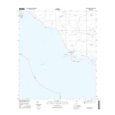
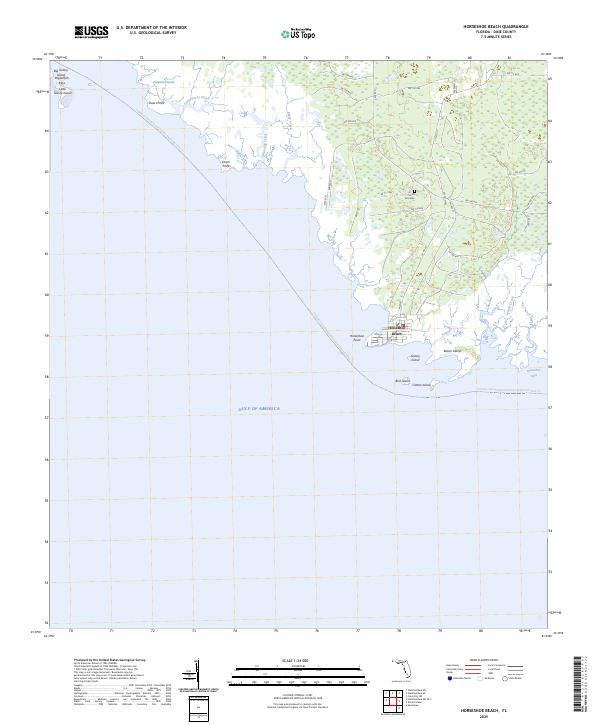 2025 Horseshoe Beach2025 Print · USGSCoastal Dixie County comes into focus in this recent survey of the Gulf of Mexico's winding marshlands and remote islands. Researchers can locate the Smith Gravesite near the village of Horseshoe Beach or trace the waterways of Pumpkin Swamp and Pepperfish Keys.
End of results
Showing maps 1-11 of 11
Top cities near Horseshoe Beach
Frequently asked questions
- What are the different types of historical maps available for Horseshoe Beach?
- What is the oldest map of Horseshoe Beach?
- Where can I purchase historical maps of Horseshoe Beach for my home or office?
- Where can I download high-res historical maps of Horseshoe Beach?
- Are there historical topographic maps available for Horseshoe Beach?
- Is there historical aerial imagery available for Horseshoe Beach?
- Where are historical maps of Horseshoe Beach sourced from?