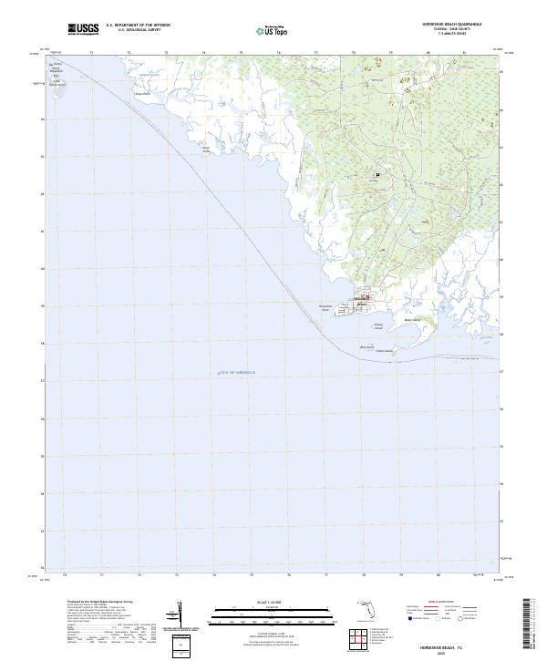
2025 Map of Horseshoe Beach
USGS Topo · Published 2025About this map
The coastal village of Horseshoe Beach serves as the focal point for this survey of the Dixie County shoreline, where the Gulf of America meets a complex network of marshes and tidal creeks. The landscape is defined by its low-lying hydrology, including the expansive Pumpkin Swamp and numerous winding waterways such as Little Rocky Creek, Whackup Creek, and Boggy Creek. This area remains largely dominated by the natural environment, with a few notable landmarks like the Smith Gravesite providing a quiet connection to local family history amidst the wetlands.
Find a feature on this map
43 named features on this map. Tap any name to fly to it.
Don’t see what you’re looking for? This feature index may not catch every label — zoom into the map to look around manually.
Map Details
Editions of this 2025 Horseshoe Beach Map
This is the sole edition of this map. No revisions or reprints were ever made.
Other maps of this area

1954 · Steinhatchee SW
USGS Topo · 1:24,000

1954 · Steinhatchee SE
USGS Topo · 1:24,000

1954 · Cross City SW
USGS Topo · 1:24,000

1954 · Horseshoe Beach
USGS Topo · 1:24,000

1954 · Suwannee
USGS Topo · 1:24,000

1954 · Gainesville
USGS Topo · 1:250,000

1955 · Shired Island
USGS Topo · 1:24,000

1958 · Gainesville
USGS Topo · 1:250,000

1959 · Gainesville
USGS Topo · 1:250,000

1978 · Cedar Keys
USGS Topo · 1:100,000