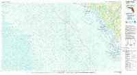
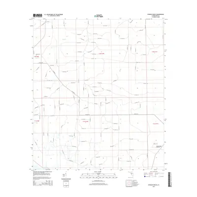
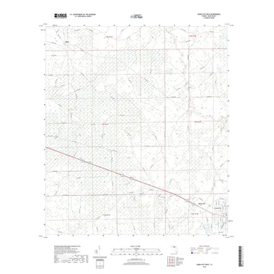
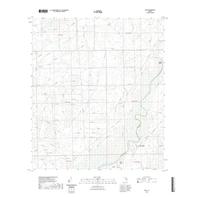
1954 Map of Cross City SW
USGS Topo · Published 1955About this map
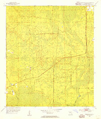
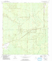
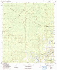
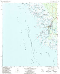
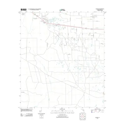
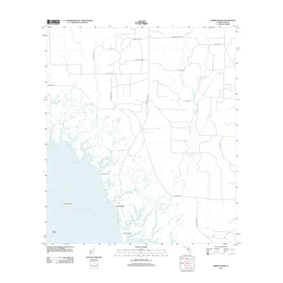
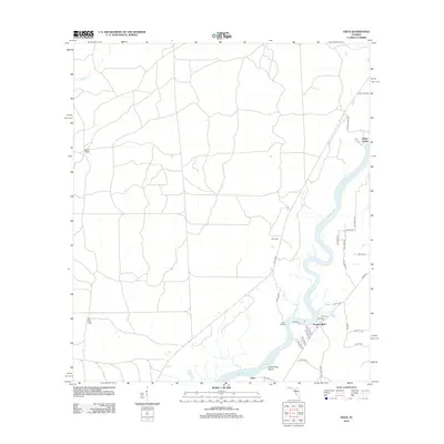
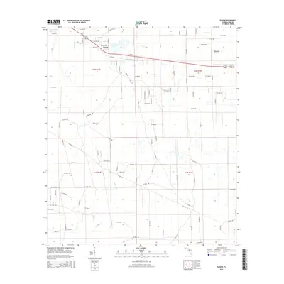
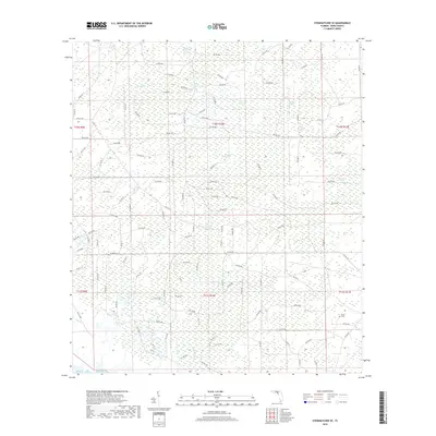
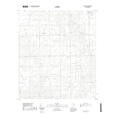
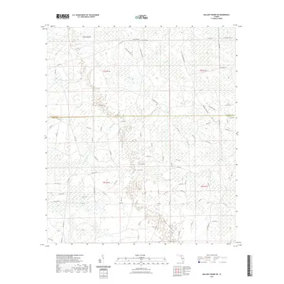
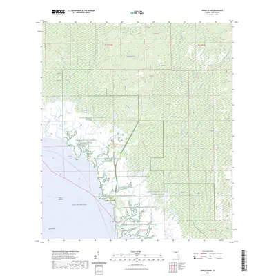
California Swamp dominates this landscape in the mid-1950s, where the low-lying terrain is defined by a network of wetlands and seasonal watercourses. The presence of the Old Railroad Grade running through the center of the sheet suggests the legacy of a timber or industrial corridor that once moved through these wetlands. Significant local landmarks include the Sandhill Cem and the Horseshoe Lookout Tower, which served as a critical vantage point for monitoring the surrounding pine forests and marshlands. To the southeast, Davis Island rises as a distinct feature near the winding path of Fishbone Creek and Station Lake. The map illustrates a period of transition where early industrial transport infrastructure was being reclaimed by the environment, leaving only the graded paths and a few established settlements and landmarks.
Find a feature on this map
9 named features on this map. Tap any name to fly to it.
Don’t see what you’re looking for? This feature index may not catch every label — zoom into the map to look around manually.
Map Details
Editions of this 1954 Cross City SW Map
4 editions found
Historical Maps of Cross City Through Time
78 maps found
1954 Cross City East
Dixie County, FL
1954 Cross City SW
Dixie County, FL
1954 Cross City West
Dixie County, FL
1954 Eugene
Dixie County, FL
1954 Jena
Dixie County, FL
1954 Mallory Swamp SE
Dixie County, FL
1954 Mallory Swamp SW
Dixie County, FL
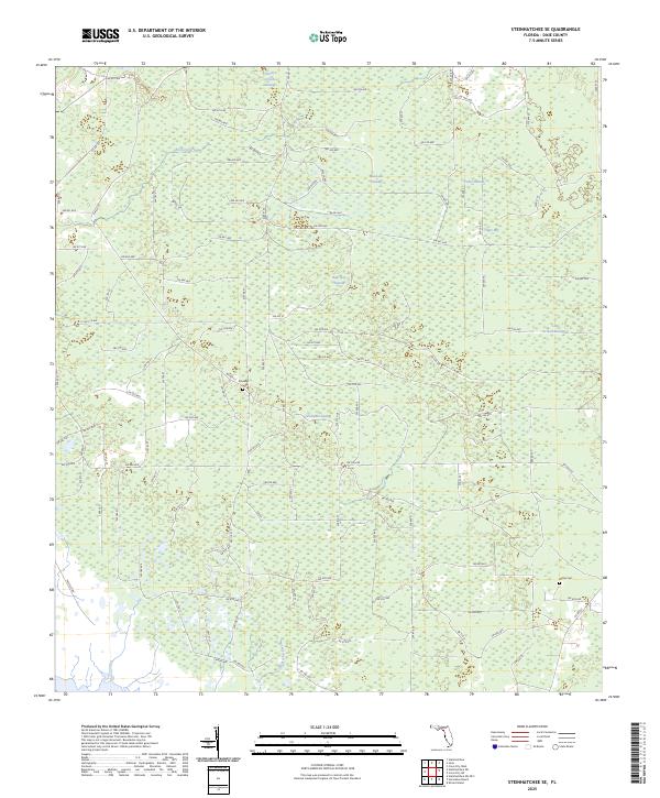
1954 Steinhatchee SE
Dixie County, FL
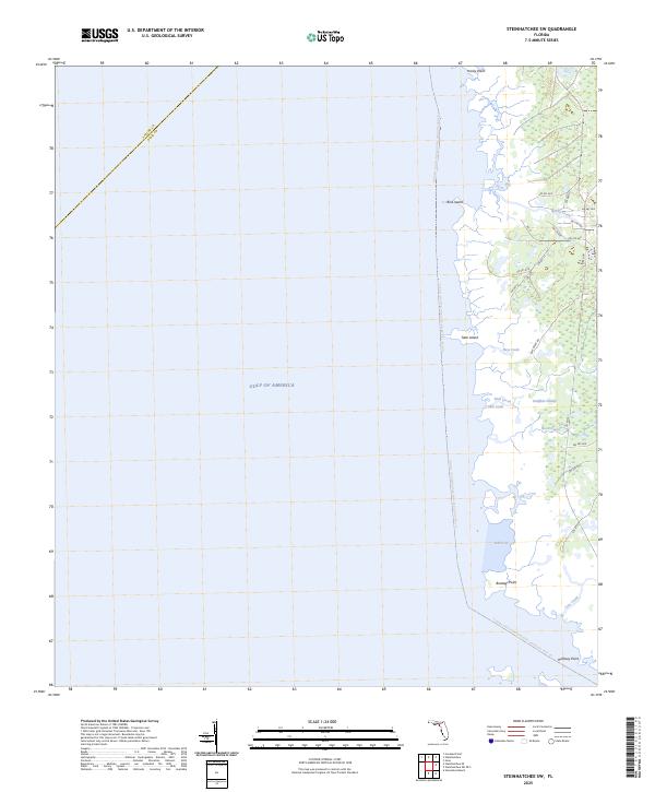
1954 Steinhatchee SW
Dixie County, FL
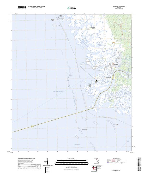
1954 Suwannee
Dixie County, FL
1954 Vista
Dixie County, FL
1955 Shired Island
Dixie County, FL
1956 Mallory Swamp SE
Dixie County, FL
1978 Cedar Keys
Dixie County, FL
2012 Cross City East
Dixie County, FL
2012 Cross City SW
Dixie County, FL
2012 Cross City West
Dixie County, FL
2012 Eugene
Dixie County, FL
2012 Jena
Dixie County, FL
2012 Mallory Swamp SE
Dixie County, FL
2012 Mallory Swamp SW
Dixie County, FL
2012 Shired Island
Dixie County, FL
2012 Steinhatchee SE
Dixie County, FL
2012 Steinhatchee SW
Dixie County, FL
2012 Suwannee
Dixie County, FL
2012 Vista
Dixie County, FL
2015 Cross City East
Dixie County, FL
2015 Cross City SW
Dixie County, FL
2015 Cross City West
Dixie County, FL
2015 Eugene
Dixie County, FL

2015 Jena
Dixie County, FL
2015 Mallory Swamp SE
Dixie County, FL
2015 Mallory Swamp SW
Dixie County, FL
2015 Shired Island
Dixie County, FL
2015 Steinhatchee SE
Dixie County, FL

2015 Steinhatchee SW
Dixie County, FL
2015 Suwannee
Dixie County, FL

2015 Vista
Dixie County, FL
2018 Cross City East
Dixie County, FL
2018 Cross City SW
Dixie County, FL
2018 Cross City West
Dixie County, FL
2018 Eugene
Dixie County, FL
2018 Jena
Dixie County, FL

2018 Mallory Swamp SE
Dixie County, FL
2018 Mallory Swamp SW
Dixie County, FL

2018 Shired Island
Dixie County, FL
2018 Steinhatchee SE
Dixie County, FL
2018 Steinhatchee SW
Dixie County, FL
2018 Suwannee
Dixie County, FL

2018 Vista
Dixie County, FL
2021 Cross City East
Dixie County, FL
2021 Cross City SW
Dixie County, FL
2021 Cross City West
Dixie County, FL

2021 Eugene
Dixie County, FL
2021 Jena
Dixie County, FL
2021 Mallory Swamp SE
Dixie County, FL
2021 Mallory Swamp SW
Dixie County, FL
2021 Shired Island
Dixie County, FL

2021 Steinhatchee SE
Dixie County, FL
2021 Steinhatchee SW
Dixie County, FL
2021 Suwannee
Dixie County, FL
2021 Vista
Dixie County, FL
2024 Cross City East
Dixie County, FL
2024 Cross City SW
Dixie County, FL
2024 Cross City West
Dixie County, FL
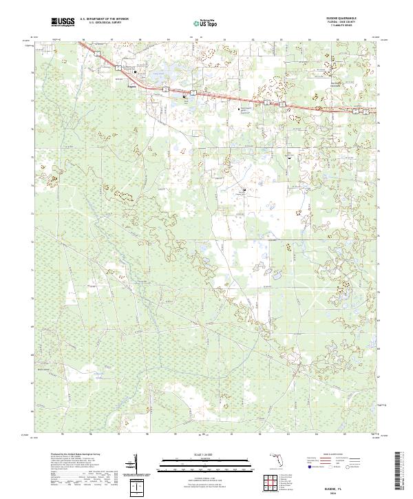
2024 Eugene
Dixie County, FL
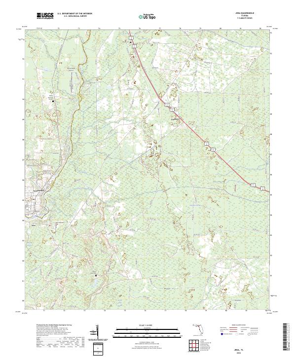
2024 Jena
Dixie County, FL
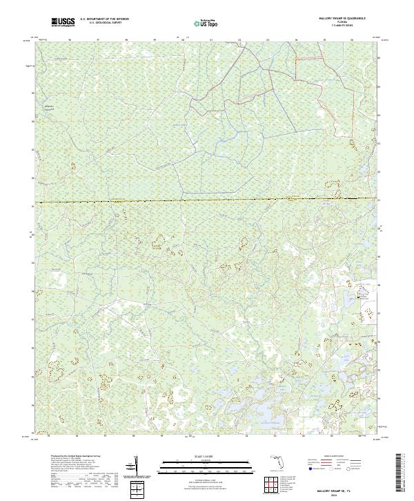
2024 Mallory Swamp SE
Dixie County, FL
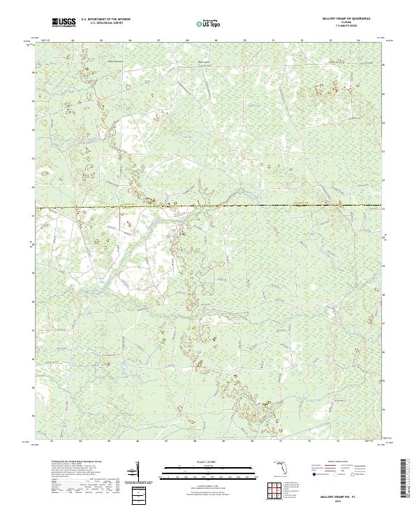
2024 Mallory Swamp SW
Dixie County, FL
2024 Shired Island
Dixie County, FL

2024 Steinhatchee SE
Dixie County, FL
2024 Steinhatchee SW
Dixie County, FL

2024 Suwannee
Dixie County, FL
2024 Vista
Dixie County, FL
2025 Shired Island
Dixie County, FL
2025 Steinhatchee SE
Dixie County, FL
2025 Steinhatchee SW
Dixie County, FL
2025 Suwannee
Dixie County, FL