
1954 Map of Eugene
USGS Topo · Published 1955About this map
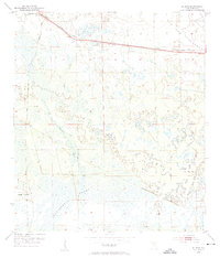
California Swamp dominates the southern reaches of this landscape in Dixie County, where the dense wetlands are drained by the winding California Creek. In the mid-1950s, the small settlement of Eugene served as a key point of activity along the Atlantic Coast Line railroad, which cuts a straight path across the northern section of the map. This rail corridor is dotted with local landmarks, including the Long Pond Cem and several Radio Towers. The terrain transitions from the low-lying Davis Island in the west to the higher ground of Old Town Hammock in the east. Rural life is anchored by several community features, such as Prospect Ch and Lee Cem, providing important points of reference for those researching family history in this corner of the Florida Big Bend. The presence of a localized Airport and a network of canals indicates the early integration of transport and water management in this heavily forested region.
Find a feature on this map
14 named features on this map. Tap any name to fly to it.
Don’t see what you’re looking for? This feature index may not catch every label — zoom into the map to look around manually.
Map Details
Editions of this 1954 Eugene Map
3 editions found
Other maps of this area

1954 · Cross City West
USGS Topo · 1:24,000

1954 · Cross City East
USGS Topo · 1:24,000

1954 · Cross City SW
USGS Topo · 1:24,000

1954 · Manatee Springs
USGS Topo · 1:24,000

1954 · Vista
USGS Topo · 1:24,000

1954 · Gainesville
USGS Topo · 1:250,000

1955 · Shired Island
USGS Topo · 1:24,000

1958 · Gainesville
USGS Topo · 1:250,000

1959 · Gainesville
USGS Topo · 1:250,000
1968 · Suwannee River
USGS Topo · 1:24,000