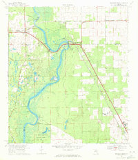
1968 Map of Suwannee River
USGS Topo · Published 1971About this map
Suwannee River curves sharply through a landscape of hammocks and springs in this late-1960s survey of the tri-county border where Dixie, Gilchrist, and Levy meet. The settlement of Old Town serves as a local hub west of the river, supported by the Old Town Sch and Old Town Cem. Along the eastern banks, the Seaboard Coast Line railroad dictates the local geography, connecting Wilcox Junction, Wilcox, and Fanning Springs.
Find a feature on this map
31 named features on this map. Tap any name to fly to it.
Don’t see what you’re looking for? This feature index may not catch every label — zoom into the map to look around manually.
Map Details
Editions of this 1968 Suwannee River Map
3 editions found
Other maps of this area

1954 · Eugene
USGS Topo · 1:24,000

1954 · Cross City East
USGS Topo · 1:24,000

1954 · Chiefland
USGS Topo · 1:24,000

1954 · Manatee Springs
USGS Topo · 1:24,000

1954 · Vista
USGS Topo · 1:24,000

1954 · Gainesville
USGS Topo · 1:250,000

1958 · Gainesville
USGS Topo · 1:250,000

1959 · Gainesville
USGS Topo · 1:250,000

1968 · Fourmile Lake
USGS Topo · 1:24,000

1968 · Trenton
USGS Topo · 1:24,000