Old Maps of Levy County, Florida
Explore 195 old maps of Levy County, spanning from 1892 to today. These high-resolution historic maps reveal how streets, neighborhoods, landmarks, and natural features evolved over time — perfect for genealogy, metal detecting, research, and local history exploration.
What you can do with these maps:
- See how Levy County changed over time: Compare historical maps to modern-day views to trace roads, homesites, rail lines & more.
- View detailed metadata: Each map includes creators, publishers, year, scale, and archive source.
- Overlay maps with satellite & LiDAR: Visualize the past alongside modern tools to explore terrain & human change.
- Trusted historical sources: Maps sourced from the USGS, Library of Congress, and other archives.
- Access maps your way: View online, download high-res files, or order prints for personal or research use.
Start exploring old maps of Levy County to uncover forgotten places, hidden landmarks, and the deep history beneath your feet.
Levy County, FL maps
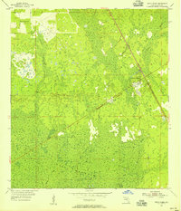
(195)- 1892 Map of Dunnellon
 1892 Dunnellon1892 Print · USGSMarion and Levy counties were at the center of a phosphate boom in the early 1890s, anchored by the riverfront settlement of Dunnellon. Researchers can trace the early industrial footprint of Eagle Mines, find rural community hubs like Cotton Plant, and locate historical crossings such as Fish Ferry.
 - 1894 Map of Dunnellon
 1894 Dunnellon1894 Print · USGSMarion and Citrus counties were centers of a burgeoning phosphate boom in the early 1890s, where river and rail infrastructure converged. You can trace early mining operations like the Chicago Mine and Eagle Mine alongside historic river crossings at Fisk Ferry.5 unique versions available
 - 1895 Map of Williston
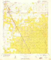
 1895 Williston1895 Print · USGSNorth Central Florida in the mid-1890s reveals a landscape shaped by phosphate mining and the arrival of the iron horse. Genealogists and historians can trace early rail hubs like Williston and Montbrook, alongside industrial sites like Standard Mine and Phosphate.6 unique versions available
 - 1954 Map of Romeo, 1955 Print
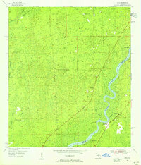
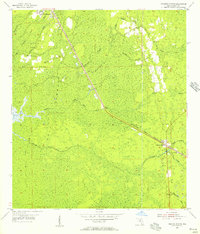
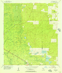
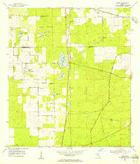 1954 Romeo1955 Print · USGSMarion and Levy counties in the mid-1950s show a landscape of rail-dependent settlements and seasonal prairies. Genealogists and historians can trace families near Romeo or Hoyt, and locate the historic Zion Hill Cem and Zion Hill Ch.2 unique versions available
 - 1954 Map of Yankeetown SE, 1955 Print
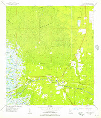
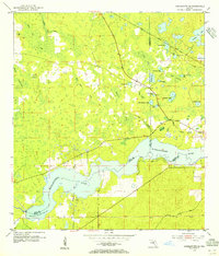 1954 Yankeetown SE1955 Print · USGSThe Florida hammock country comes into focus in the mid-1950s as the Withlacoochee River flows through the convergence of three counties. You can trace the Atlantic Coast Line rail route and locate secluded landmarks like Lebanon Cem and Dog Ear Cem.3 unique versions available
 - 1954 Map of Chiefland, 1956 Print
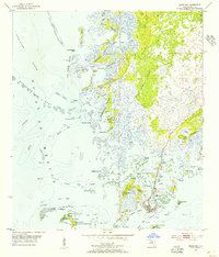
 1954 Chiefland1956 Print · USGSThe Levy County countryside during the mid-fifties is captured here as the ATLANTIC COAST LINE corridor shapes the local geography. Trace family roots at Hardee town or find rural landmarks like Levyville Cem and Morning Star Ch.4 unique versions available
 - 1954 Map of Suwannee, 1956 Print
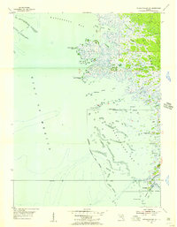
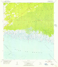
 1954 Suwannee1956 Print · USGSThe Suwannee River delta meets the Gulf of Mexico in the mid-1950s, revealing a landscape of tidal passes and timber history. Genealogists and historians can trace the Old Railroad Grade through the California Swamp and locate a Sunken Wreck near the settlement of Suwannee.4 unique versions available
 - 1954 Map of Otter Creek, 1956 Print
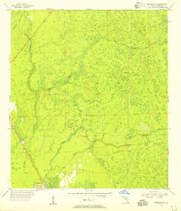
 1954 Otter Creek1956 Print · USGSLevy County's wetlands and timber lands are documented here in the mid-1950s, centered on the junction at Otter Creek. Researchers can locate family landmarks like Kirkland Cem and Rocky Hammock Ch or trace the Atlantic Coast Line railroad.3 unique versions available
 - 1954 Map of Bronson, 1956 Print
 1954 Bronson1956 Print · USGSBronson stood as a vital Levy County junction in the mid-fifties, surrounded by the dense wetlands of the Florida interior. Researchers can trace the path of the Atlantic Coast Line, the expanse of Devils Hammock, and the shoreline of Chunky Pond.3 unique versions available
 - 1954 Map of Manatee Springs, 1956 Print
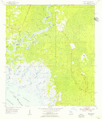
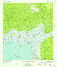
 1954 Manatee Springs1956 Print · USGSThe Suwannee River forms the heart of this mid-1950s Florida survey, where the river-fed Manatee Springs meets the dense wetlands of Levy County. Local historians can trace riverside life at Lower Clay Landing and find family roots at Antioch Cem and Long Pond Ch.3 unique versions available
 - 1954 Map of Chiefland SW, 1956 Print
 1954 Chiefland SW1956 Print · USGSLevy County's coastal wetlands and dense timberlands are captured here in the mid-1950s. Researchers can trace the layout of the small settlement of Sumner and the vast, undeveloped expanse of the Gulf Hammock forest.3 unique versions available
 - 1954 Map of Vista, 1956 Print
 1954 Vista1956 Print · USGSThe Suwannee River forms the heart of this Dixie County landscape in the mid-1950s. Trace the riverfront history of Fowler Bluff, locate the Keen Cem near the wetlands, or explore the expansive California Swamp and Otter Sink Camp.4 unique versions available
 - 1954 Map of Bronson SW, 1956 Print
 1954 Bronson SW1956 Print · USGSLevy County's dense swamp and hardwood forests are captured here in the mid-1950s during a period of active timbering and rail transport. Genealogists and historians can trace the Atlantic Coast Line through Gulf Hammock and locate the Wekiva Lookout Tower.3 unique versions available
 - 1954 Map of East Pass, 1956 Print
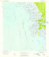
 1954 East Pass1956 Print · USGSThe Suwannee River delta meets the Gulf of Mexico in the mid-1950s, revealing a pristine coastal wilderness of tidal creeks and marsh islands. Trace the intricate waterways of East Pass, the remote outpost at Fletcher Landing, and landmarks like Tiger Island and Lone Cabbage Reef.4 unique versions available
 - 1954 Map of Dunnellon, 1960 Print
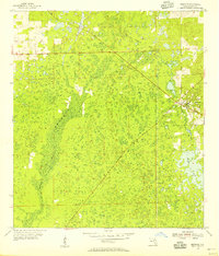
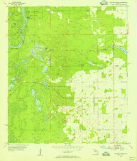
 1954 Dunnellon1960 Print · USGSDunnellon and rural Marion County appear in the mid-1950s as a landscape of phosphate mining, railroads, and fresh water springs. Genealogists and historians can trace family locations near Zion Hill Cem, Cotton Plant, and the Circle Square Ranch.
 - 1954 Map of Gainesville, 1965 Print
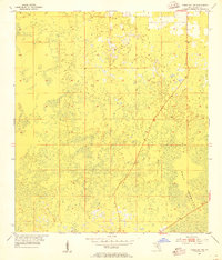
 1954 Gainesville1965 Print · USGSMid-century North Central Florida comes into focus as a landscape of timber, rails, and river towns along the Gulf. Trace family roots in established centers like Gainesville or follow the path of the Suwannee River to the coastal docks of Cedar Key.3 unique versions available
 - 1955 Map of Seahorse Key, 1956 Print
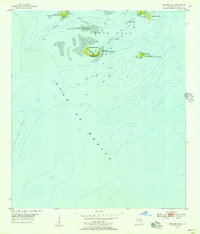 1955 Seahorse Key1956 Print · USGSThe Cedar Keys archipelago comes to life in the mid-1950s, showing the isolated islands and coastal waters of Levy County before modern development. You can trace early burial grounds like Atsena Otie Cem or locate the Lighthouse (Abandoned) overlooking Seahorse Key.4 unique versions available
 - 1955 Map of Lebanon Station, 1956 Print
 1955 Lebanon Station1956 Print · USGSCoastal Levy County in the mid-1950s is a landscape defined by the wetlands of Gulf Hammock and the rail lines of the Atlantic Coast Line. Researchers can trace the heritage of local landings like Peeks Landing and historic sites such as Mt Moriah Ch and Lebanon Station.3 unique versions available
 - 1955 Map of Cedar Key, 1956 Print
 1955 Cedar Key1956 Print · USGSThe Florida Gulf Coast near the mid-fifties presents a labyrinth of tidal islands and maritime history centered on the town of Cedar Key. Researchers can trace old navigation routes through Steamboat Gap, locate the community Cem, or explore the Cedar Keys National Wildlife Refuge.4 unique versions available
 - 1955 Map of Withlacoochee Bay, 1956 Print
 1955 Withlacoochee Bay1956 Print · USGSThe Florida Gulf Coast in the mid-fifties was a wild network of tidal creeks and oyster bars. Local historians and boaters can trace the intricate channels of Port Inglis, Bungalow Pass, and family landmarks like Pitts Camp or Deadman Key.4 unique versions available
 - 1955 Map of Waccasassa Bay, 1956 Print
 1955 Waccasassa Bay1956 Print · USGSCoastal Levy County in the mid-fifties is captured here as a wild expanse of marsh and riverine hammock before modern development. Genealogists and historians can trace the Old Railroad Grade and remote outposts like Williams Camp or Camp D.4 unique versions available
 - 1955 Map of Yankeetown, 1956 Print
 1955 Yankeetown1956 Print · USGSThe coastal wetlands of Levy County are mapped here in the mid-1950s, showing the early development of the riverfront. You can trace the community layouts of Yankeetown and Inglis alongside family landmarks like Priest Cem and Botts Field.5 unique versions available
 - 1955 Map of Sumner, 1956 Print
 1955 Sumner1956 Print · USGSThe Levy County coastline in the mid-1950s reveals a complex world of tidal marshes and hardwood hammocks. Researchers can trace the layout of Rosewood and Sumner, locate the Shiloh Cem, and explore the winding paths of Porpoise Creek and Jacks Creek.4 unique versions available
 - 1955 Map of Tidewater, 1956 Print
 1955 Tidewater1956 Print · USGSLevy County's forested wetlands and rail corridors are captured here in the mid-fifties, centered on the settlement of Tidewater. Researchers can trace the Atlantic Coast Line railroad and locate rural landmarks like Sand Pond Cem and Tiger Lake.3 unique versions available
 - 1955 Map of Bronson NE, 1956 Print
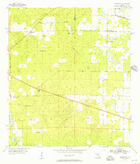 1955 Bronson NE1956 Print · USGSLevy County's rural landscape in the mid-fifties reveals a network of sinkhole ponds and early industrial sites. Local historians can trace the Seaboard Air Line and Old Railroad Grade near Merediths or locate the Smith Cem.3 unique versions available
Showing maps 1-25 of 195
Top cities of Levy County
- Williston historical maps
- Chiefland historical maps
- East Bronson historical maps
- Inglis historical maps
- Bronson historical maps
- Cedar Key historical maps
See more
Frequently asked questions
- What are the different types of historical maps available for Levy County?
- What is the oldest map of Levy County?
- Where can I purchase historical maps of Levy County for my home or office?
- Where can I download high-res historical maps of Levy County?
- Are there historical topographic maps available for Levy County?
- Is there historical aerial imagery available for Levy County?
- Where are historical maps of Levy County sourced from?