
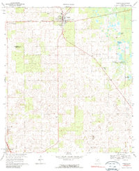
1968 Map of Trenton
USGS Topo · Published 1971About this map
Trenton serves as the central hub of this late-1960s agricultural and pine-woodland landscape on the border of Gilchrist and Levy counties. The town's grid is concentrated around the Seaboard Coast Line railroad, illustrating the importance of rail transit for North Florida's rural interior during this era. Beyond the settlement, the map reveals a terrain heavily shaped by karst topography, where the land is dotted with countless small depressions and sinkholes, many of which are obscured by dense woodland cover indicated by the green tinting. This detailed survey captures the sparse development pattern of the region before significant modern expansion, highlighting the isolation of the surrounding homesteads and the primary transport corridors connecting the county seat to the broader Florida panhandle.
Find a feature on this map
1 named feature on this map. Tap any name to fly to it.
Don’t see what you’re looking for? This feature index may not catch every label — zoom into the map to look around manually.
Map Details
Editions of this 1968 Trenton Map
3 editions found
Other maps of this area

1954 · Chiefland
USGS Topo · 1:24,000

1954 · Bronson
USGS Topo · 1:24,000

1954 · Manatee Springs
USGS Topo · 1:24,000

1954 · Gainesville
USGS Topo · 1:250,000

1958 · Gainesville
USGS Topo · 1:250,000

1959 · Gainesville
USGS Topo · 1:250,000

1968 · Newberry SW
USGS Topo · 1:24,000

1968 · Waters Lake
USGS Topo · 1:24,000

1968 · Fourmile Lake
USGS Topo · 1:24,000
1968 · Suwannee River
USGS Topo · 1:24,000