Old Maps of Los Robles, Tallahassee
Explore 15 old maps of Los Robles, spanning from 1940 to today. These high-resolution historic maps reveal how streets, neighborhoods, landmarks, and natural features evolved over time — perfect for genealogy, metal detecting, research, and local history exploration.
What you can do with these maps:
- See how Los Robles changed over time: Compare historical maps to modern-day views to trace roads, homesites, rail lines & more.
- View detailed metadata: Each map includes creators, publishers, year, scale, and archive source.
- Overlay maps with satellite & LiDAR: Visualize the past alongside modern tools to explore terrain & human change.
- Trusted historical sources: Maps sourced from the USGS, Library of Congress, and other archives.
- Access maps your way: View online, download high-res files, or order prints for personal or research use.
Start exploring old maps of Los Robles to uncover forgotten places, hidden landmarks, and the deep history beneath your feet.
Los Robles, Tallahassee maps
(15)- 1940 Map of Tallahassee, 1958 Print
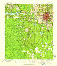 1940 Tallahassee1958 Print · USGSFlorida's capital city and the surrounding Leon County pine forests are captured here just before the mid-century expansion. Genealogists and local historians can trace rural communities like Hilliardville and Woodville alongside landmarks like Richardson Sch and Lake Talquin.2 unique versions available
 - 1942 Map of Tallahassee
 1942 Tallahassee1942 Print · USGSTallahassee and the surrounding Leon County area appear here in the early 1940s, balancing its role as a college town with the wilderness of the Apalachicola National Forest. Researchers can trace the rural church and school networks of Woodville and Spring Hill, or locate early campus footprints for Florida State College for Women.
 - 1943 Map of Tallahassee
 1943 Tallahassee1943 Print · USGSMid-century Tallahassee and the eastern edge of the Apalachicola National Forest appear here in the years just before post-war suburban growth. Genealogists can trace rural communities through landmarks like Florida Agricultural and Mechanical College, Hilliardville, and the Gum Pond Sch.2 unique versions available
 - 1954 Map of Tallahassee, 1967 Print
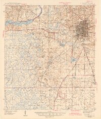
 1954 Tallahassee1967 Print · USGSThe Florida Panhandle and South Georgia are captured here during a period of mid-century growth and military expansion. Researchers can trace the development of Panama City, the footprint of Tyndall Air Force Base, and the rail lines of the Atlantic Coast Line.4 unique versions available
 - 1959 Map of Tallahassee
 1959 Tallahassee1959 Print · USGSFlorida's Panhandle and the Big Bend region appear here in the mid-fifties, showing a landscape defined by its great river systems and developing coast. Trace the early layout of Panama City, the expansive Apalachicola National Forest, and the coastal St Marks Lighthouse.
 - 1960 Map of Tallahassee
 1960 Tallahassee1960 Print · USGSThe Florida Panhandle and southern Georgia are captured here in the mid-twentieth century, showing a region defined by its rivers and military installations. Genealogists and historians can trace the growth of Tallahassee or locate coastal landmarks like the St Marks Lighthouse and Tyndall Air Force Base.
 - 1970 Map of Tallahassee, 1972 Print
 1970 Tallahassee1972 Print · USGSTallahassee is shown during a period of rapid expansion in the early seventies, balancing its role as a state capital and university hub. Genealogists can locate family landmarks from the Governor's Mansion to the Roselawn Cemetery and Bond Sch.4 unique versions available
 - 1979 Map of Tallahassee, 1980 Print
 1979 Tallahassee1980 Print · USGSFlorida's capital and the Gulf coast are captured here in the late seventies, showing the region's balance between urban growth and massive protected wetlands. Researchers can trace the routes of the Apalachicola Northern Railroad or locate small inland hubs like Sopchoppy, Panacea, and Hosford.
 - 1988 Map of Tallahassee
 1988 Tallahassee1988 Print · USGSThe Florida Panhandle and South Georgia are captured here in the late eighties, showing the expansion of the regional highway network and coastal growth. Genealogists and historians can trace rail lines like the Seaboard System Railroad or locate family roots in Blountstown, Graceville, or Crawfordville.2 unique versions available
 - 1999 Map of Tallahassee, 2000 Print
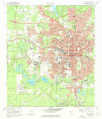
 1999 Tallahassee2000 Print · USGSTallahassee at the close of the century shows a bustling state capital and academic hub surrounded by the southern pines. Researchers can trace historic sites like the Old City Cemetery, schools including Leon High Sch, and the grounds of Florida State University.
 - 2012 Map of Tallahassee, 2012 Print
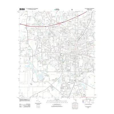 2012 Tallahassee2012 Print · USGSCovers Los Robles, including Tallahassee, Belair, and other nearby areas
 - 2015 Map of Tallahassee, 2015 Print
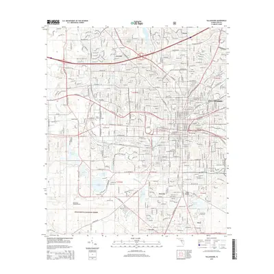 2015 Tallahassee2015 Print · USGSCovers Los Robles, including Tallahassee, Belair, and other nearby areas
 - 2018 Map of Tallahassee, 2018 Print
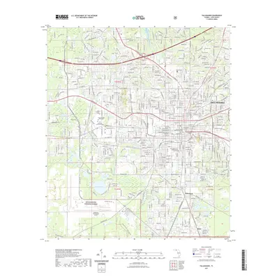
 2018 Tallahassee2018 Print · USGSCovers Los Robles, including Tallahassee, Belair, and other nearby areas
 - 2021 Map of Tallahassee, 2021 Print
 2021 Tallahassee2021 Print · USGSCovers Los Robles, including Tallahassee, Belair, and other nearby areas
 - 2024 Map of Tallahassee, 2024 Print
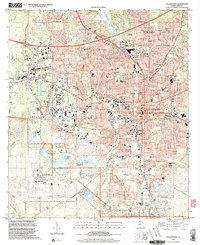
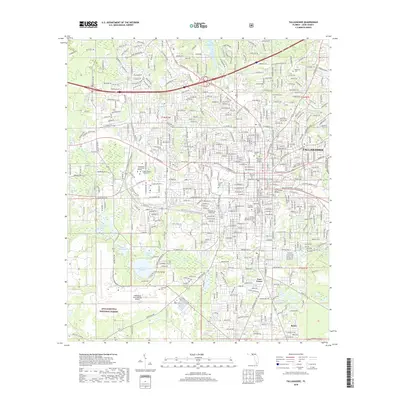
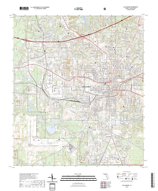 2024 Tallahassee2024 Print · USGSFlorida's capital city is charted in great detail during the early 2020s, showing the intersection of modern university campuses and deep-rooted local history. Researchers can identify numerous family burial grounds like the Johnson Family Cem and follow the Tallahassee St Marks Rail Trl.
End of results
Showing maps 1-15 of 15
Frequently asked questions
- What are the different types of historical maps available for Los Robles?
- What is the oldest map of Los Robles?
- Where can I purchase historical maps of Los Robles for my home or office?
- Where can I download high-res historical maps of Los Robles?
- Are there historical topographic maps available for Los Robles?
- Is there historical aerial imagery available for Los Robles?
- Where are historical maps of Los Robles sourced from?