Old Maps of Fort McCoy, Florida
Explore 11 old maps of Fort McCoy, spanning from 1954 to today. These high-resolution historic maps reveal how streets, neighborhoods, landmarks, and natural features evolved over time — perfect for genealogy, metal detecting, research, and local history exploration.
What you can do with these maps:
- See how Fort McCoy changed over time: Compare historical maps to modern-day views to trace roads, homesites, rail lines & more.
- View detailed metadata: Each map includes creators, publishers, year, scale, and archive source.
- Overlay maps with satellite & LiDAR: Visualize the past alongside modern tools to explore terrain & human change.
- Trusted historical sources: Maps sourced from the USGS, Library of Congress, and other archives.
- Access maps your way: View online, download high-res files, or order prints for personal or research use.
Start exploring old maps of Fort McCoy to uncover forgotten places, hidden landmarks, and the deep history beneath your feet.
Fort McCoy, FL maps
(11)- 1954 Map of Daytona Beach, 1974 Print
 1954 Daytona Beach1974 Print · USGSNortheast Florida is captured in the mid-1950s, showing the transition from river-based commerce to coastal tourism. Researchers can trace the Florida East Coast rail lines and find historic sites like Castillo de San Marcos Nat Mon and Palatka.
 - 1958 Map of Daytona Beach
 1958 Daytona Beach1958 Print · USGSThe Florida coast and St. Johns River valley are captured in the late 1950s, showing a landscape defined by citrus-belt rail towns and Atlantic shorelines. Genealogists can trace family roots through riverside settlements like Palatka and Welaka or coastal hubs like Daytona Beach.2 unique versions available
 - 1964 Map of Daytona Beach
 1964 Daytona Beach1964 Print · USGSCoastal Florida in the mid-1960s shows a fascinating balance between burgeoning beach tourism and the deep interior wilderness of the Ocala National Forest. Researchers can trace the path of the Florida East Coast railway through historic settlements like St. Augustine, Marineland, and Palatka.
 - 1970 Map of Ft McCoy, 1973 Print
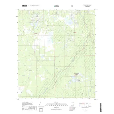
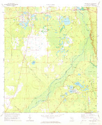 1970 Ft McCoy1973 Print · USGSMarion County's river-fed wetlands and forests are captured here in the early 1970s, showcasing the intricate relationship between the Oklawaha River and its surrounding communities. Researchers can trace historic river access points like Strouds Landing and Parch Landing or locate family sites near Fort McCoy and Graveyard Lake.3 unique versions available
 - 1978 Map of Daytona Beach, 1980 Print
 1978 Daytona Beach1980 Print · USGSCoastal development meets the wild Florida interior in the late seventies, spanning from the Atlantic beaches to the St. Johns River. Trace the growth of Daytona Beach or find inland outposts like Salt Springs, De Leon Springs, and the U S Naval Reservation.2 unique versions available
 - 1999 Map of Fort Mc Coy, 2001 Print
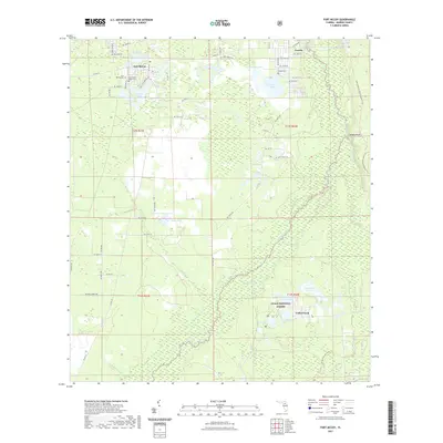
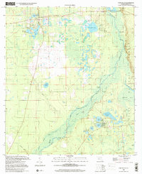 1999 Fort Mc Coy2001 Print · USGSMarion County at the end of the twentieth century remains a landscape of river landings and dense forest. Genealogists and researchers can trace local family ties and land use through Fort McCoy, the Cem sites, and landings like Osceola Landing or Gores Landing.
 - 2012 Map of Fort McCoy, 2012 Print
 2012 Fort McCoy2012 Print · USGSCovers Fort McCoy, including Eureka, Cedar Creek, and other nearby areas
 - 2015 Map of Fort McCoy, 2015 Print
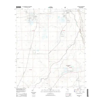 2015 Fort McCoy2015 Print · USGSCovers Fort McCoy, including Eureka, Cedar Creek, and other nearby areas
 - 2018 Map of Fort McCoy, 2018 Print
 2018 Fort McCoy2018 Print · USGSCovers Fort McCoy, including Eureka, Cedar Creek, and other nearby areas
 - 2021 Map of Fort McCoy, 2021 Print
 2021 Fort McCoy2021 Print · USGSCovers Fort McCoy, including Eureka, Cedar Creek, and other nearby areas
 - 2024 Map of Fort McCoy, 2024 Print
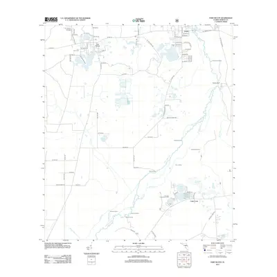
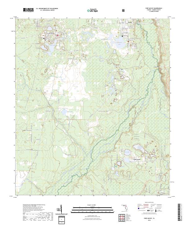 2024 Fort McCoy2024 Print · USGSThe northern Marion County interior is documented here in the early twenty-first century, centered on the settlement of Fort McCoy. Researchers can locate several burial sites including Fort McCoy Negro Cem and Eureka Cem alongside the winding Ocklawaha River.
End of results
Showing maps 1-11 of 11
Top cities near Fort McCoy
- Ocala historical maps
- Citra historical maps
- Hawthorne historical maps
- Reddick historical maps
- Island Grove historical maps
Frequently asked questions
- What are the different types of historical maps available for Fort McCoy?
- What is the oldest map of Fort McCoy?
- Where can I purchase historical maps of Fort McCoy for my home or office?
- Where can I download high-res historical maps of Fort McCoy?
- Are there historical topographic maps available for Fort McCoy?
- Is there historical aerial imagery available for Fort McCoy?
- Where are historical maps of Fort McCoy sourced from?