Old Maps of Summer Haven, Florida
Explore 13 old maps of Summer Haven, spanning from 1927 to today. These high-resolution historic maps reveal how streets, neighborhoods, landmarks, and natural features evolved over time — perfect for genealogy, metal detecting, research, and local history exploration.
What you can do with these maps:
- See how Summer Haven changed over time: Compare historical maps to modern-day views to trace roads, homesites, rail lines & more.
- View detailed metadata: Each map includes creators, publishers, year, scale, and archive source.
- Overlay maps with satellite & LiDAR: Visualize the past alongside modern tools to explore terrain & human change.
- Trusted historical sources: Maps sourced from the USGS, Library of Congress, and other archives.
- Access maps your way: View online, download high-res files, or order prints for personal or research use.
Start exploring old maps of Summer Haven to uncover forgotten places, hidden landmarks, and the deep history beneath your feet.
Summer Haven, FL maps
(13)- 1927 Map of Matanzas
 1927 Matanzas1927 Print · USGSThe Florida coast near the border of St. Johns and Flagler Counties comes to life in this mid-1930s survey. Researchers can trace the early path of State Hy No 140 and locate vanished coastal sites like Summer Haven, Shell, and Hopper.
 - 1943 Map of Matanzas, 1957 Print
 1943 Matanzas1957 Print · USGSThe Florida coast near the St. Johns and Flagler line is captured here during the mid-century, before massive development altered the shoreline. Researchers can trace the path of the Old Kings Road and locate sites like Marineland and Ft Matanzas.
 - 1944 Map of Matanzas
 1944 Matanzas1944 Print · USGSThe Florida coast near the St. Johns and Flagler line is shown here in the mid-1940s, just as the region began its modern growth. Researchers can trace the historical Old Kings Road and locate early landmarks like Ft Matanzas, Summer Haven, and Marineland.
 - 1954 Map of Daytona Beach, 1974 Print
 1954 Daytona Beach1974 Print · USGSNortheast Florida is captured in the mid-1950s, showing the transition from river-based commerce to coastal tourism. Researchers can trace the Florida East Coast rail lines and find historic sites like Castillo de San Marcos Nat Mon and Palatka.
 - 1956 Map of Matanzas Inlet, 1960 Print
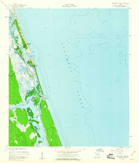 1956 Matanzas Inlet1960 Print · USGSAlong the Atlantic coast in the mid-1950s, this area preserves the strategic landscape surrounding the Matanzas Inlet. Researchers can trace the early layout of Summer Haven and Marineland, or explore the historical site of Ft Matanzas on the Matanzas River.4 unique versions available
 - 1958 Map of Daytona Beach
 1958 Daytona Beach1958 Print · USGSThe Florida coast and St. Johns River valley are captured in the late 1950s, showing a landscape defined by citrus-belt rail towns and Atlantic shorelines. Genealogists can trace family roots through riverside settlements like Palatka and Welaka or coastal hubs like Daytona Beach.2 unique versions available
 - 1964 Map of Daytona Beach
 1964 Daytona Beach1964 Print · USGSCoastal Florida in the mid-1960s shows a fascinating balance between burgeoning beach tourism and the deep interior wilderness of the Ocala National Forest. Researchers can trace the path of the Florida East Coast railway through historic settlements like St. Augustine, Marineland, and Palatka.
 - 1981 Map of Saint Augustine, 1982 Print
 1981 Saint Augustine1982 Print · USGSNortheast Florida in the early eighties shows a landscape of deep river commerce and coastal growth. Genealogists and historians can trace the inland rail network of the Seaboard Coast Line through rural Hastings or explore the military footprint of Camp Blanding.2 unique versions available
 - 2012 Map of Matanzas Inlet, 2012 Print
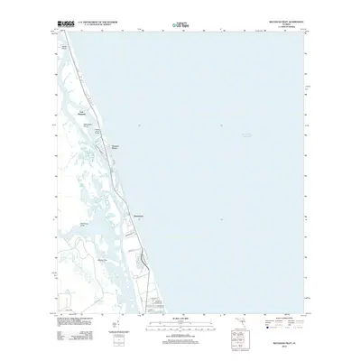 2012 Matanzas Inlet2012 Print · USGSCovers Summer Haven, including Palm Coast, Marineland, and other nearby areas
 - 2015 Map of Matanzas Inlet, 2015 Print
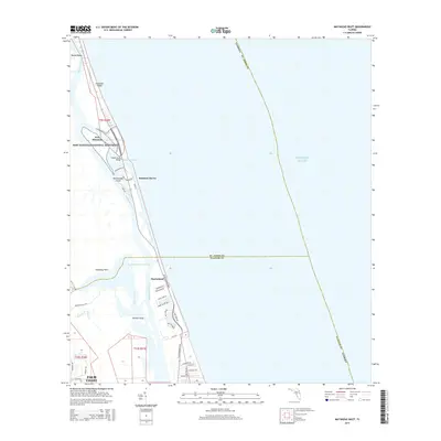 2015 Matanzas Inlet2015 Print · USGSCovers Summer Haven, including Palm Coast, Marineland, and other nearby areas
 - 2018 Map of Matanzas Inlet, 2018 Print
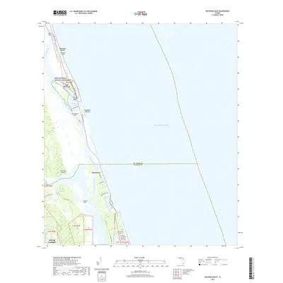 2018 Matanzas Inlet2018 Print · USGSCovers Summer Haven, including Palm Coast, Marineland, and other nearby areas
 - 2021 Map of Matanzas Inlet, 2021 Print
 2021 Matanzas Inlet2021 Print · USGSCovers Summer Haven, including Palm Coast, Marineland, and other nearby areas
 - 2024 Map of Matanzas Inlet, 2024 Print
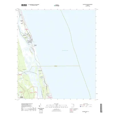
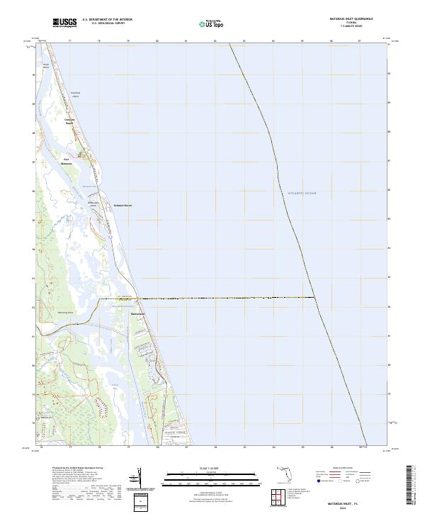 2024 Matanzas Inlet2024 Print · USGSThe Florida coast near the St. Johns and Flagler county line remains a landscape defined by historic seafaring routes and barrier island geography. Genealogists and historians can trace the development of coastal settlements like Summer Haven and Marineland, or locate the historic site of Fort Matanzas.
End of results
Showing maps 1-13 of 13
Top cities near Summer Haven
- Palm Coast historical maps
- Saint Augustine historical maps
- Saint Augustine Beach historical maps
- Flagler Beach historical maps
- Saint Augustine South historical maps
- Saint Augustine Shores historical maps
See more
Frequently asked questions
- What are the different types of historical maps available for Summer Haven?
- What is the oldest map of Summer Haven?
- Where can I purchase historical maps of Summer Haven for my home or office?
- Where can I download high-res historical maps of Summer Haven?
- Are there historical topographic maps available for Summer Haven?
- Is there historical aerial imagery available for Summer Haven?
- Where are historical maps of Summer Haven sourced from?