Old Maps of Brooks County, Georgia
Explore 103 old maps of Brooks County, spanning from 1953 to today. These high-resolution historic maps reveal how streets, neighborhoods, landmarks, and natural features evolved over time — perfect for genealogy, metal detecting, research, and local history exploration.
What you can do with these maps:
- See how Brooks County changed over time: Compare historical maps to modern-day views to trace roads, homesites, rail lines & more.
- View detailed metadata: Each map includes creators, publishers, year, scale, and archive source.
- Overlay maps with satellite & LiDAR: Visualize the past alongside modern tools to explore terrain & human change.
- Trusted historical sources: Maps sourced from the USGS, Library of Congress, and other archives.
- Access maps your way: View online, download high-res files, or order prints for personal or research use.
Start exploring old maps of Brooks County to uncover forgotten places, hidden landmarks, and the deep history beneath your feet.
Brooks County, GA maps
(103)- 1953 Map of Waycross, 1967 Print
 1953 Waycross1967 Print · USGSSouth Georgia's agricultural and rail heartland is captured here in the mid-1950s, showing a vast network of timber and farming towns. Researchers can trace the rail lines connecting Waycross and Tifton or locate landmarks like Jefferson Davis State Park and Lake Blackshear.2 unique versions available
 - 1954 Map of Valdosta, 1967 Print
 1954 Valdosta1967 Print · USGSThe South Georgia and North Florida borderlands are captured here in the mid-fifties, showing the deep timber and wetland networks of the coastal plain. Researchers can trace the path of the Atlantic Coast Line through Valdosta or explore the interior of the Okefenokee Swamp.2 unique versions available
 - 1956 Map of Grooverville, 1957 Print
 1956 Grooverville1957 Print · USGSThe Georgia-Florida borderlands in the mid-fifties reveal a quiet rural landscape of family cemeteries and timbered bays. Researchers can pinpoint the locations of local schools like Grooverville Sch and the grounds of Simmons Hill Ch Cem.2 unique versions available
 - 1956 Map of Clyattville, 1957 Print
 1956 Clyattville1957 Print · USGSThe Georgia-Florida border country comes into focus in the mid-fifties, centered on the railroad town of Clyattville. Genealogists can trace family roots at Forest Grove Cem and numerous rural houses of worship like Benevolence Ch.3 unique versions available
 - 1956 Map of Nankin, 1957 Print
 1956 Nankin1957 Print · USGSGeorgia's border with Florida in the mid-fifties is defined by the winding Withlacoochee River and a landscape of rural congregations. Genealogists can trace family roots through numerous sites like Redland Cem, Antioch Ch, and the settlement of Nankin.2 unique versions available
 - 1956 Map of Baden, 1958 Print
 1956 Baden1958 Print · USGSThe Georgia-Florida borderlands come to life in the mid-1950s, showing the rural communities and railroad stops along the SOUTHERN line. Researchers can trace family roots at Radford-Denson Cem, Hickory Head Ch, and local schoolhouses like Liberty Sch.2 unique versions available
 - 1958 Map of Valdosta
 1958 Valdosta1958 Print · USGSSouth Georgia and North Florida are captured here in the mid-fifties, showing the vast Okefenokee Swamp and the vital timber and rail corridors connecting the two states. Researchers can locate the footprint of Moody Air Force Base, trace the Live Oak Perry and Gulf railroad, or find early community sites like Bakers Mill and Paradise Church.
 - 1958 Map of Waycross
 1958 Waycross1958 Print · USGSSoutheast Georgia in the late fifties remains a landscape of deep river basins and vital rail junctions. Genealogists and historians can trace family-named landmarks and rural hubs like Union Church, South Georgia College, and the sprawling Okefenokee Swamp.2 unique versions available
 - 1959 Map of Valdosta
 1959 Valdosta1959 Print · USGSThe Georgia-Florida borderlands in the mid-fifties reveal a landscape of massive blackwater swamps and emerging military aviation hubs. Genealogists and historians can trace rail-stop towns like Fargo and Stockton or explore the interior reaches of the Okefenokee Swamp and Billys Island.
 - 1961 Map of Hahira East, 1964 Print
 1961 Hahira East1964 Print · USGSIn the early sixties, this area north of Valdosta shows a landscape of traditional agriculture beginning to meet modern highway development. Genealogists can locate family landmarks like Passmore Cem, Jerusalem Ch, and the rural community at Mineola.4 unique versions available
 - 1961 Map of Quitman, 1964 Print
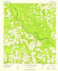
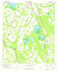
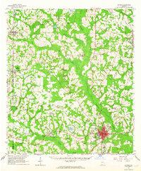 1961 Quitman1964 Print · USGSBrooks and Thomas counties are shown in the early sixties as a thriving rail-centered landscape. Genealogists can trace family names and local landmarks through sites like Robinson Cem, Simmon Hill Ch, and the mills at Bowen Millpond.
 - 1961 Map of Valdosta, 1965 Print
 1961 Valdosta1965 Print · USGSValdosta and its surrounding Lowndes County communities are captured in the early sixties as a thriving center of Georgia education and industry. Researchers can trace the footprints of Valdosta State College, locate family sites near Riverhill Cem, or follow the ATLANTIC COAST LINE through West Valdosta.4 unique versions available
 - 1961 Map of Hahira West, 1965 Print
 1961 Hahira West1965 Print · USGSBrooks and Lowndes counties in the early sixties reveal a landscape of rural schoolhouses and historic travel routes. Genealogists can locate family burial grounds and congregations like Miller Cem, Second Elizabeth Ch, and the Webb-Miller Sch along the Little River.2 unique versions available
 - 1961 Map of Ousley, 1965 Print
 1961 Ousley1965 Print · USGSBrooks and Lowndes counties at the start of the sixties were defined by the winding Withlacoochee River and the steady pulse of the Atlantic Coast Line. Researchers can trace the layout of small rural centers like Ousley and Durden or locate historic congregation sites such as Philadelphia Ch.2 unique versions available
 - 1973 Map of Cecil, 1975 Print
 1973 Cecil1975 Print · USGSThe rural landscape of Cook and Lowndes counties comes into focus in the early 1970s, dominated by the Georgia South and Florida rail line. Researchers can trace the history of local congregations at Jerusalem Missionary Ch and Salem Ch, or locate family sites near Cecil Bay.
 - 1974 Map of Berlin East, 1976 Print
 1974 Berlin East1976 Print · USGSThe rural borderlands of Colquitt, Cook, and Brooks counties come into focus in the mid-1970s as agricultural life centers on the LITTLE RIVER. Genealogists and local historians can trace the foundations of these communities through landmarks like China Grove Ch, the settlement of Berlin, and the OLD RAILROAD GRADE.2 unique versions available
 - 1974 Map of Quitman, 1987 Print
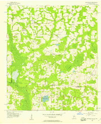
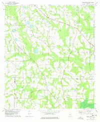
 1974 Quitman1987 Print · USGSBrooks County is shown at a mid-century peak in this survey of Quitman and its surrounding rail junctions. Researchers can trace family roots at Oak Hill Cem or locate rural hamlets like Spain and Shiver along the Okapilco Creek basin.
 - 1975 Map of Pebble Hill, 1987 Print
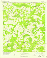
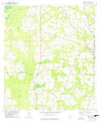
 1975 Pebble Hill1987 Print · USGSBrooks County during the mid-seventies shows a landscape of deep-rooted rural communities connected by historic pioneer routes and the regional rail network. Genealogists and historians can trace family sites near Salem Ch, follow the path of the Old Coffee Road, and locate the old Live Oak Perry and South Georgia rail grade.
 - 1977 Map of Quitman, 1978 Print
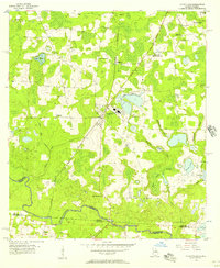
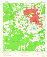
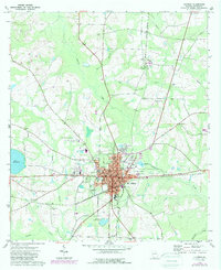
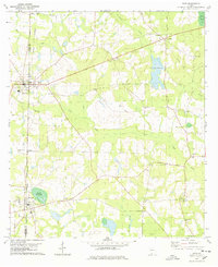
 1977 Quitman1978 Print · USGSBrooks County during the late 1970s centers on the busy rail and road corridors of QUITMAN. Genealogists and historians can trace family sites at Bethlehem Cem, Rogers Cem, and the historic Monument Ch along the SEABOARD COAST LINE route.
 - 1978 Map of Pebble Hill
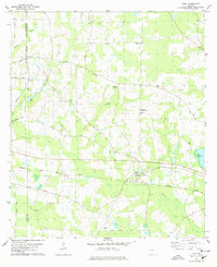
 1978 Pebble Hill1978 Print · USGSBrooks County in the late seventies is a landscape of rural congregations and historic transit routes. Genealogists and local historians can trace family ties through St James Cem and numerous country churches, while following the path of the Old Coffee Road.
 - 1978 Map of Pavo
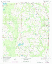
 1978 Pavo1978 Print · USGSBrooks and Thomas Counties in the late seventies showcase a rural landscape centered on the town of Pavo and the historic Old Coffee Road. Genealogists and historians can trace numerous family-named sites including Lebanon Cem, Pope Millpond, and Okapilco Ch.2 unique versions available
 - 1978 Map of Dixie
 1978 Dixie1978 Print · USGSDixie and the surrounding Brooks County countryside are shown here in the late seventies as the railroad still dictated the local geography. Researchers can trace the heritage of local families and congregations at Westbrook High Sch, Groover Cem, and Ham City Ch.2 unique versions available
 - 1978 Map of Berlin West
 1978 Berlin West1978 Print · USGSSouth Georgia's rural landscape at the edge of the Colquitt and Brooks county line reveals a network of farming communities and rail lines in the late seventies. Researchers can trace family roots at Sardis Ch Cem, visit the settlement of Berlin, or follow the Georgia Northern Railroad.2 unique versions available
 - 1979 Map of Moultrie, 1980 Print
 1979 Moultrie1980 Print · USGSSouth Georgia’s agricultural heartland is documented here in the late 1970s, showcasing the intricate rail and river networks of Colquitt and Tift Counties. Researchers can trace historic settlements along the Georgia Northern railroad or locate landmarks like Spence Air Force Auxiliary Field and Banks Lake.2 unique versions available
 - 1981 Map of Valdosta
 1981 Valdosta1981 Print · USGSCrossing the Georgia and Florida border in the early eighties, this survey captures the agricultural and military landscape of the coastal plain. Genealogists and historians can trace the rail-linked growth of Valdosta and Quitman or find rural landmarks like New Hope Church and Lake Miccosukee.
Showing maps 1-25 of 103
Top cities of Brooks County
Frequently asked questions
- What are the different types of historical maps available for Brooks County?
- What is the oldest map of Brooks County?
- Where can I purchase historical maps of Brooks County for my home or office?
- Where can I download high-res historical maps of Brooks County?
- Are there historical topographic maps available for Brooks County?
- Is there historical aerial imagery available for Brooks County?
- Where are historical maps of Brooks County sourced from?