Old Maps of Marietta, Georgia
Explore 29 old maps of Marietta, spanning from 1888 to today. These high-resolution historic maps reveal how streets, neighborhoods, landmarks, and natural features evolved over time — perfect for genealogy, metal detecting, research, and local history exploration.
What you can do with these maps:
- See how Marietta changed over time: Compare historical maps to modern-day views to trace roads, homesites, rail lines & more.
- View detailed metadata: Each map includes creators, publishers, year, scale, and archive source.
- Overlay maps with satellite & LiDAR: Visualize the past alongside modern tools to explore terrain & human change.
- Trusted historical sources: Maps sourced from the USGS, Library of Congress, and other archives.
- Access maps your way: View online, download high-res files, or order prints for personal or research use.
Start exploring old maps of Marietta to uncover forgotten places, hidden landmarks, and the deep history beneath your feet.
Marietta, GA maps
(29)- 1888 Map of Atlanta, 1955 Print
 1888 Atlanta1955 Print · USGSCovers Marietta, including Atlanta, Sandy Springs, and other nearby areas
 - 1890 Map of Cartersville
 1890 Cartersville1890 Print · USGSCovers Marietta, including Kennesaw, Woodstock, and other nearby areas
 - 1890 Map of Atlanta
 1890 Atlanta1890 Print · USGSCovers Marietta, including Atlanta, Sandy Springs, and other nearby areas
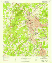
 - 1891 Map of Marietta
 1891 Marietta1891 Print · USGSCovers Marietta, including Atlanta, South Fulton, and other nearby areas
 - 1891 Map of Cartersville
 1891 Cartersville1891 Print · USGSCovers Marietta, including Kennesaw, Woodstock, and other nearby areas
 - 1892 Map of Atlanta
 1892 Atlanta1892 Print · USGSCovers Marietta, including Atlanta, Sandy Springs, and other nearby areas
 - 1895 Map of Atlanta
 1895 Atlanta1895 Print · USGSCovers Marietta, including Atlanta, Sandy Springs, and other nearby areas7 unique versions available
 - 1895 Map of Marietta
 1895 Marietta1895 Print · USGSCovers Marietta, including Atlanta, South Fulton, and other nearby areas
 - 1896 Map of Cartersville
 1896 Cartersville1896 Print · USGSCovers Marietta, including Kennesaw, Woodstock, and other nearby areas4 unique versions available
 - 1897 Map of Marietta
 1897 Marietta1897 Print · USGSCovers Marietta, including Atlanta, South Fulton, and other nearby areas
 - 1901 Map of Marietta
 1901 Marietta1901 Print · USGSCovers Marietta, including Atlanta, South Fulton, and other nearby areas4 unique versions available
 - 1907 Map of Acworth, 1954 Print
 1907 Acworth1954 Print · USGSCovers Marietta, including Kennesaw, Woodstock, and other nearby areas
 - 1909 Map of Acworth
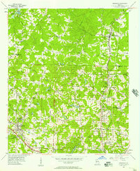
 1909 Acworth1909 Print · USGSCovers Marietta, including Kennesaw, Woodstock, and other nearby areas
 - 1953 Map of Atlanta, 1965 Print
 1953 Atlanta1965 Print · USGSCovers Marietta, including Atlanta, Sandy Springs, and other nearby areas2 unique versions available
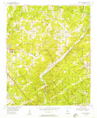
 - 1954 Map of Marietta, 1957 Print
 1954 Marietta1957 Print · USGSCovers Marietta, including Smyrna, Kennesaw, and other nearby areas6 unique versions available
 - 1955 Map of Rome
 1955 Rome1955 Print · USGSCovers Marietta, including Chattanooga, Sandy Springs, and other nearby areas
 - 1955 Map of Sandy Springs, 1957 Print
 1955 Sandy Springs1957 Print · USGSCovers Marietta, including Atlanta, Sandy Springs, and other nearby areas6 unique versions available
 - 1956 Map of Kennesaw, 1957 Print
 1956 Kennesaw1957 Print · USGSCovers Marietta, including Kennesaw, Woodstock, and other nearby areas5 unique versions available
 - 1957 Map of Atlanta
 1957 Atlanta1957 Print · USGSCovers Marietta, including Atlanta, Sandy Springs, and other nearby areas
 - 1958 Map of Atlanta
 1958 Atlanta1958 Print · USGSCovers Marietta, including Atlanta, Sandy Springs, and other nearby areas
 - 1958 Map of Rome, 1966 Print
 1958 Rome1966 Print · USGSCovers Marietta, including Chattanooga, Sandy Springs, and other nearby areas3 unique versions available
 - 1961 Map of Rome
 1961 Rome1961 Print · USGSCovers Marietta, including Chattanooga, Sandy Springs, and other nearby areas
 - 1963 Map of Rome
 1963 Rome1963 Print · USGSCovers Marietta, including Chattanooga, Sandy Springs, and other nearby areas
 - 1981 Map of Cartersville, 1982 Print
 1981 Cartersville1982 Print · USGSCovers Marietta, including Sandy Springs, Roswell, and other nearby areas2 unique versions available
 - 1981 Map of Atlanta, 1982 Print
 1981 Atlanta1982 Print · USGSCovers Marietta, including Atlanta, Sandy Springs, and other nearby areas
Showing maps 1-25 of 29
Top cities near Marietta
- Atlanta historical maps
- Sandy Springs historical maps
- Roswell historical maps
- Alpharetta historical maps
- Smyrna historical maps
- Brookhaven historical maps
See more
Top neighborhoods of Marietta
- Elizabeth historical maps
- Whitlock Avenue Historic District historical maps
- Northwest Marietta Historic District historical maps
- Marietta Square historical maps
- Magnolia Park historical maps
- Barrett Heights historical maps
See more
Frequently asked questions
- What are the different types of historical maps available for Marietta?
- What is the oldest map of Marietta?
- Where can I purchase historical maps of Marietta for my home or office?
- Where can I download high-res historical maps of Marietta?
- Are there historical topographic maps available for Marietta?
- Is there historical aerial imagery available for Marietta?
- Where are historical maps of Marietta sourced from?