Old Maps of Cumming, Georgia
Explore 23 old maps of Cumming, spanning from 1890 to today. These high-resolution historic maps reveal how streets, neighborhoods, landmarks, and natural features evolved over time — perfect for genealogy, metal detecting, research, and local history exploration.
What you can do with these maps:
- See how Cumming changed over time: Compare historical maps to modern-day views to trace roads, homesites, rail lines & more.
- View detailed metadata: Each map includes creators, publishers, year, scale, and archive source.
- Overlay maps with satellite & LiDAR: Visualize the past alongside modern tools to explore terrain & human change.
- Trusted historical sources: Maps sourced from the USGS, Library of Congress, and other archives.
- Access maps your way: View online, download high-res files, or order prints for personal or research use.
Start exploring old maps of Cumming to uncover forgotten places, hidden landmarks, and the deep history beneath your feet.
Cumming, GA maps
(23)- 1890 Map of Suwanee
 1890 Suwanee1890 Print · USGSNorth Georgia in the 1890s was a landscape of river-powered commerce and gold prospecting. Genealogists and historians can trace family-named river crossings like Jones Ferry and Pirkle's Ferry or locate the historic Kin Mori Gold Mine.
 - 1894 Map of Suwanee
 1894 Suwanee1894 Print · USGSNorth Georgia in the late nineteenth century was a landscape of river ferries and rising industry, from marble quarries to gold mines. Genealogists can trace family landmarks like Fields Cross Roads, the Kin Mori Gold Mine, and Fort Buffington.6 unique versions available
 - 1955 Map of Rome
 1955 Rome1955 Print · USGSThe tri-state borderlands of Georgia, Alabama, and Tennessee appear in the mid-fifties as a landscape of ridge-and-valley industry and river navigation. Genealogists can trace family footprints near Chattanooga, the iron works of Gadsden, and textile towns like Trion or Summerville.
 - 1958 Map of Rome, 1966 Print
 1958 Rome1966 Print · USGSNorthwest Georgia and neighboring Tennessee and Alabama are captured here in the late fifties, showcasing a landscape of high ridges and river valleys. Researchers can trace historic rail lines like the Seaboard Air Line RR and explore the bounds of Cloudland Canyon State Park or Fort Oglethorpe.3 unique versions available
 - 1961 Map of Rome
 1961 Rome1961 Print · USGSNorthwest Georgia and neighboring Tennessee and Alabama are shown here at a moment of significant mid-century growth. Researchers can trace the rail networks of the Central of Georgia or locate landmarks within Chickamauga and Chattanooga Nat Military Park.
 - 1963 Map of Rome
 1963 Rome1963 Print · USGSThe tri-state corner of Georgia, Alabama, and Tennessee is captured here during a period of massive reservoir expansion and post-war growth. Genealogists and historians can trace the rail corridors of the Southern Ry or locate landmarks like Fort Oglethorpe and Cloudland Canyon State Park.
 - 1964 Map of Buford Dam, 1965 Print
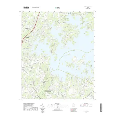
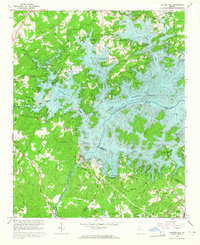 1964 Buford Dam1965 Print · USGSForsyth County landscape during the mid-sixties reveals the profound changes following the creation of Lake Sidney Lanier. Genealogists and historians can trace traditional landmarks like Beaver Ruin Cem and Chattahoochee Sch alongside the massive Buford Dam.4 unique versions available
 - 1964 Map of Cumming, 1965 Print
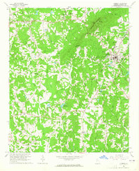 1964 Cumming1965 Print · USGSForsyth County during the mid-sixties shows a landscape of small rural communities and ridge-top landmarks. Researchers can locate family roots at country churches like Bethelview Ch or trace industrial sites like Sawnee Quarry and the Fish Hatchery.4 unique versions available
 - 1981 Map of Cartersville, 1982 Print
 1981 Cartersville1982 Print · USGSNorth Georgia at the start of the eighties shows a landscape defined by massive reservoirs and historic rail corridors. Researchers can trace the heritage of the Etowah Indian Mounds or locate old junctions along the Southern Railway and Seaboard Coast Line.2 unique versions available
 - 1992 Map of Cumming, 1993 Print
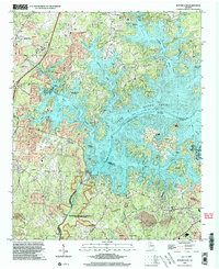
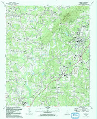 1992 Cumming1993 Print · USGSCumming and southern Forsyth County were on the verge of significant growth in the early nineties as the Atlanta suburbs expanded north. Researchers can trace family sites and local landmarks like Sawnee Mountain, Ducktown, and historic congregations at Daves Creek Ch and Shiloh Ch.
 - 1993 Map of Buford Dam, 2000 Print
 1993 Buford Dam2000 Print · USGSLake Sidney Lanier defines the Forsyth County landscape in the early nineties as modern recreation meets traditional rural life. Trace long-established landmarks like Ebenezer Ch, Island Ford, and the rising waters around Bald Ridge.
 - 1999 Map of Buford Dam, 2003 Print
 1999 Buford Dam2003 Print · USGSThe northern reaches of the metro-Atlanta area were undergoing significant suburbanization in the late 1990s as Lake Sidney Lanier became a primary recreational focal point. Researchers can locate long-standing landmarks such as Corinth Ch and Shoal Creek Ch alongside the engineering of Buford Dam.
 - 1999 Map of Cumming, 2003 Print
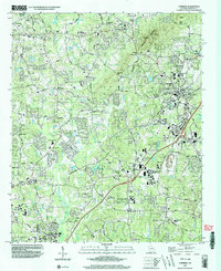 1999 Cumming2003 Print · USGSNorth Georgia’s suburban expansion meets the ridgeline of the Blue Ridge foothills in the final years of the millennium. Genealogists and local researchers can pinpoint family landmarks from Ducktown to Brandywine Community House, along with numerous historic congregations like Friendship Ch and Shiloh Ch.
 - 2011 Map of Cumming, 2011 Print
 2011 Cumming2011 Print · USGSCovers Cumming, including Pirkle Woods, Ducktown, and other nearby areas
 - 2011 Map of Buford Dam, 2011 Print
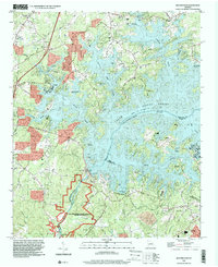
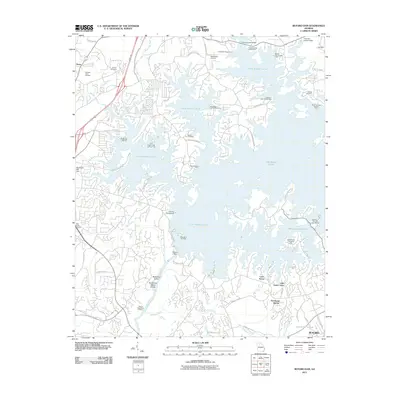 2011 Buford Dam2011 Print · USGSCovers Cumming, including Sugar Hill, Buford, and other nearby areas
 - 2014 Map of Buford Dam, 2014 Print
 2014 Buford Dam2014 Print · USGSCovers Cumming, including Sugar Hill, Buford, and other nearby areas
 - 2014 Map of Cumming, 2014 Print
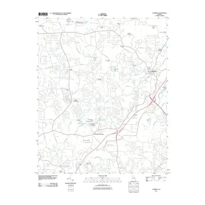
 2014 Cumming2014 Print · USGSCovers Cumming, including Pirkle Woods, Ducktown, and other nearby areas
 - 2017 Map of Cumming, 2017 Print
 2017 Cumming2017 Print · USGSCovers Cumming, including Pirkle Woods, Ducktown, and other nearby areas
 - 2017 Map of Buford Dam, 2017 Print
 2017 Buford Dam2017 Print · USGSCovers Cumming, including Sugar Hill, Buford, and other nearby areas
 - 2020 Map of Buford Dam, 2020 Print
 2020 Buford Dam2020 Print · USGSCovers Cumming, including Sugar Hill, Buford, and other nearby areas
 - 2020 Map of Cumming, 2020 Print
 2020 Cumming2020 Print · USGSCovers Cumming, including Pirkle Woods, Ducktown, and other nearby areas
 - 2024 Map of Cumming, 2024 Print
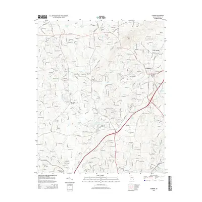
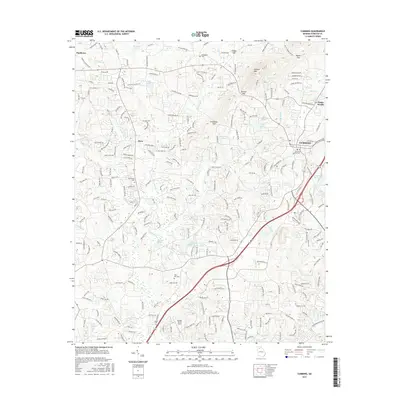
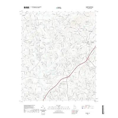
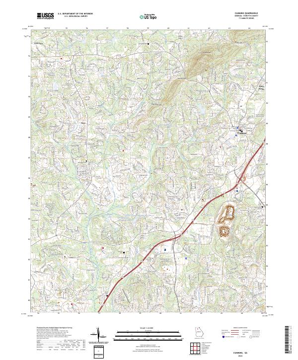 2024 Cumming2024 Print · USGSThe foothills of the Georgia Piedmont meet modern growth in Forsyth County during the early twenty-first century. Genealogists and researchers can locate family landmarks at Mars Hill Cemetery or Friendship Cemetery and trace the civic heart of Cumming.
 - 2024 Map of Buford Dam, 2024 Print
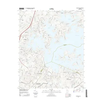
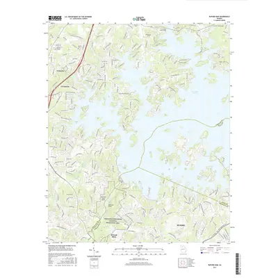
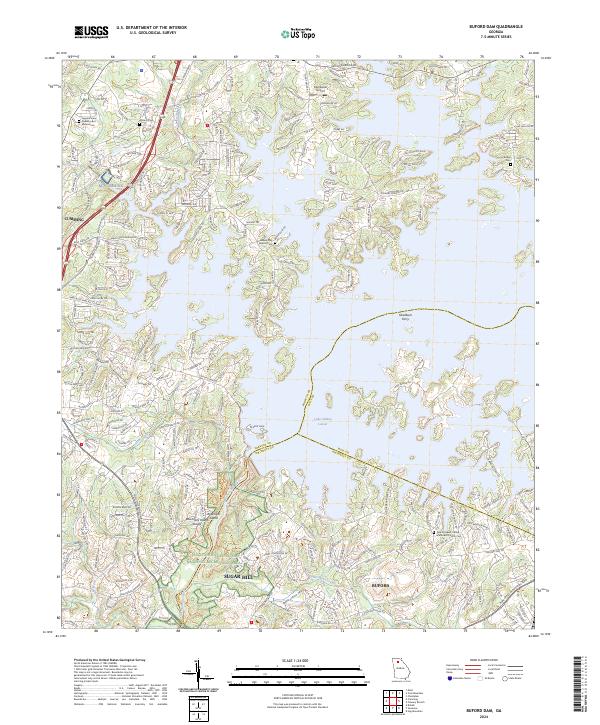 2024 Buford Dam2024 Print · USGSThe shorelines of Lake Sidney Lanier and the Chattahoochee River take center stage in this recent survey of the Forsyth and Gwinnett county borders. Researchers can trace historic river crossings at Shadburn Ferry and locate local landmarks like Beaver Run Baptist Cem or the Ebeneezer Airport.
End of results
Showing maps 1-23 of 23
Top cities near Cumming
- Sandy Springs historical maps
- Roswell historical maps
- Johns Creek historical maps
- Alpharetta historical maps
- Peachtree Corners historical maps
- Milton historical maps
See more
Top neighborhoods of Cumming
Frequently asked questions
- What are the different types of historical maps available for Cumming?
- What is the oldest map of Cumming?
- Where can I purchase historical maps of Cumming for my home or office?
- Where can I download high-res historical maps of Cumming?
- Are there historical topographic maps available for Cumming?
- Is there historical aerial imagery available for Cumming?
- Where are historical maps of Cumming sourced from?