Old Maps of Dacula, Georgia
Explore 32 old maps of Dacula, spanning from 1891 to today. These high-resolution historic maps reveal how streets, neighborhoods, landmarks, and natural features evolved over time — perfect for genealogy, metal detecting, research, and local history exploration.
What you can do with these maps:
- See how Dacula changed over time: Compare historical maps to modern-day views to trace roads, homesites, rail lines & more.
- View detailed metadata: Each map includes creators, publishers, year, scale, and archive source.
- Overlay maps with satellite & LiDAR: Visualize the past alongside modern tools to explore terrain & human change.
- Trusted historical sources: Maps sourced from the USGS, Library of Congress, and other archives.
- Access maps your way: View online, download high-res files, or order prints for personal or research use.
Start exploring old maps of Dacula to uncover forgotten places, hidden landmarks, and the deep history beneath your feet.
Dacula, GA maps
(32)- 1891 Map of Gainesville
 1891 Gainesville1891 Print · USGSNorth Georgia in the early 1890s appears as a landscape of rail-junction towns and river-powered industry centered on Hall and Jackson Counties. Researchers can trace historic river crossings like Browns Bridge and Keiths Fy, or locate nineteenth-century landmarks such as Oconee Mills and Flowery Branch.5 unique versions available
 - 1896 Map of Monroe
 1896 Monroe1896 Print · USGSNorth-central Georgia thrives during the late nineteenth century as a hub of river-powered industry and rail expansion. Genealogists and historians can trace family locations near Salem Camp Ground, the local commerce at Carithers Store, and several early crossings like Bells Bridge.5 unique versions available
 - 1953 Map of Athens, 1966 Print
 1953 Athens1966 Print · USGSGeorgia's Piedmont and Savannah River borderlands come alive in this mid-century survey of the region surrounding Athens and Augusta. Trace the rail-and-river economy through the Georgia RR and landmarks like the Fort Gordon Military Reservation.3 unique versions available
 - 1954 Map of Greenville, 1965 Print
 1954 Greenville1965 Print · USGSThe Upstate and Northeast Georgia are captured here during a decade of massive transformation as new reservoirs reshaped the Piedmont. Genealogists and hikers can trace the Appalachian Trail over Brasstown Bald or locate old community centers like Demorest, Westminster, and Royston.3 unique versions available
 - 1958 Map of Greenville
 1958 Greenville1958 Print · USGSThe Piedmont and Blue Ridge foothills come alive in this mid-century survey of the Upstate and Northeast Georgia. Trace the regional rail-and-river economy through the Southern Railway corridors and early reservoir developments like Lake Sidney Lanier.
 - 1958 Map of Athens
 1958 Athens1958 Print · USGSNorth-central Georgia and the Savannah River valley are captured in the late fifties, showing the region as the new reservoirs were filling. Researchers can trace historic rail lines like the Georgia RR and locate rural landmarks such as Social Circle, Graves Mountain, and the Fort Gordon Military Reservation.
 - 1959 Map of Athens
 1959 Athens1959 Print · USGSNortheast Georgia and the South Carolina borderlands appear here in the mid-fifties, during a decade of infrastructure growth. Genealogists and historians can trace the rail-and-river geography of towns like Social Circle, the sprawl of Fort Gordon Military Reservation, and the newly formed Clark Hill Reservoir.
 - 1963 Map of Athens
 1963 Athens1963 Print · USGSGeorgia's Piedmont and the Savannah River valley are captured in the early sixties as major reservoirs and military installations reshaped the landscape. Researchers can trace the development of Clark Hill Reservoir, locate the Fort Gordon Military Reservation, and find historic towns like Social Circle and Eatonton.
 - 1964 Map of Hog Mountain, 1965 Print
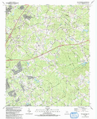
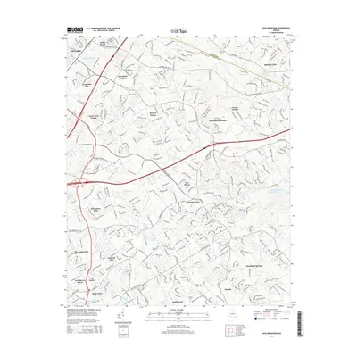
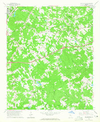 1964 Hog Mountain1965 Print · USGSGwinnett County in the mid-sixties remains a landscape of headwater rivers and country crossroads before the height of suburban expansion. Researchers can locate community anchors like Antioch Ch, Harmony Sch, and historic burials at Old Ivy Cem.3 unique versions available
 - 1964 Map of Bold Springs, 1965 Print
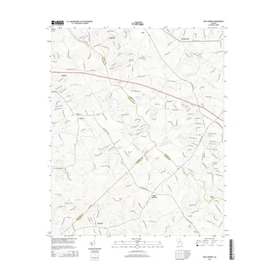
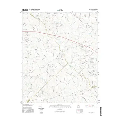
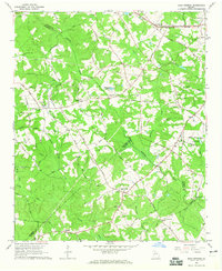 1964 Bold Springs1965 Print · USGSBarrow and Gwinnett counties appear here in the mid-sixties, a landscape of family-run farms and quiet rural crossroads. Researchers can trace historic land use through sites like Kilgore Cem, the Seaboard Air Line rail corridor, and the settlement at Bold Springs.4 unique versions available
 - 1964 Map of Lawrenceville, 1965 Print
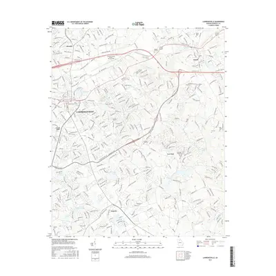
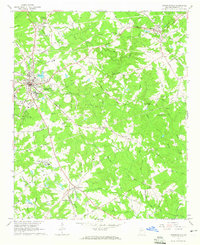 1964 Lawrenceville1965 Print · USGSGwinnett County is captured in the mid-1960s as the town of Lawrenceville grows outward into a landscape of family farms and country churches. Genealogists and historians can locate Shadowlawn Cemetery, Tribble Mill, and the Lawrenceville Campground.2 unique versions available
 - 1979 Map of Commerce, 1980 Print
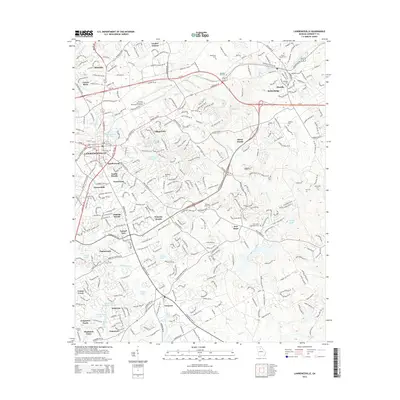
 1979 Commerce1980 Print · USGSThe Georgia and South Carolina Piedmont reached a period of significant regional growth in the late seventies. Genealogists and historians can trace family roots through locations like Blackberry Church, Old Pioneer Cem, and the Gillsville Sch.2 unique versions available
 - 1980 Map of Athens, 1981 Print
 1980 Athens1981 Print · USGSNorth Georgia in the early eighties exhibits a landscape of growing university towns and deep-rooted rail hubs. Genealogists can trace family lands near Social Circle or Watkinsville while following the routes of the Central of Georgia and the Appalachee River.2 unique versions available
 - 1988 Map of Athens
 1988 Athens1988 Print · USGSThe Georgia Piedmont and South Carolina borderlands appear in the late eighties as a landscape of vast reservoirs and growing towns. Researchers can trace the legacy of the Georgia RR connecting Athens and Augusta, or locate landmarks within Oconee National Forest.
 - 1992 Map of Lawrenceville
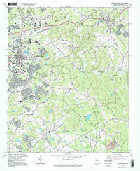
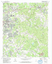 1992 Lawrenceville1992 Print · USGSGwinnett County's rapid growth during the early nineties is documented here, showing the expansion of Lawrenceville and Dacula. Local historians can trace long-standing landmarks like the Lawrenceville Camp Ground and McMillan Cem alongside the modern Tribble Mill County Park.
 - 1992 Map of Hog Mountain, 1993 Print
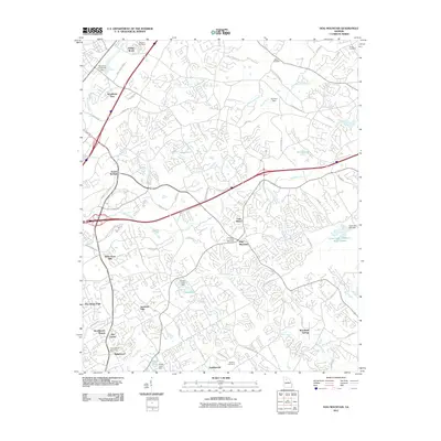
 1992 Hog Mountain1993 Print · USGSGwinnett County in the early nineties shows a landscape of suburban growth reaching into its rural heritage near Hog Mountain. Researchers can trace genealogies through numerous sites like Ivy Creek Ch Cem and Old Ivy Ch Cem or locate the historic Harmony Sch.
 - 1998 Map of Lawrenceville, 1999 Print
 1998 Lawrenceville1999 Print · USGSGwinnett County during the late nineties shows a landscape of growing suburban centers and preserved local history. Genealogists can trace family roots at Shadowlawn Cemetery and Ewings Cem, or explore older community hubs like New Hope and Grayson.
 - 2011 Map of Lawrenceville, 2011 Print
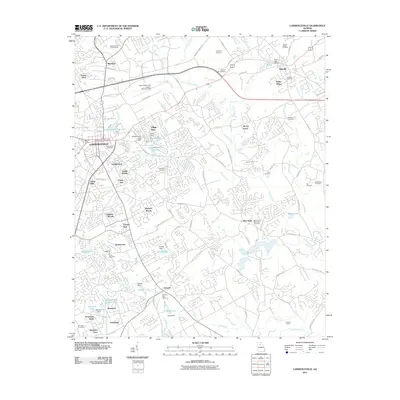 2011 Lawrenceville2011 Print · USGSCovers Dacula, including Lawrenceville, Snellville, and other nearby areas
 - 2011 Map of Bold Springs, 2011 Print
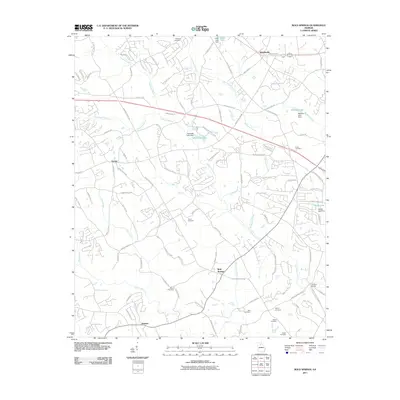 2011 Bold Springs2011 Print · USGSCovers Dacula, including Winder, Auburn, and other nearby areas
 - 2011 Map of Hog Mountain, 2011 Print
 2011 Hog Mountain2011 Print · USGSCovers Dacula, including Buford, Braselton, and other nearby areas
 - 2014 Map of Bold Springs, 2014 Print
 2014 Bold Springs2014 Print · USGSCovers Dacula, including Winder, Auburn, and other nearby areas
 - 2014 Map of Lawrenceville, 2014 Print
 2014 Lawrenceville2014 Print · USGSCovers Dacula, including Lawrenceville, Snellville, and other nearby areas
 - 2014 Map of Hog Mountain, 2014 Print
 2014 Hog Mountain2014 Print · USGSCovers Dacula, including Buford, Braselton, and other nearby areas
 - 2017 Map of Lawrenceville, 2017 Print
 2017 Lawrenceville2017 Print · USGSCovers Dacula, including Lawrenceville, Snellville, and other nearby areas
 - 2017 Map of Bold Springs, 2017 Print
 2017 Bold Springs2017 Print · USGSCovers Dacula, including Winder, Auburn, and other nearby areas
Showing maps 1-25 of 32
Top cities near Dacula
- Johns Creek historical maps
- Stonecrest historical maps
- Lawrenceville historical maps
- Duluth historical maps
- Sugar Hill historical maps
- Snellville historical maps
See more
Top neighborhoods of Dacula
Frequently asked questions
- What are the different types of historical maps available for Dacula?
- What is the oldest map of Dacula?
- Where can I purchase historical maps of Dacula for my home or office?
- Where can I download high-res historical maps of Dacula?
- Are there historical topographic maps available for Dacula?
- Is there historical aerial imagery available for Dacula?
- Where are historical maps of Dacula sourced from?