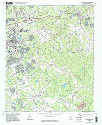
1998 Map of Lawrenceville
USGS Topo · Published 1999About this map
Lawrenceville serves as the focal point for this Gwinnett County landscape, showing the suburban expansion and infrastructural development of the late 1990s. The seat of local government is anchored by the Courthouse and Armory, while the industrial and transport needs of the era are visible through the CSX Transportation line and the Progress Center Ave commercial corridor. The map reveals a high density of local heritage sites, including numerous family-named burial grounds like McHaffey Cem and Pharr Cem that dot the lands between the Alcovy River and Yellow River.
Find a feature on this map
63 named features on this map. Tap any name to fly to it.
Don’t see what you’re looking for? This feature index may not catch every label — zoom into the map to look around manually.
Map Details
Editions of this 1998 Lawrenceville Map
This is the sole edition of this map. No revisions or reprints were ever made.
Other maps of this area

1888 · Atlanta
USGS Topo · 1:125,000

1890 · Suwanee
USGS Topo · 1:125,000

1890 · Atlanta
USGS Topo · 1:125,000

1891 · Gainesville
USGS Topo · 1:125,000

1892 · Atlanta
USGS Topo · 1:125,000

1894 · Suwanee
USGS Topo · 1:125,000

1895 · Atlanta
USGS Topo · 1:125,000

1896 · Monroe
USGS Topo · 1:125,000

1953 · Atlanta
USGS Topo · 1:250,000

1953 · Athens
USGS Topo · 1:250,000