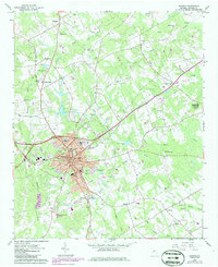
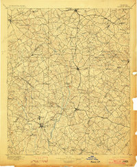
1896 Map of Monroe
USGS Topo · Published 1896About this map
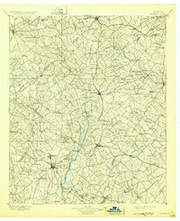
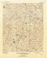
The Alcovy and Apalachee River systems dominate this late-nineteenth-century survey of the Piedmont, where agricultural communities are linked by early rail lines and numerous river crossings. This landscape is defined by its water-powered industry and social nodes, featuring several named shoals such as Bramblett Shoals and Hinton Shoals, alongside the notable Paper Mills and Salem Camp Ground. The network of travel is preserved here through specifically named infrastructure, including Bells Bridge and Lee Ford, which served the local commerce centered around Monroe, Lawrenceville, and Winder. The transition from rural homesteads to village centers is evident in sites like Carithers Store and Good Hope, while the Georgia R. R. and Seaboard Air Line railroads trace the era's emerging transportation corridors across Walton and Gwinnett counties.
Find a feature on this map
132 named features on this map. Tap any name to fly to it.
Don’t see what you’re looking for? This feature index may not catch every label — zoom into the map to look around manually.
Map Details
Editions of this 1896 Monroe Map
5 editions found
Historical Maps of Athens Through Time
7 maps found