Old Maps of Athens, Georgia
Explore 55 old maps of Athens, spanning from 1891 to today. These high-resolution historic maps reveal how streets, neighborhoods, landmarks, and natural features evolved over time — perfect for genealogy, metal detecting, research, and local history exploration.
What you can do with these maps:
- See how Athens changed over time: Compare historical maps to modern-day views to trace roads, homesites, rail lines & more.
- View detailed metadata: Each map includes creators, publishers, year, scale, and archive source.
- Overlay maps with satellite & LiDAR: Visualize the past alongside modern tools to explore terrain & human change.
- Trusted historical sources: Maps sourced from the USGS, Library of Congress, and other archives.
- Access maps your way: View online, download high-res files, or order prints for personal or research use.
Start exploring old maps of Athens to uncover forgotten places, hidden landmarks, and the deep history beneath your feet.
Athens, GA maps
(55)- 1891 Map of Carnesville
 1891 Carnesville1891 Print · USGSNortheast Georgia in the late nineteenth century is documented here as a landscape of small river settlements and emerging rail towns. Genealogists can trace family roots through locations like Jewellville, Fort Lamar, and the river crossing at Braggs Fy.6 unique versions available
 - 1896 Map of Monroe
 1896 Monroe1896 Print · USGSNorth-central Georgia thrives during the late nineteenth century as a hub of river-powered industry and rail expansion. Genealogists and historians can trace family locations near Salem Camp Ground, the local commerce at Carithers Store, and several early crossings like Bells Bridge.5 unique versions available
 - 1953 Map of Athens, 1966 Print
 1953 Athens1966 Print · USGSGeorgia's Piedmont and Savannah River borderlands come alive in this mid-century survey of the region surrounding Athens and Augusta. Trace the rail-and-river economy through the Georgia RR and landmarks like the Fort Gordon Military Reservation.3 unique versions available
 - 1954 Map of Greenville, 1965 Print
 1954 Greenville1965 Print · USGSThe Upstate and Northeast Georgia are captured here during a decade of massive transformation as new reservoirs reshaped the Piedmont. Genealogists and hikers can trace the Appalachian Trail over Brasstown Bald or locate old community centers like Demorest, Westminster, and Royston.3 unique versions available
 - 1958 Map of Greenville
 1958 Greenville1958 Print · USGSThe Piedmont and Blue Ridge foothills come alive in this mid-century survey of the Upstate and Northeast Georgia. Trace the regional rail-and-river economy through the Southern Railway corridors and early reservoir developments like Lake Sidney Lanier.
 - 1958 Map of Athens
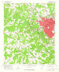
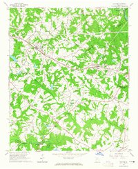
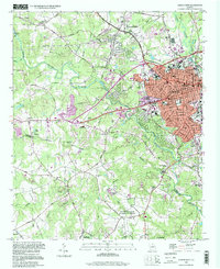
 1958 Athens1958 Print · USGSNorth-central Georgia and the Savannah River valley are captured in the late fifties, showing the region as the new reservoirs were filling. Researchers can trace historic rail lines like the Georgia RR and locate rural landmarks such as Social Circle, Graves Mountain, and the Fort Gordon Military Reservation.
 - 1959 Map of Athens
 1959 Athens1959 Print · USGSNortheast Georgia and the South Carolina borderlands appear here in the mid-fifties, during a decade of infrastructure growth. Genealogists and historians can trace the rail-and-river geography of towns like Social Circle, the sprawl of Fort Gordon Military Reservation, and the newly formed Clark Hill Reservoir.
 - 1963 Map of Athens
 1963 Athens1963 Print · USGSGeorgia's Piedmont and the Savannah River valley are captured in the early sixties as major reservoirs and military installations reshaped the landscape. Researchers can trace the development of Clark Hill Reservoir, locate the Fort Gordon Military Reservation, and find historic towns like Social Circle and Eatonton.
 - 1964 Map of Athens West, 1965 Print
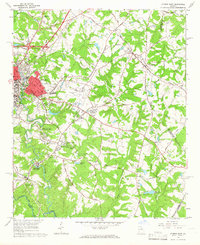
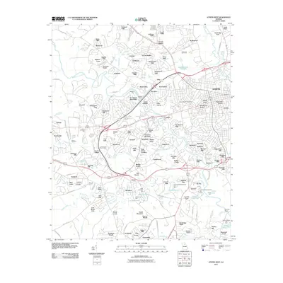
 1964 Athens West1965 Print · USGSMid-century western Athens and the Oconee River valley are captured here just as the city's modern suburban and institutional footprint was expanding. Researchers can trace the legacy of local landmarks like the Athens Speedway, US Naval Supply Corps School, and Mars Hill Ch.5 unique versions available
 - 1964 Map of Barnett Shoals, 1965 Print
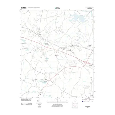
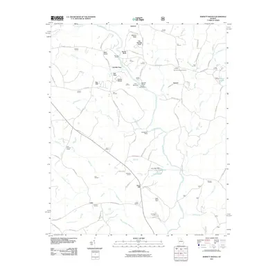
 1964 Barnett Shoals1965 Print · USGSThe Oconee River winds through the borders of four Georgia counties in the mid-1960s, anchored by the Barnett Shoals Dam and its local powerplant. Genealogists can trace family names at the Puryear Cem, Antioch Ch, and the rural community of Rose Hill.2 unique versions available
 - 1964 Map of Nicholson, 1965 Print
 1964 Nicholson1965 Print · USGSNortheast Georgia at the start of the sixties reveals a landscape shaped by the Southern and Seaboard Air Line railroads. Family researchers can trace roots at Stapler Cem, Benton Sch, and Bethany Ch.2 unique versions available
 - 1964 Map of Hull, 1965 Print
 1964 Hull1965 Print · USGSMadison and Clarke counties come into focus in the mid-sixties, showing a landscape of small settlements and family farms connected by the Seaboard Air Line. Researchers can locate historic rural centers like Planter, Neese, and Diamond Hill, along with numerous local landmarks including Gordons Chapel and Porterfield Cem.2 unique versions available
 - 1964 Map of Statham, 1965 Print
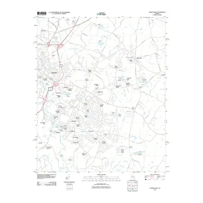
 1964 Statham1965 Print · USGSThe rail-and-road corridor between Statham and Bogart is captured here in the mid-1960s, showing a rural landscape of Piedmont farms and creek-side settlements. Researchers can trace historic family landmarks such as Pleasant Hill Ch, Barber Creek Sch, and the Millsap Cem.4 unique versions available
 - 1964 Map of Athens East, 1966 Print
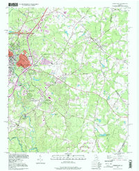
 1964 Athens East1966 Print · USGSAthens and the surrounding Georgia Piedmont underwent significant postwar expansion as the university system grew and aviation matured. Genealogists can trace family landmarks like Oconee Hill Cemetery and Whitehall, while tracing old rail spurs of the Georgia Railroad.3 unique versions available
 - 1971 Map of Crawford, 1973 Print
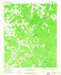
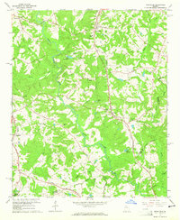
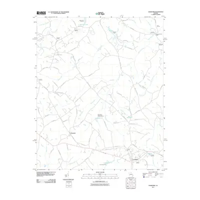
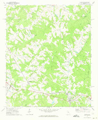 1971 Crawford1973 Print · USGSOglethorpe County in the early seventies shows a landscape of established rail towns and rural congregations. Genealogists can trace family lines through Clouds Creek Cem or locate community centers like Arnoldsville and the County High Sch.2 unique versions available
 - 1979 Map of Commerce, 1980 Print
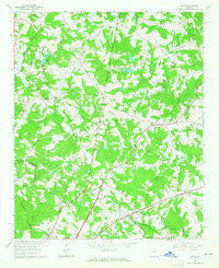
 1979 Commerce1980 Print · USGSThe Georgia and South Carolina Piedmont reached a period of significant regional growth in the late seventies. Genealogists and historians can trace family roots through locations like Blackberry Church, Old Pioneer Cem, and the Gillsville Sch.2 unique versions available
 - 1980 Map of Athens, 1981 Print
 1980 Athens1981 Print · USGSNorth Georgia in the early eighties exhibits a landscape of growing university towns and deep-rooted rail hubs. Genealogists can trace family lands near Social Circle or Watkinsville while following the routes of the Central of Georgia and the Appalachee River.2 unique versions available
 - 1988 Map of Athens
 1988 Athens1988 Print · USGSThe Georgia Piedmont and South Carolina borderlands appear in the late eighties as a landscape of vast reservoirs and growing towns. Researchers can trace the legacy of the Georgia RR connecting Athens and Augusta, or locate landmarks within Oconee National Forest.
 - 1998 Map of Athens East, 1999 Print
 1998 Athens East1999 Print · USGSThe eastern edges of the University of Georgia and the surrounding Clarke County countryside appear here just before the millennium. Genealogists and local historians can trace the old rail lines of the Georgia railroad and locate rural landmarks like Winterville, Whitehall, and the Oconee Hill Cemetery.
 - 1998 Map of Athens West, 1999 Print
 1998 Athens West1999 Print · USGSIn the late nineties, the western outskirts of Athens and Watkinsville showcase a landscape where academic and naval facilities meet traditional Georgia riverlands. Researchers can trace the Georgia Railroad and locate local landmarks like the Athens Speedway or Chestnut Grove Ch.
 - 2011 Map of Athens West, 2011 Print
 2011 Athens West2011 Print · USGSCovers Athens, including Watkinsville, Danson Woods, and other nearby areas
 - 2011 Map of Athens East, 2011 Print
 2011 Athens East2011 Print · USGSCovers Athens, including Winterville, Lakeside Hills, and other nearby areas
 - 2011 Map of Crawford, 2011 Print
 2011 Crawford2011 Print · USGSCovers Athens, including Crawford, Arnoldsville, and other nearby areas
 - 2011 Map of Statham, 2011 Print
 2011 Statham2011 Print · USGSCovers Athens, including Statham, Bogart, and other nearby areas
 - 2011 Map of Barnett Shoals, 2011 Print
 2011 Barnett Shoals2011 Print · USGSCovers Athens, including Pioneer Woods, Old Mill Chase, and other nearby areas
Showing maps 1-25 of 55
Top cities near Athens
- Jefferson historical maps
- Watkinsville historical maps
- Statham historical maps
- Arcade historical maps
- Nicholson historical maps
- Winterville historical maps
See more
Top neighborhoods of Athens
- Camelot historical maps
- Homewood Hills historical maps
- Elder historical maps
- Chatham Park historical maps
- Jefferson Valley historical maps
- Northridge Park historical maps
See more
Frequently asked questions
- What are the different types of historical maps available for Athens?
- What is the oldest map of Athens?
- Where can I purchase historical maps of Athens for my home or office?
- Where can I download high-res historical maps of Athens?
- Are there historical topographic maps available for Athens?
- Is there historical aerial imagery available for Athens?
- Where are historical maps of Athens sourced from?