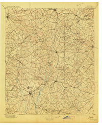
1896 Map of Monroe
USGS Topo · Published 1913About this map
The Alcovy River and Yellow River define the agricultural and industrial landscape of this late-nineteenth-century Georgia interior. Between the established county seats of Lawrenceville and Monroe, the terrain is marked by numerous river crossings and small commerce centers like Carithers Store and Nicholasville. The influence of the Seaboard Line and the Georgia R. R. is evident, driving the development of railroad towns such as Winder, Statham, and Bogart.
Find a feature on this map
136 named features on this map. Tap any name to fly to it.
Don’t see what you’re looking for? This feature index may not catch every label — zoom into the map to look around manually.
Map Details
Editions of this 1896 Monroe Map
5 editions found
Other maps of this area

1888 · Atlanta
USGS Topo · 1:125,000

1890 · Suwanee
USGS Topo · 1:125,000

1890 · Atlanta
USGS Topo · 1:125,000

1891 · Gainesville
USGS Topo · 1:125,000

1891 · Carnesville
USGS Topo · 1:125,000

1892 · Atlanta
USGS Topo · 1:125,000

1894 · Suwanee
USGS Topo · 1:125,000

1895 · Atlanta
USGS Topo · 1:125,000

1896 · Monroe
USGS Topo · 1:125,000

1953 · Atlanta
USGS Topo · 1:250,000