1900s (20th Century) Maps of Providence Lake Subdivision, Forsyth County
Explore 11 historic maps of Providence Lake Subdivision from the 1900s (20th Century). These maps offer a rare glimpse into what life looked like during the 1900s — showing old roads, neighborhoods, homes, and landmarks that have changed or disappeared over time.
Whether you're researching your family's past, planning a metal detecting trip, or studying how Providence Lake Subdivision's landscape evolved across the 1900s, these high-resolution maps are a powerful tool for exploring the history of this region.
- Focus on a specific era: All maps on this page are from the 1900s, giving you a focused view of this time period.
- See what’s changed: Compare century-old streets, trails, and buildings to today's modern landscape using overlays and satellite layers.
- Research with precision: Use these maps for genealogy, historical research, land use analysis, or educational projects.
- View, download, or print: Maps are fully viewable online in high resolution, and can be downloaded or printed for your own records.
Start exploring Providence Lake Subdivision's history through authentic maps from the 1900s. This is your window into the past.
Providence Lake Subdivision, Forsyth County maps
(11)- 1954 Map of Greenville, 1965 Print
 1954 Greenville1965 Print · USGSThe Upstate and Northeast Georgia are captured here during a decade of massive transformation as new reservoirs reshaped the Piedmont. Genealogists and hikers can trace the Appalachian Trail over Brasstown Bald or locate old community centers like Demorest, Westminster, and Royston.3 unique versions available
 - 1955 Map of Rome
 1955 Rome1955 Print · USGSThe tri-state borderlands of Georgia, Alabama, and Tennessee appear in the mid-fifties as a landscape of ridge-and-valley industry and river navigation. Genealogists can trace family footprints near Chattanooga, the iron works of Gadsden, and textile towns like Trion or Summerville.
 - 1958 Map of Greenville
 1958 Greenville1958 Print · USGSThe Piedmont and Blue Ridge foothills come alive in this mid-century survey of the Upstate and Northeast Georgia. Trace the regional rail-and-river economy through the Southern Railway corridors and early reservoir developments like Lake Sidney Lanier.
 - 1958 Map of Rome, 1966 Print
 1958 Rome1966 Print · USGSNorthwest Georgia and neighboring Tennessee and Alabama are captured here in the late fifties, showcasing a landscape of high ridges and river valleys. Researchers can trace historic rail lines like the Seaboard Air Line RR and explore the bounds of Cloudland Canyon State Park or Fort Oglethorpe.3 unique versions available
 - 1961 Map of Rome
 1961 Rome1961 Print · USGSNorthwest Georgia and neighboring Tennessee and Alabama are shown here at a moment of significant mid-century growth. Researchers can trace the rail networks of the Central of Georgia or locate landmarks within Chickamauga and Chattanooga Nat Military Park.
 - 1963 Map of Rome
 1963 Rome1963 Print · USGSThe tri-state corner of Georgia, Alabama, and Tennessee is captured here during a period of massive reservoir expansion and post-war growth. Genealogists and historians can trace the rail corridors of the Southern Ry or locate landmarks like Fort Oglethorpe and Cloudland Canyon State Park.
 - 1964 Map of Coal Mountain, 1965 Print
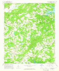 1964 Coal Mountain1965 Print · USGSForsyth and Dawson counties are captured during the mid-sixties as the landscape adjusted to the presence of Lake Sidney Lanier. Genealogists and local historians can trace family locations near Lumpkin, Silver City, and several country churches like Bethel Ch.3 unique versions available
 - 1964 Map of Chestatee, 1965 Print
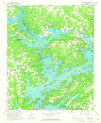 1964 Chestatee1965 Print · USGSThe Hall and Forsyth County borderland is transformed by the rising waters of Lake Sidney Lanier in the mid-sixties. Genealogists can trace family names at Bethel Tabernacle, Mayfield Ch, and Sardis Sch along the sprawling river-bay shoreline.3 unique versions available
 - 1979 Map of Commerce, 1980 Print
 1979 Commerce1980 Print · USGSThe Georgia and South Carolina Piedmont reached a period of significant regional growth in the late seventies. Genealogists and historians can trace family roots through locations like Blackberry Church, Old Pioneer Cem, and the Gillsville Sch.2 unique versions available
 - 1981 Map of Cartersville, 1982 Print
 1981 Cartersville1982 Print · USGSNorth Georgia at the start of the eighties shows a landscape defined by massive reservoirs and historic rail corridors. Researchers can trace the heritage of the Etowah Indian Mounds or locate old junctions along the Southern Railway and Seaboard Coast Line.2 unique versions available
 - 1997 Map of Coal Mountain, 2000 Print
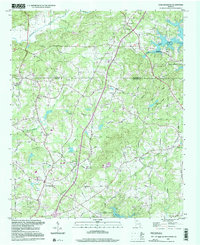 1997 Coal Mountain2000 Print · USGSUpper Forsyth County in the late nineties shows a landscape defined by the encroaching waters of the reservoir and long-standing rural crossroads. Researchers can trace historic family landmarks and community hubs like Silver City, Coal Mountain, and the Byrd Cem.
End of results
Showing maps 1-11 of 11
Frequently asked questions
- What are the different types of historical maps available for Providence Lake Subdivision?
- What is the oldest map of Providence Lake Subdivision?
- Where can I purchase historical maps of Providence Lake Subdivision for my home or office?
- Where can I download high-res historical maps of Providence Lake Subdivision?
- Are there historical topographic maps available for Providence Lake Subdivision?
- Is there historical aerial imagery available for Providence Lake Subdivision?
- Where are historical maps of Providence Lake Subdivision sourced from?