Old Maps of Whigham, Georgia for Metal Detecting
Plan your next treasure hunt with 12 historic maps of Whigham. Find old homesites, ghost towns, trails, and gathering spots that may be lost to time — perfect for identifying promising metal detecting locations.
- Locate forgotten sites: Uncover places like long-lost settlements, abandoned rail lines, or gathering spots.
- Plan better hunts: Use map overlays combined with LiDAR or satellite views to narrow in on historically rich areas.
- Made for detectorists: Thousands of hobbyists use these maps to discover relics, coins, and hidden history.
Use these historic maps to boost your research and find new opportunities beneath the surface of Whigham.
Whigham, GA maps
(12)- 1954 Map of Tallahassee, 1967 Print
 1954 Tallahassee1967 Print · USGSThe Florida Panhandle and South Georgia are captured here during a period of mid-century growth and military expansion. Researchers can trace the development of Panama City, the footprint of Tyndall Air Force Base, and the rail lines of the Atlantic Coast Line.4 unique versions available
 - 1955 Map of Whigham, 1957 Print
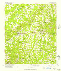 1955 Whigham1957 Print · USGSThe rural landscape of South Georgia comes alive in the mid-1950s, showing a region shaped by dual rail lines and scattered agricultural hamlets. Genealogists and historians can trace family roots through numerous churches and schools like Union Spring Ch and Bell-Dixon Sch, or locate industrial sites such as the local Strip Mines.2 unique versions available
 - 1959 Map of Tallahassee
 1959 Tallahassee1959 Print · USGSFlorida's Panhandle and the Big Bend region appear here in the mid-fifties, showing a landscape defined by its great river systems and developing coast. Trace the early layout of Panama City, the expansive Apalachicola National Forest, and the coastal St Marks Lighthouse.
 - 1960 Map of Tallahassee
 1960 Tallahassee1960 Print · USGSThe Florida Panhandle and southern Georgia are captured here in the mid-twentieth century, showing a region defined by its rivers and military installations. Genealogists and historians can trace the growth of Tallahassee or locate coastal landmarks like the St Marks Lighthouse and Tyndall Air Force Base.
 - 1974 Map of Whigham, 1976 Print
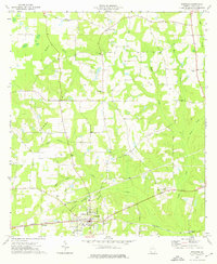 1974 Whigham1976 Print · USGSIn the mid-1970s, the rural Grady County landscape centered on the railway town of Whigham and its timber-lined creeks. Genealogists can trace family roots through numerous sites like Woodlawn Cem, Peoples Still, and Union Spring Ch.
 - 1978 Map of Bainbridge, 1980 Print
 1978 Bainbridge1980 Print · USGSIn the late seventies, this Georgia-Florida borderland was defined by the confluence of the Flint and Chattahoochee rivers. Trace the region's infrastructure via the Seaboard Coast Line Railroad and find sites like Bainbridge State Hospital.
 - 1988 Map of Tallahassee
 1988 Tallahassee1988 Print · USGSThe Florida Panhandle and South Georgia are captured here in the late eighties, showing the expansion of the regional highway network and coastal growth. Genealogists and historians can trace rail lines like the Seaboard System Railroad or locate family roots in Blountstown, Graceville, or Crawfordville.2 unique versions available
 - 2011 Map of Whigham, 2011 Print
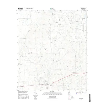
 2011 Whigham2011 Print · USGSCovers Whigham, including Boydville, Roddenberry, and other nearby areas
 - 2014 Map of Whigham, 2014 Print
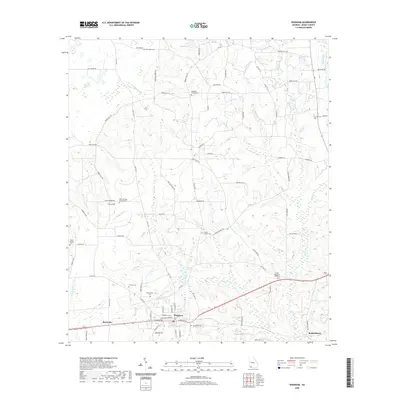
 2014 Whigham2014 Print · USGSCovers Whigham, including Boydville, Roddenberry, and other nearby areas
 - 2017 Map of Whigham, 2017 Print
 2017 Whigham2017 Print · USGSCovers Whigham, including Boydville, Roddenberry, and other nearby areas
 - 2020 Map of Whigham, 2020 Print
 2020 Whigham2020 Print · USGSCovers Whigham, including Boydville, Roddenberry, and other nearby areas
 - 2024 Map of Whigham, 2024 Print
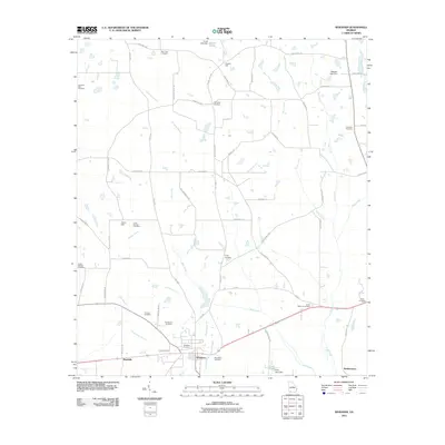
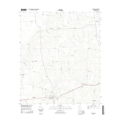
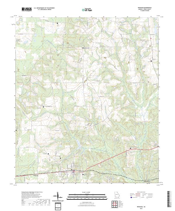 2024 Whigham2024 Print · USGSWhigham and the surrounding Grady County countryside are captured here in the mid-2020s, showing a landscape defined by small-town grids and rural burial grounds. Researchers can locate several family and community landmarks, including Roddenberry, the Whigham Cem, and Trinity Church Cem.
End of results
Showing maps 1-12 of 12
Top cities near Whigham
- Bainbridge historical maps
- Cairo historical maps
- Pelham historical maps
- Meigs historical maps
- Attapulgus historical maps
- Climax historical maps
Frequently asked questions
- What are the different types of historical maps available for Whigham?
- What is the oldest map of Whigham?
- Where can I purchase historical maps of Whigham for my home or office?
- Where can I download high-res historical maps of Whigham?
- Are there historical topographic maps available for Whigham?
- Is there historical aerial imagery available for Whigham?
- Where are historical maps of Whigham sourced from?