Old Maps of Hall County, Georgia for Academic Research
Study the evolution of Hall County with 118 high-resolution historic maps. Whether you're teaching, researching, or modeling changes in land use, these maps provide essential visual documentation of urban, environmental, and geographic change.
- Analyze long-term change: Track patterns in development, transportation, and natural features.
- Ideal for environmental or urban studies: Support academic projects with primary historical map data.
- Use in the classroom or lab: Educators and researchers rely on these maps to bring historical context to life.
These maps are a powerful tool for teaching, research, and visualizing how Hall County has changed over the decades.
Hall County, GA maps
(118)- 1886 Map of Dahlonega
 1886 Dahlonega1886 Print · USGSThe North Georgia mountains in the mid-1880s reveal a landscape of mining camps and early settlements before the modern era. Genealogists and historians can trace family-named landmarks like Helton's Field and Osbornes, or locate the Findley Mine and the Indian Mound.
 - 1890 Map of Suwanee
 1890 Suwanee1890 Print · USGSNorth Georgia in the 1890s was a landscape of river-powered commerce and gold prospecting. Genealogists and historians can trace family-named river crossings like Jones Ferry and Pirkle's Ferry or locate the historic Kin Mori Gold Mine.
 - 1891 Map of Gainesville
 1891 Gainesville1891 Print · USGSNorth Georgia in the early 1890s appears as a landscape of rail-junction towns and river-powered industry centered on Hall and Jackson Counties. Researchers can trace historic river crossings like Browns Bridge and Keiths Fy, or locate nineteenth-century landmarks such as Oconee Mills and Flowery Branch.5 unique versions available
 - 1892 Map of Dahlonega
 1892 Dahlonega1892 Print · USGSThe North Georgia mountains come alive in the late nineteenth century, showing the rugged terrain around the mining hub of Dahlonega. Genealogists and historians can trace family-named sites like Osbornes, find the elusive Gold Mine, and locate the Indian Mound.2 unique versions available
 - 1894 Map of Suwanee
 1894 Suwanee1894 Print · USGSNorth Georgia in the late nineteenth century was a landscape of river ferries and rising industry, from marble quarries to gold mines. Genealogists can trace family landmarks like Fields Cross Roads, the Kin Mori Gold Mine, and Fort Buffington.6 unique versions available
 - 1896 Map of Dahlonega
 1896 Dahlonega1896 Print · USGSThe Blue Ridge and North Georgia gold belt are shown here in the 1890s, when mining and mountain gaps defined local travel. Genealogists can trace family roots in Dahlonega, Porter Springs, and the Findley Mine or locate early settlements like Nacoochee.
 - 1903 Map of Dahlonega
 1903 Dahlonega1903 Print · USGSNorth Georgia and the Blue Ridge were defined by mountain settlements and early industry at the turn of the century. Genealogists and historians can trace family locations across the Nacoochee Valley, locate the Asbestos Mines, or find old sites like Loudsville and Porter Springs.5 unique versions available
 - 1951 Map of Cleveland, 1952 Print
 1951 Cleveland1952 Print · USGSNorth Georgia's mountain foothills come to life in the early fifties, centering on the growing community of Cleveland. Researchers can trace the rural landscape of White County through local landmarks like Mt View Ch, Grace Sch, and the waters of Tesnatee Creek.4 unique versions available
 - 1954 Map of Greenville, 1965 Print
 1954 Greenville1965 Print · USGSThe Upstate and Northeast Georgia are captured here during a decade of massive transformation as new reservoirs reshaped the Piedmont. Genealogists and hikers can trace the Appalachian Trail over Brasstown Bald or locate old community centers like Demorest, Westminster, and Royston.3 unique versions available
 - 1955 Map of Rome
 1955 Rome1955 Print · USGSThe tri-state borderlands of Georgia, Alabama, and Tennessee appear in the mid-fifties as a landscape of ridge-and-valley industry and river navigation. Genealogists can trace family footprints near Chattanooga, the iron works of Gadsden, and textile towns like Trion or Summerville.
 - 1958 Map of Greenville
 1958 Greenville1958 Print · USGSThe Piedmont and Blue Ridge foothills come alive in this mid-century survey of the Upstate and Northeast Georgia. Trace the regional rail-and-river economy through the Southern Railway corridors and early reservoir developments like Lake Sidney Lanier.
 - 1958 Map of Rome, 1966 Print
 1958 Rome1966 Print · USGSNorthwest Georgia and neighboring Tennessee and Alabama are captured here in the late fifties, showcasing a landscape of high ridges and river valleys. Researchers can trace historic rail lines like the Seaboard Air Line RR and explore the bounds of Cloudland Canyon State Park or Fort Oglethorpe.3 unique versions available
 - 1961 Map of Rome
 1961 Rome1961 Print · USGSNorthwest Georgia and neighboring Tennessee and Alabama are shown here at a moment of significant mid-century growth. Researchers can trace the rail networks of the Central of Georgia or locate landmarks within Chickamauga and Chattanooga Nat Military Park.
 - 1963 Map of Rome
 1963 Rome1963 Print · USGSThe tri-state corner of Georgia, Alabama, and Tennessee is captured here during a period of massive reservoir expansion and post-war growth. Genealogists and historians can trace the rail corridors of the Southern Ry or locate landmarks like Fort Oglethorpe and Cloudland Canyon State Park.
 - 1964 Map of Maysville, 1965 Print
 1964 Maysville1965 Print · USGSMaysville and the surrounding rural landscape of Jackson and Banks Counties are captured in the mid-1960s, showing a community built around the railroad and river. Genealogists can trace family footprints through numerous sites like Sunrise Cem, Mize Cem, and the Grove Level Ch.2 unique versions available
 - 1964 Map of Murrayville, 1965 Print
 1964 Murrayville1965 Print · USGSUpper Georgia’s river valleys were undergoing a major transformation in the mid-sixties as the newly formed Lake Sidney Lanier reshaped the terrain. Genealogists and local historians can trace family-named sites like the Calhoun Gold Mine, Soules Chapel, and Yellow Creek Cem.4 unique versions available
 - 1964 Map of Hog Mountain, 1965 Print
 1964 Hog Mountain1965 Print · USGSGwinnett County in the mid-sixties remains a landscape of headwater rivers and country crossroads before the height of suburban expansion. Researchers can locate community anchors like Antioch Ch, Harmony Sch, and historic burials at Old Ivy Cem.3 unique versions available
 - 1964 Map of Chestnut Mountain, 1965 Print
 1964 Chestnut Mountain1965 Print · USGSHall County’s rural landscape is captured in the mid-1960s, showing a community defined by its creeks, ridges, and rail lines. Researchers can trace family sites like Blackshear Place or locate local landmarks including Tanner Mill and South Hall Sch.3 unique versions available
 - 1964 Map of Lula, 1965 Print
 1964 Lula1965 Print · USGSThe foothills of northeast Georgia meet the expanding shoreline of Lake Sidney Lanier in the mid-1960s. Genealogists can trace rural communities through landmarks like Skitts Mtn Ch Cem, the Southern rail line, and Belton Bridge.4 unique versions available
 - 1964 Map of Auburn, 1965 Print
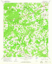 1964 Auburn1965 Print · USGSBarrow and Gwinnett counties come alive in the mid-sixties as the Seaboard Air Line connects the rural hubs of Auburn and Carl. Local researchers can trace historic church sites like Mt Moriah Ch or find the Covered Bridge near Thompsons Mill.3 unique versions available
 - 1964 Map of Buford Dam, 1965 Print
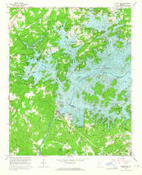 1964 Buford Dam1965 Print · USGSForsyth County landscape during the mid-sixties reveals the profound changes following the creation of Lake Sidney Lanier. Genealogists and historians can trace traditional landmarks like Beaver Ruin Cem and Chattahoochee Sch alongside the massive Buford Dam.4 unique versions available
 - 1964 Map of Gainesville, 1965 Print
 1964 Gainesville1965 Print · USGSGainesville and Hall County are shown here in the mid-1960s as the community expanded around the waters of the newly formed reservoir. Researchers can trace the industrial footprint of the Gainesville Mill, locate family plots at Alta Vista Cemetery, and find old schools like Air Line Sch.4 unique versions available
 - 1964 Map of Chestatee, 1965 Print
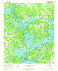 1964 Chestatee1965 Print · USGSThe Hall and Forsyth County borderland is transformed by the rising waters of Lake Sidney Lanier in the mid-sixties. Genealogists can trace family names at Bethel Tabernacle, Mayfield Ch, and Sardis Sch along the sprawling river-bay shoreline.3 unique versions available
 - 1964 Map of Leaf, 1965 Print
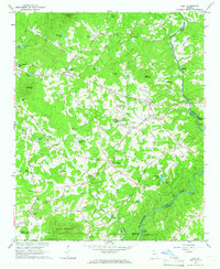 1964 Leaf1965 Print · USGSNortheast Georgia in the mid-sixties reveals a rural landscape of mountain ridges and riverside mills along the Chattahoochee River. Genealogists and historians can locate family landmarks like Blue Creek Cem, the White Creek Sch, and the old Satterfield Store.4 unique versions available
 - 1964 Map of Pendergrass, 1965 Print
 1964 Pendergrass1965 Print · USGSNortheast Georgia in the mid-1960s was a landscape of rail-linked towns and deep-rooted rural congregations. Genealogists and local historians can trace family locations through several landmark churches and cemeteries, including Harmony Hall Ch, Sugar Hill Ch, and Jarrett Cem.
Showing maps 1-25 of 118
Top cities of Hall County
- Gainesville historical maps
- Flowery Branch historical maps
- Oakwood historical maps
- Lula historical maps
- Clermont historical maps
Frequently asked questions
- What are the different types of historical maps available for Hall County?
- What is the oldest map of Hall County?
- Where can I purchase historical maps of Hall County for my home or office?
- Where can I download high-res historical maps of Hall County?
- Are there historical topographic maps available for Hall County?
- Is there historical aerial imagery available for Hall County?
- Where are historical maps of Hall County sourced from?