Old Maps of Henry County, Georgia
Explore 32 old maps of Henry County, spanning from 1888 to today. These high-resolution historic maps reveal how streets, neighborhoods, landmarks, and natural features evolved over time — perfect for genealogy, metal detecting, research, and local history exploration.
What you can do with these maps:
- See how Henry County changed over time: Compare historical maps to modern-day views to trace roads, homesites, rail lines & more.
- View detailed metadata: Each map includes creators, publishers, year, scale, and archive source.
- Overlay maps with satellite & LiDAR: Visualize the past alongside modern tools to explore terrain & human change.
- Trusted historical sources: Maps sourced from the USGS, Library of Congress, and other archives.
- Access maps your way: View online, download high-res files, or order prints for personal or research use.
Start exploring old maps of Henry County to uncover forgotten places, hidden landmarks, and the deep history beneath your feet.
Henry County, GA maps
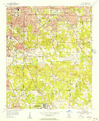
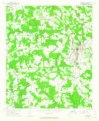
(32)- 1888 Map of Atlanta, 1955 Print
 1888 Atlanta1955 Print · USGSCovers Henry County, including Atlanta, Sandy Springs, and other nearby areas
 - 1890 Map of Atlanta
 1890 Atlanta1890 Print · USGSCovers Henry County, including Atlanta, Sandy Springs, and other nearby areas
 - 1892 Map of Atlanta
 1892 Atlanta1892 Print · USGSCovers Henry County, including Atlanta, Sandy Springs, and other nearby areas
 - 1895 Map of Atlanta
 1895 Atlanta1895 Print · USGSCovers Henry County, including Atlanta, Sandy Springs, and other nearby areas7 unique versions available
 - 1953 Map of Atlanta, 1965 Print
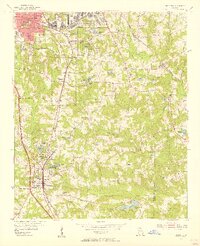
 1953 Atlanta1965 Print · USGSCovers Henry County, including Atlanta, Sandy Springs, and other nearby areas2 unique versions available
 - 1953 Map of Athens, 1966 Print
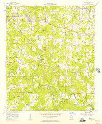
 1953 Athens1966 Print · USGSCovers Henry County, including Augusta, Athens, and other nearby areas3 unique versions available
 - 1954 Map of Conley, 1956 Print
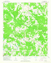
 1954 Conley1956 Print · USGSCovers Henry County, including Atlanta, Candler-McAfee, and other nearby areas5 unique versions available
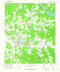
 - 1954 Map of Jonesboro, 1956 Print
 1954 Jonesboro1956 Print · USGSCovers Henry County, including Stockbridge, Forest Park, and other nearby areas5 unique versions available
 - 1956 Map of Redan, 1957 Print
 1956 Redan1957 Print · USGSCovers Henry County, including Stonecrest, Pinehurst, and other nearby areas7 unique versions available
 - 1957 Map of Atlanta
 1957 Atlanta1957 Print · USGSCovers Henry County, including Atlanta, Sandy Springs, and other nearby areas
 - 1958 Map of Athens
 1958 Athens1958 Print · USGSCovers Henry County, including Augusta, Athens, and other nearby areas
 - 1958 Map of Atlanta
 1958 Atlanta1958 Print · USGSCovers Henry County, including Atlanta, Sandy Springs, and other nearby areas
 - 1959 Map of Athens
 1959 Athens1959 Print · USGSCovers Henry County, including Augusta, Athens, and other nearby areas
 - 1963 Map of Athens
 1963 Athens1963 Print · USGSCovers Henry County, including Augusta, Athens, and other nearby areas
 - 1964 Map of Luella, 1965 Print
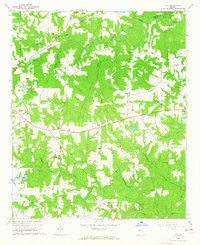
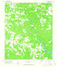
 1964 Luella1965 Print · USGSCovers Henry County, including Griffin, Locust Grove, and other nearby areas3 unique versions available
 - 1964 Map of Mc Donough, 1965 Print
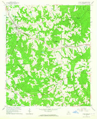
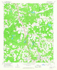
 1964 Mc Donough1965 Print · USGSCovers Henry County, including Stockbridge, McDonough, and other nearby areas4 unique versions available
 - 1964 Map of Jackson, 1965 Print
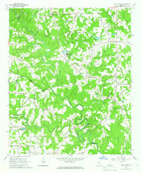
 1964 Jackson1965 Print · USGSCovers Henry County, including Jackson, Flovilla, and other nearby areas3 unique versions available
 - 1964 Map of Ola, 1965 Print
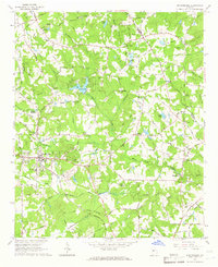
 1964 Ola1965 Print · USGSCovers Henry County, including McDonough, Locust Grove, and other nearby areas3 unique versions available
 - 1964 Map of Locust Grove, 1965 Print
 1964 Locust Grove1965 Print · USGSCovers Henry County, including Locust Grove, Jackson, and other nearby areas3 unique versions available
 - 1964 Map of Worthville, 1965 Print
 1964 Worthville1965 Print · USGSCovers Henry County, including Leadmore, Rocky Plains, and other nearby areas2 unique versions available
 - 1964 Map of Kelleytown, 1966 Print
 1964 Kelleytown1966 Print · USGSCovers Henry County, including Stonecrest, Conyers, and other nearby areas3 unique versions available
 - 1964 Map of Stockbridge, 1966 Print
 1964 Stockbridge1966 Print · USGSCovers Henry County, including Stockbridge, Whitehouse, and other nearby areas3 unique versions available
 - 1965 Map of Hampton, 1967 Print
 1965 Hampton1967 Print · USGSCovers Henry County, including Irondale, Hampton, and other nearby areas3 unique versions available
 - 1965 Map of Griffin North, 1967 Print
 1965 Griffin North1967 Print · USGSCovers Henry County, including Griffin, Hampton, and other nearby areas2 unique versions available
 - 1979 Map of Griffin, 1980 Print
 1979 Griffin1980 Print · USGSCovers Henry County, including Newnan, Peachtree City, and other nearby areas3 unique versions available
Showing maps 1-25 of 32
Top cities of Henry County
- Stockbridge historical maps
- McDonough historical maps
- Locust Grove historical maps
- Hampton historical maps
Frequently asked questions
- What are the different types of historical maps available for Henry County?
- What is the oldest map of Henry County?
- Where can I purchase historical maps of Henry County for my home or office?
- Where can I download high-res historical maps of Henry County?
- Are there historical topographic maps available for Henry County?
- Is there historical aerial imagery available for Henry County?
- Where are historical maps of Henry County sourced from?