Old Maps of Manchester, Georgia
Explore 19 old maps of Manchester, spanning from 1907 to today. These high-resolution historic maps reveal how streets, neighborhoods, landmarks, and natural features evolved over time — perfect for genealogy, metal detecting, research, and local history exploration.
What you can do with these maps:
- See how Manchester changed over time: Compare historical maps to modern-day views to trace roads, homesites, rail lines & more.
- View detailed metadata: Each map includes creators, publishers, year, scale, and archive source.
- Overlay maps with satellite & LiDAR: Visualize the past alongside modern tools to explore terrain & human change.
- Trusted historical sources: Maps sourced from the USGS, Library of Congress, and other archives.
- Access maps your way: View online, download high-res files, or order prints for personal or research use.
Start exploring old maps of Manchester to uncover forgotten places, hidden landmarks, and the deep history beneath your feet.
Manchester, GA maps
(19)- 1907 Map of Talbotton
 1907 Talbotton1907 Print · USGSWest-central Georgia at the turn of the century is a landscape of ridges and rail-lines, dominated by the thermal waters of Warm Springs. Local historians can trace the foundations of Talbotton and rural life at Turntime Crossroads, Cataula Camp Ground, and Greens Mill.3 unique versions available
 - 1934 Map of Warm Springs, 1958 Print
 1934 Warm Springs1958 Print · USGSWest-central Georgia at the height of the New Deal era reveals a landscape of therapeutic springs, mountain gaps, and busy rail junctions. Genealogists and historians can locate family landmarks like Williams Chapel, the Warm Springs Foundation, and Chalybeate Springs along the rugged Pine Mountain ridge.7 unique versions available
 - 1936 Map of Warm Springs
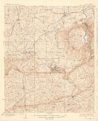 1936 Warm Springs1936 Print · USGSWest-central Georgia at the height of the New Deal era centers on the therapeutic and institutional development of Warm Springs. Researchers can trace the rail-and-road network connecting Manchester and Woodbury or locate landmarks like the Warm Springs Foundation and Ebenezer Cem.4 unique versions available
 - 1955 Map of Phenix City, 1964 Print
 1955 Phenix City1964 Print · USGSPost-war Alabama and Georgia meet along the Chattahoochee River as industry and military installations expand. Trace the rail lines of the Central of Georgia through towns like Opelika, Tuskegee, and Alexander City.3 unique versions available
 - 1957 Map of Phenix City
 1957 Phenix City1957 Print · USGSThe Alabama-Georgia borderlands are captured here in the mid-fifties, centered on the bustling river crossing at Phenix City and Columbus. Researchers can trace the mid-century footprint of the Fort Benning Military Reservation or locate smaller textile and railroad towns like Langdale and Camp Hill.
 - 1958 Map of Phenix City
 1958 Phenix City1958 Print · USGSThe Alabama-Georgia borderlands thrive during the late fifties, anchored by the river-driven industry of Columbus and Phenix City. Researchers can trace the mid-century footprints of Fort Benning, Auburn, and the textile towns of Fairfax and Lanett.
 - 1971 Map of Manchester, 1973 Print
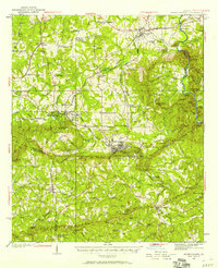
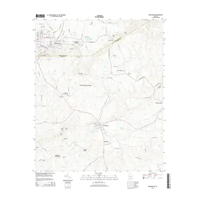
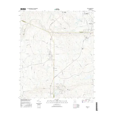
 1971 Manchester1973 Print · USGSThe Georgia Piedmont at the start of the 1970s was defined by the ridges of PINE MOUNTAIN and the tracks of the Seaboard Coast Line. Genealogists and historians can trace the rural communities of Chalybeate Springs and Belleview, and locate local landmarks like Greens Mill and Valley Grove Ch.2 unique versions available
 - 1971 Map of Shiloh, 1973 Print
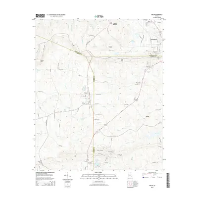
 1971 Shiloh1973 Print · USGSShiloh and the surrounding ridgelines are captured here in the early seventies as the railroad and rural life defined this part of Georgia. Researchers can trace family history at Tramell Cem or locate the site of St Pauls Ch and Bulloch Crossroads.2 unique versions available
 - 1981 Map of Thomaston, 1982 Print
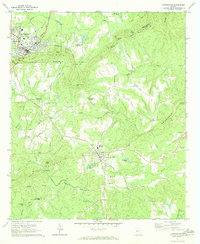
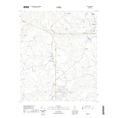
 1981 Thomaston1982 Print · USGSCentral Georgia’s ridgeline and river country comes into focus in this early 1980s survey of the Pine Mountain corridor. Researchers can trace historic church sites like Oak Grove Ch, the rail junctions at Manchester, and the expansive Franklin D Roosevelt State Park.
 - 2011 Map of Manchester, 2011 Print
 2011 Manchester2011 Print · USGSCovers Manchester, including Woodland, Belleview, and other nearby areas
 - 2011 Map of Shiloh, 2011 Print
 2011 Shiloh2011 Print · USGSCovers Manchester, including Shiloh, Warm Springs, and other nearby areas
 - 2014 Map of Manchester, 2014 Print
 2014 Manchester2014 Print · USGSCovers Manchester, including Woodland, Belleview, and other nearby areas
 - 2014 Map of Shiloh, 2014 Print
 2014 Shiloh2014 Print · USGSCovers Manchester, including Shiloh, Warm Springs, and other nearby areas
 - 2017 Map of Manchester, 2017 Print
 2017 Manchester2017 Print · USGSCovers Manchester, including Woodland, Belleview, and other nearby areas
 - 2017 Map of Shiloh, 2017 Print
 2017 Shiloh2017 Print · USGSCovers Manchester, including Shiloh, Warm Springs, and other nearby areas
 - 2020 Map of Manchester, 2020 Print
 2020 Manchester2020 Print · USGSCovers Manchester, including Woodland, Belleview, and other nearby areas
 - 2020 Map of Shiloh, 2020 Print
 2020 Shiloh2020 Print · USGSCovers Manchester, including Shiloh, Warm Springs, and other nearby areas
 - 2024 Map of Manchester, 2024 Print
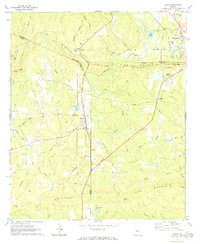
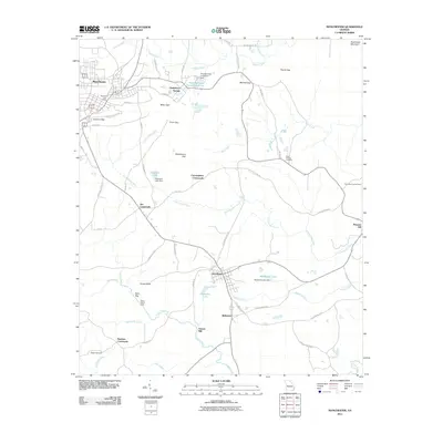
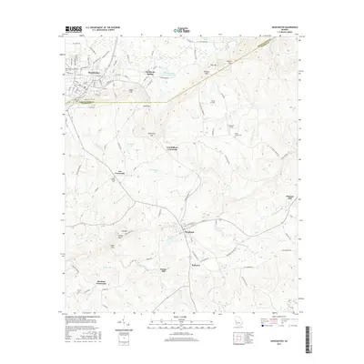
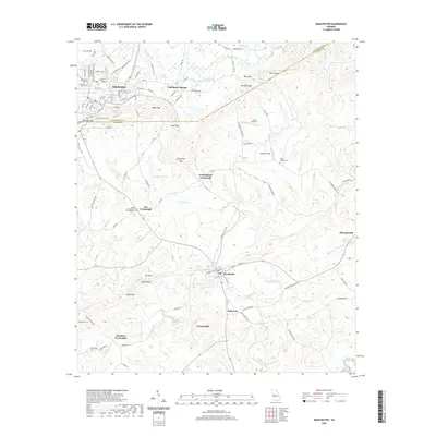
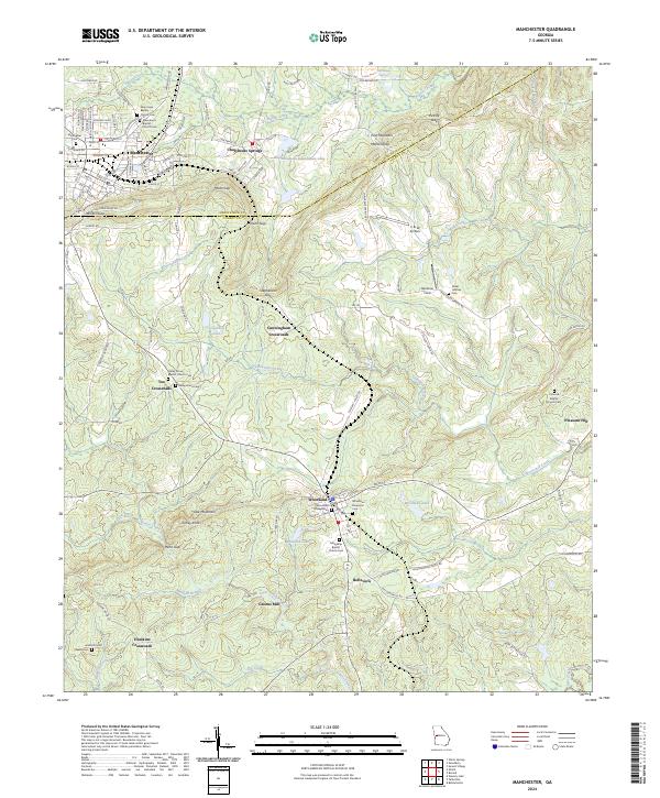 2024 Manchester2024 Print · USGSThe Meriwether and Talbot County line is defined by ridges and gaps in this modern look at the Georgia uplands. Genealogists and local researchers can pinpoint family landmarks like Greens Mill, Woodland Memorial Cem, and the rural junction at Hawkins Crossroads.
 - 2024 Map of Shiloh, 2024 Print
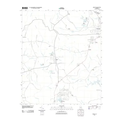
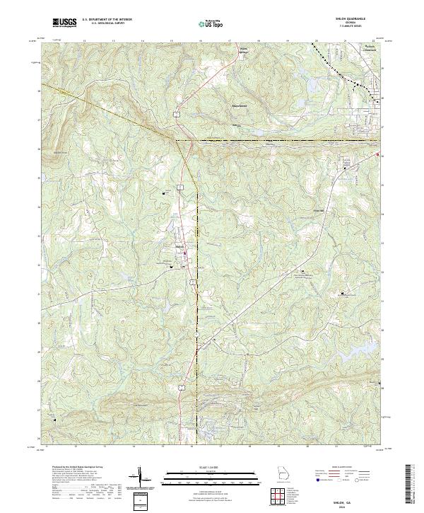 2024 Shiloh2024 Print · USGSThe peaks of Pine Mountain and Oak Mountain define this Georgia landscape in the early twenty-first century. Researchers can trace rural lineages through the Old Shiloh Baptist Church Cem, Sardis Methodist Church Cem, and the settlement at Bulloch Crossroads.
End of results
Showing maps 1-19 of 19
Top cities near Manchester
- Pine Mountain historical maps
- Woodbury historical maps
- Talbotton historical maps
- Greenville historical maps
- Waverly Hall historical maps
- Hamilton historical maps
See more
Frequently asked questions
- What are the different types of historical maps available for Manchester?
- What is the oldest map of Manchester?
- Where can I purchase historical maps of Manchester for my home or office?
- Where can I download high-res historical maps of Manchester?
- Are there historical topographic maps available for Manchester?
- Is there historical aerial imagery available for Manchester?
- Where are historical maps of Manchester sourced from?