1900s (20th Century) Maps of Patterson, Georgia
Explore 8 historic maps of Patterson from the 1900s (20th Century). These maps offer a rare glimpse into what life looked like during the 1900s — showing old roads, neighborhoods, homes, and landmarks that have changed or disappeared over time.
Whether you're researching your family's past, planning a metal detecting trip, or studying how Patterson's landscape evolved across the 1900s, these high-resolution maps are a powerful tool for exploring the history of this region.
- Focus on a specific era: All maps on this page are from the 1900s, giving you a focused view of this time period.
- See what’s changed: Compare century-old streets, trails, and buildings to today's modern landscape using overlays and satellite layers.
- Research with precision: Use these maps for genealogy, historical research, land use analysis, or educational projects.
- View, download, or print: Maps are fully viewable online in high resolution, and can be downloaded or printed for your own records.
Start exploring Patterson's history through authentic maps from the 1900s. This is your window into the past.
Patterson, GA maps
(8)- 1953 Map of Waycross, 1967 Print
 1953 Waycross1967 Print · USGSSouth Georgia's agricultural and rail heartland is captured here in the mid-1950s, showing a vast network of timber and farming towns. Researchers can trace the rail lines connecting Waycross and Tifton or locate landmarks like Jefferson Davis State Park and Lake Blackshear.2 unique versions available
 - 1958 Map of Waycross
 1958 Waycross1958 Print · USGSSoutheast Georgia in the late fifties remains a landscape of deep river basins and vital rail junctions. Genealogists and historians can trace family-named landmarks and rural hubs like Union Church, South Georgia College, and the sprawling Okefenokee Swamp.2 unique versions available
 - 1971 Map of Blackshear East, 1974 Print
 1971 Blackshear East1974 Print · USGSPierce County in the early seventies remains a landscape of rural family settlements and small country churches. Genealogists can trace local roots at the Jot 'Em Down Store, Homestead Ch, and the Seaboard Coast Line rail corridor.2 unique versions available
 - 1971 Map of Patterson, 1974 Print
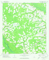
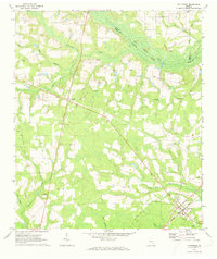 1971 Patterson1974 Print · USGSPierce County during the early seventies reveals a landscape of railroad towns and timbered creek bottoms. Genealogists can trace family landmarks like Aspinwall Cem, Gethsemane Cem, and the rural community surrounding Union Chapel.
 - 1971 Map of Screven, 1974 Print
 1971 Screven1974 Print · USGSSoutheast Georgia in the early seventies shows the rail-side development of Screven and Offerman amidst the winding Little Satilla River bottomlands. Genealogists can locate several burial sites like Foster Cem and Moody Cem alongside the New Home Ch.2 unique versions available
 - 1971 Map of Patterson SE, 1974 Print
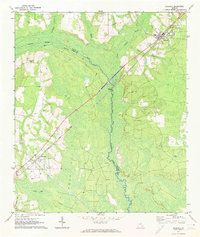
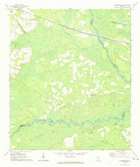 1971 Patterson SE1974 Print · USGSSoutheast of Patterson in the early 1970s, this rural Georgia landscape is defined by the winding Satilla River and its expansive wetlands. Genealogists and local historians can trace family roots through landmarks like Raulerson Cem, Laura Chapel, and the Raulerson Community Center.2 unique versions available
 - 1978 Map of Waycross, 1982 Print
 1978 Waycross1982 Print · USGSSoutheast Georgia in the late seventies is a landscape of vast wetlands and busy rail junctions. Genealogists and local historians can trace the Seaboard Coast Line through rural stops like Millwood and Pearson or locate family sites near the Okefenokee Swamp.
 - 1988 Map of Waycross
 1988 Waycross1988 Print · USGSSouth Georgia's wiregrass and timber country is documented here in the late eighties, centered on the vital rail junction of Waycross. Genealogists and historians can trace the rural landscape from Okefenokee up to the Ocmulgee, finding sites like Lumber City and Jefferson Davis Memorial State Park.
End of results
Showing maps 1-8 of 8
Top cities near Patterson
- Waycross historical maps
- Jesup historical maps
- Blackshear historical maps
- Nahunta historical maps
- Screven historical maps
- Hoboken historical maps
See more
Frequently asked questions
- What are the different types of historical maps available for Patterson?
- What is the oldest map of Patterson?
- Where can I purchase historical maps of Patterson for my home or office?
- Where can I download high-res historical maps of Patterson?
- Are there historical topographic maps available for Patterson?
- Is there historical aerial imagery available for Patterson?
- Where are historical maps of Patterson sourced from?