1900s (20th Century) Maps of Union County, Georgia
Explore 62 historic maps of Union County from the 1900s (20th Century). These maps offer a rare glimpse into what life looked like during the 1900s — showing old roads, neighborhoods, homes, and landmarks that have changed or disappeared over time.
Whether you're researching your family's past, planning a metal detecting trip, or studying how Union County's landscape evolved across the 1900s, these high-resolution maps are a powerful tool for exploring the history of this region.
- Focus on a specific era: All maps on this page are from the 1900s, giving you a focused view of this time period.
- See what’s changed: Compare century-old streets, trails, and buildings to today's modern landscape using overlays and satellite layers.
- Research with precision: Use these maps for genealogy, historical research, land use analysis, or educational projects.
- View, download, or print: Maps are fully viewable online in high resolution, and can be downloaded or printed for your own records.
Start exploring Union County's history through authentic maps from the 1900s. This is your window into the past.
Union County, GA maps
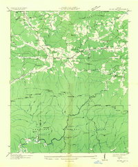
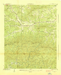
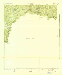
(62)- 1903 Map of Dahlonega
 1903 Dahlonega1903 Print · USGSNorth Georgia and the Blue Ridge were defined by mountain settlements and early industry at the turn of the century. Genealogists and historians can trace family locations across the Nacoochee Valley, locate the Asbestos Mines, or find old sites like Loudsville and Porter Springs.5 unique versions available
 - 1911 Map of Ellijay
 1911 Ellijay1911 Print · USGSNorth Georgia and the Tennessee border are captured here at the turn of the century, showing a mountain landscape of river ferries and early rail. Genealogists can locate family landmarks like Higdons Store, the Pisgah church, or crossings at Bakers Ferry and Shallow Ford.4 unique versions available
 - 1935 Map of Coosa Bald
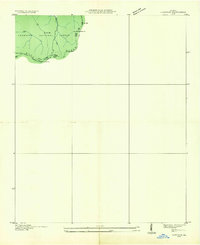
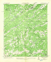
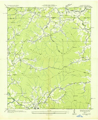
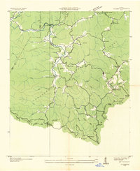
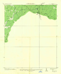
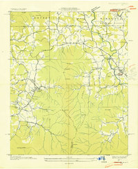
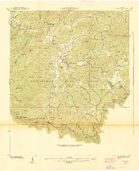
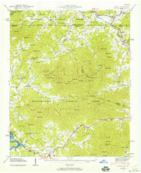
 1935 Coosa Bald1935 Print · USGSUnion County, Georgia, is captured during the mid-thirties as the river valleys were being surveyed for infrastructure and conservation. Genealogists and historians can trace family locations near Cowden Cem, Choestoe, and rural landmarks like Trackrock School.
 - 1935 Map of Ivylog
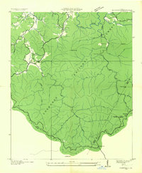
 1935 Ivylog1935 Print · USGSUnion County, Georgia, and the North Carolina borderlands are captured here in the mid-1930s before major dam projects reshaped the river valleys. Genealogists and local historians can trace family roots through numerous country landmarks like Ivylog Cem, Mt Zion Sch, and Davenport Mill.
 - 1935 Map of Mulky Gap
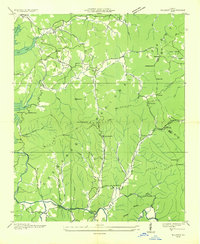
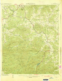
 1935 Mulky Gap1935 Print · USGSUnion and Fannin Counties were characterized by small mills and mountain gaps in the mid-1930s. Genealogists can trace family roots at Jones Cem or Harkins Cem, while historians can locate CCC Camp No F-12 and Clements Mills.
 - 1935 Map of Cowrock
 1935 Cowrock1935 Print · USGSThe northern Georgia high country is captured here during the mid-1930s as federal agencies mapped the watershed for the Tennessee Valley Authority. Hikers and historians can trace the early route of the Appalachian Trail through Tesnatee Gap and past the summit of Cowrock Mtn.
 - 1935 Map of Noontootla
 1935 Noontootla1935 Print · USGSNorth Georgia's mountain ridges and valley settlements are captured here in the mid-1930s as the Tennessee Valley Authority and USGS surveyed the region. Researchers can trace the early APPALACHIAN TRAIL past the FIRE TOWER on Hawk Mtn and locate sites like Stock Hill Ch or the Rock Creek Cem.
 - 1935 Map of Wilscot
 1935 Wilscot1935 Print · USGSNorth Georgia mountain life is caught in a moment of transition in the mid-1930s as the TVA and CCC arrived in the Blue Ridge. Genealogists can trace old homesteads and landmarks like Star Creek Mill, Sugar Hill Ch, and CCC Camp F 8 along the Toccoa River.
 - 1935 Map of Culberson
 1935 Culberson1935 Print · USGSThe borderlands of North Carolina and Georgia come alive in this mid-1930s study of the mountain gaps and rail corridors. Genealogists and historians can trace family-named sites like Hawkins Mill, Bell Sch, and New Liberty Ch along the winding Hemptown Creek.
 - 1935 Map of Gumlog
 1935 Gumlog1935 Print · USGSUpper Georgia and North Carolina meet in this mid-1930s landscape, where mountain gaps and creek valleys dictate the layout of rural life. Researchers can trace the heritage of remote settlements like Gumlog and find local landmarks such as Ownby Mill and Zebulon Ch.
 - 1935 Map of Suches
 1935 Suches1935 Print · USGSThe North Georgia mountains in the mid-1930s are captured here as federal forestry and New Deal projects began to reshape the Blue Ridge. Genealogists can trace early homesteads near Suches and Gaddistown or locate rural landmarks like Corinth Sch and Gilreath Mill.
 - 1935 Map of Jacks Gap
 1935 Jacks Gap1935 Print · USGSThe high ridges of Union and Towns counties are captured here in the mid-1930s just as the Appalachian Trail was being established through the Cherokee National Forest. Researchers can locate vanished rural landmarks like Town Creek Sch and Old Liberty Ch tucked between Brasstown Bald Mtn and the Nottely River.
 - 1935 Map of Neels Gap
 1935 Neels Gap1935 Print · USGSThe high peaks of the Blue Ridge come into focus during the mid-1930s as early park infrastructure and mountain trails are established. Trace the original path of the Appalachian Trail past Blood Mtn, Zion Ch, and the heights of Neels Gap.
 - 1935 Map of Hiawassee
 1935 Hiawassee1935 Print · USGSThe Georgia-North Carolina border country comes alive in the mid-1930s, showing the early infrastructure of the Appalachian highlands. You can trace family history through sites like Young Harris, Townsend Mill, and the Lower Bell Creek School.
 - 1938 Map of Mulky Gap
 1938 Mulky Gap1938 Print · USGSUnion County and Fannin County meet here in the late 1930s, showing a mountain landscape of rural post offices and federal conservation camps. Genealogists and historians can trace family locations through Jones Cem, Youngcane School, and Dillard Chapel.4 unique versions available
 - 1938 Map of Cowrock
 1938 Cowrock1938 Print · USGSHigh in the Blue Ridge during the late thirties, this survey shows the rugged intersection of White, Union, and Lumpkin counties. Hikers and historians can trace the early Appalachian Trail as it crosses through Tesnatee Gap and past Cowrock Mtn.
 - 1938 Map of Coosa Bald
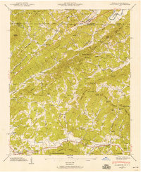
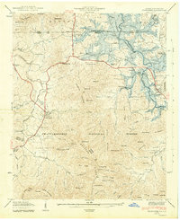
 1938 Coosa Bald1938 Print · USGSUnion County and the mountain seat of Blairsville are captured here in the late 1930s, showing a landscape of high ridges and deep river valleys. Genealogists can locate family-named landmarks like Butt Cem and early community centers such as Shadydale Sch and Coosa Ch.3 unique versions available
 - 1938 Map of Jacks Gap
 1938 Jacks Gap1938 Print · USGSThe high peaks of the Blue Ridge Mountains are captured in the late 1930s, centered on the summit of Brasstown Bald. Genealogists and hikers can trace early routes like the Appalachian Trail or locate the Old Liberty Ch and the settlement of Hood.
 - 1938 Map of Neels Gap
 1938 Neels Gap1938 Print · USGSThe high ridges of Lumpkin and Union counties are shown in the late 1930s, just as the region’s modern parks were taking shape. Researchers can trace the early Appalachian Trail, the grounds of Vogel State Park, and the community at Zion Church.
 - 1938 Map of Suches
 1938 Suches1938 Print · USGSUpper Union County and the Toccoa River valley are captured in the late 1930s, showing a landscape of high mountain gaps and isolated rural communities. Researchers can locate the CCC Camp F1, the Appalachian Trail, and schools like Peggy Hale Sch.
 - 1941 Map of Hiawassee
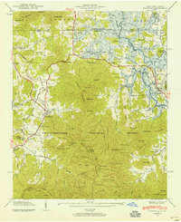 1941 Hiawassee1941 Print · USGSThe Georgia-North Carolina borderlands appear here in the early 1940s, just as the landscape was being reshaped by the Chatuge Lake reservoir. Researchers can trace ancestral locations at Wood Grove Cem, Ledford Chapel, and the now-submerged areas near Friendship.2 unique versions available
 - 1941 Map of Culberson, 1958 Print
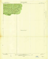
 1941 Culberson1958 Print · USGSThe borderlands of Georgia and North Carolina are captured here in the early 1940s, showing a landscape defined by mountain ridges and valley mills. Researchers can trace the Louisville and Nashville rail line through Culberson or locate family landmarks like Paris Cem and Loving Sch.4 unique versions available
 - 1941 Map of Gumlog, 1960 Print
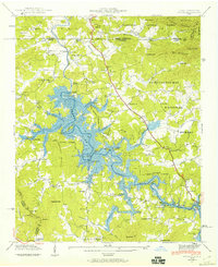
 1941 Gumlog1960 Print · USGSThe mountain valleys of Union County appear here just as the landscape was changing with the creation of Nottely Lake. Genealogists and local historians can trace family-named sites like Many Forks Ch, Owenby Mill, and the Pleasant Hill Cem.2 unique versions available
 - 1941 Map of Ivylog, 1960 Print
 1941 Ivylog1960 Print · USGSThe Georgia and North Carolina borderlands appear here in the early 1940s as the Tennessee Valley Authority creates the new Nottely Lake. Genealogists can trace old homesteads and local institutions like the Ivylog Cem, Bethany Church, and Davenport Mill before the valley's landscape was forever changed.2 unique versions available
 - 1942 Map of Hiawassee
 1942 Hiawassee1942 Print · USGSTowns County and the North Carolina borderlands are captured during the 1940s transformation of the river valley. Genealogists and historians can locate family landmarks like Townsend Mill, Wood Grove Cem, and Lower Bell Creek Sch as the Chatuge Reservoir began to form.2 unique versions available
Showing maps 1-25 of 62
Top cities of Union County
Frequently asked questions
- What are the different types of historical maps available for Union County?
- What is the oldest map of Union County?
- Where can I purchase historical maps of Union County for my home or office?
- Where can I download high-res historical maps of Union County?
- Are there historical topographic maps available for Union County?
- Is there historical aerial imagery available for Union County?
- Where are historical maps of Union County sourced from?