Old Maps of Wilkinson County, Georgia for Academic Research
Study the evolution of Wilkinson County with 119 high-resolution historic maps. Whether you're teaching, researching, or modeling changes in land use, these maps provide essential visual documentation of urban, environmental, and geographic change.
- Analyze long-term change: Track patterns in development, transportation, and natural features.
- Ideal for environmental or urban studies: Support academic projects with primary historical map data.
- Use in the classroom or lab: Educators and researchers rely on these maps to bring historical context to life.
These maps are a powerful tool for teaching, research, and visualizing how Wilkinson County has changed over the decades.
Wilkinson County, GA maps
(119)- 1912 Map of Milledgeville
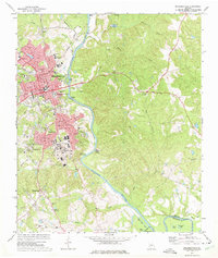
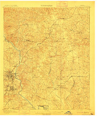 1912 Milledgeville1912 Print · USGSMilledgeville and its surroundings at the start of the century show a landscape shaped by state institutions and an expanding rail network. Researchers can trace the extensive State Sanitarium grounds or locate rural landmarks like Coleman Mill and Griffin Academy.3 unique versions available
 - 1916 Map of Irwinton, 1963 Print
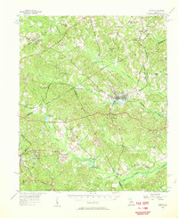
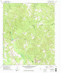
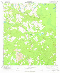
 1916 Irwinton1963 Print · USGSWilkinson County is captured here in the years before the Great War, showing a network of rural settlements connected by the Central of Georgia railroad. Genealogists can trace family landmarks and community centers like Goldens Mill, Hazelino School, and Toomsboro.2 unique versions available
 - 1920 Map of Irwinton
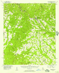
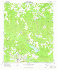
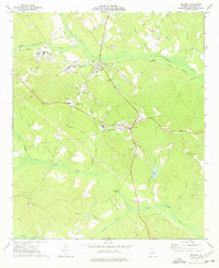
 1920 Irwinton1920 Print · USGSWilkinson County in the years following the Great War reveals a landscape of scattered rural hamlets and river-bottom agriculture. Researchers can trace the lineage of local landmarks like Goldens Mill, Myrtle Spring Church, and the winding Oconee River corridor.2 unique versions available
 - 1953 Map of Athens, 1966 Print
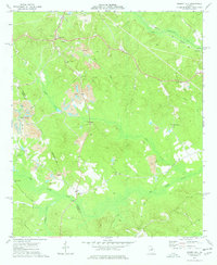
 1953 Athens1966 Print · USGSGeorgia's Piedmont and Savannah River borderlands come alive in this mid-century survey of the region surrounding Athens and Augusta. Trace the rail-and-river economy through the Georgia RR and landmarks like the Fort Gordon Military Reservation.3 unique versions available
 - 1956 Map of Gordon, 1957 Print
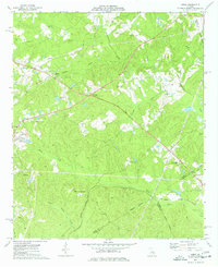
 1956 Gordon1957 Print · USGSWilkinson County and its neighbors are shown in the mid-fifties during a peak era of clay mining and rail transport. Researchers can trace family roots through numerous rural sites like Myricks Mill, Stevens Pottery, and Tarrance Chapel Sch.
 - 1956 Map of Jeffersonville, 1957 Print
 1956 Jeffersonville1957 Print · USGSMiddle Georgia's rural heartland is captured here in the mid-fifties, centered on the railroad hub of Jeffersonville. Genealogists can trace family connections to numerous landmarks like New Richland Ch, White Springs Sch, and the riverfront at Cary.2 unique versions available
 - 1957 Map of Macon
 1957 Macon1957 Print · USGSMid-century Georgia comes into focus as the river-and-rail economy shifts toward a new era of aviation and highway travel. Trace family roots and vanished landmarks across the Ocmulgee River valley from Macon to the onion fields of Vidalia.
 - 1958 Map of Macon
 1958 Macon1958 Print · USGSMiddle Georgia during the late fifties shows the post-war expansion of Warner Robins alongside the deep-rooted rail hubs of the Central of Georgia line. Researchers can trace the river-bound boundaries of numerous counties and find local landmarks like Veterans Memorial Hospital and Robins AFB.
 - 1958 Map of Athens
 1958 Athens1958 Print · USGSNorth-central Georgia and the Savannah River valley are captured in the late fifties, showing the region as the new reservoirs were filling. Researchers can trace historic rail lines like the Georgia RR and locate rural landmarks such as Social Circle, Graves Mountain, and the Fort Gordon Military Reservation.
 - 1959 Map of Athens
 1959 Athens1959 Print · USGSNortheast Georgia and the South Carolina borderlands appear here in the mid-fifties, during a decade of infrastructure growth. Genealogists and historians can trace the rail-and-river geography of towns like Social Circle, the sprawl of Fort Gordon Military Reservation, and the newly formed Clark Hill Reservoir.
 - 1962 Map of Oconee, 1963 Print
 1962 Oconee1963 Print · USGSThe Oconee River valley in the early 1960s showcases a landscape shaped by river transport and the Central of Georgia railroad. Researchers can trace rural life through landmarks like Balls Ferry Bridge, Gardner, and the Wesley Chapel Cem.
 - 1963 Map of Athens
 1963 Athens1963 Print · USGSGeorgia's Piedmont and the Savannah River valley are captured in the early sixties as major reservoirs and military installations reshaped the landscape. Researchers can trace the development of Clark Hill Reservoir, locate the Fort Gordon Military Reservation, and find historic towns like Social Circle and Eatonton.
 - 1964 Map of Macon
 1964 Macon1964 Print · USGSCentral Georgia in the mid-sixties is defined by its major river valleys and a booming military presence. Genealogists and historians can trace the growth of Warner Robins near Robins AFB or locate smaller rural junctions like Allentown and Jeffersonville along the historic Southern railroad lines.2 unique versions available
 - 1972 Map of Milledgeville, 1975 Print
 1972 Milledgeville1975 Print · USGSMilledgeville and the Oconee River valley are captured here in the early seventies, showcasing a landscape defined by prominent state institutions and schools. Genealogists and historians can trace State Hospital grounds and local landmarks like Memory Hill Cem and Fort Wilkinson Historical Site.3 unique versions available
 - 1972 Map of Friendship, 1975 Print
 1972 Friendship1975 Print · USGSMiddle Georgia's rural character is preserved here in the early seventies, where the settlement of Friendship sits near a complex web of county boundaries. Researchers can trace rural lineages through local landmarks like Nebo Ch, Harmony Ch, and the old Indian Trail Road.2 unique versions available
 - 1973 Map of Gordon, 1977 Print
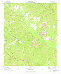
 1973 Gordon1977 Print · USGSWilkinson County industries and rural rail stops are in focus during the early seventies. Genealogists and historians can trace family locations near Stevens Pottery, Lake Tchutolako, and several country churches like Emmanuel Ch or Smith Chapel.2 unique versions available
 - 1973 Map of Massey Hill, 1977 Print
 1973 Massey Hill1977 Print · USGSWilkinson and Twiggs counties appear here in the early 1970s, showcasing a landscape shaped by the kaolin industry and rural community life. Genealogists and historians can locate numerous landmarks like Spring Hill Ch Cem, Asbury Ch, and the Old Grade Railroad.
 - 1973 Map of Napier Pond, 1977 Print
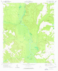
 1973 Napier Pond1977 Print · USGSWilkinson County was defined by its clay industry and deep family roots in the early seventies. Genealogists can locate numerous family burial sites like Byington Cem and Bentley Cem, while industrial historians can trace the massive Clay Pit near Commissioner Creek.
 - 1973 Map of Irwinton, 1977 Print
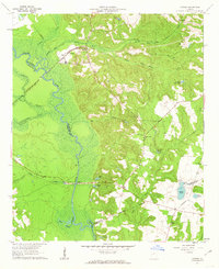
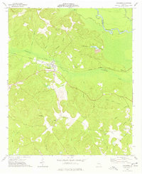
 1973 Irwinton1977 Print · USGSWilkinson County in the early seventies shows a landscape shaped by clay mining and the Central of Georgia rail line. Genealogists can locate rural landmarks like Sacred Heart Ch, Walters Cem, and the County High Sch near Irwinton.2 unique versions available
 - 1973 Map of Toomsboro, 1977 Print
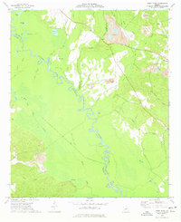
 1973 Toomsboro1977 Print · USGSToomsboro was a critical junction of the Central of Georgia railroad and rural bypasses in the early 1970s. Genealogists and local historians can trace family roots through several legacy sites, including Ebenezer Church, Lords Cemetery, and Beech Hill.
 - 1973 Map of Gumm Pond, 1977 Print
 1973 Gumm Pond1977 Print · USGSThe Oconee River bottomlands near the tri-county line of Baldwin, Wilkinson, and Washington were a maze of oxbows and wetlands in the early seventies. Genealogists and local historians can trace rural landmarks like Gumm Hill Church, Olive Hill Church, and the settlement of Hebron.
 - 1973 Map of James, 1977 Print
 1973 James1977 Print · USGSJones and Wilkinson counties come into focus in the 1970s as rural communities thrive along the Central of Georgia railroad. Researchers can trace ancestral roots through small settlements like Lewiston, find local landmarks such as Mountain Springs, and locate several rural churches including New Salem Ch.2 unique versions available
 - 1973 Map of Dry Branch, 1977 Print
 1973 Dry Branch1977 Print · USGSTwiggs County's kaolin mining landscape and rural crossroads are captured here in the early 1970s. Trace local family roots at Nelson Cem or explore industrial history through the sprawling Clay Pits and the historic site of Myricks Mill.2 unique versions available
 - 1974 Map of Cow Hell Swamp, 1976 Print
 1974 Cow Hell Swamp1976 Print · USGSThe Oconee River bottomlands in the mid-1970s reveal a landscape dominated by winding waterways and rural family enclaves. Genealogists and local historians can trace legacy landmarks like Stanley Cem, Halls Landing, and the curiously named Cow Hell Swamp.
 - 1974 Map of Danville East, 1976 Print
 1974 Danville East1976 Print · USGSThe railroad towns of Danville, Allentown, and Montrose anchor this mid-1970s Georgia landscape where four counties meet. Genealogists can locate rural landmarks like the Twiggs-Wilkinson Sch, Laurens Hill Ch, and the old Claypit mines.
Showing maps 1-25 of 119
Top cities of Wilkinson County
- Gordon historical maps
- Ivey historical maps
- McIntyre historical maps
- Irwinton historical maps
- Toomsboro historical maps
Frequently asked questions
- What are the different types of historical maps available for Wilkinson County?
- What is the oldest map of Wilkinson County?
- Where can I purchase historical maps of Wilkinson County for my home or office?
- Where can I download high-res historical maps of Wilkinson County?
- Are there historical topographic maps available for Wilkinson County?
- Is there historical aerial imagery available for Wilkinson County?
- Where are historical maps of Wilkinson County sourced from?