2000s (21st Century) Maps of Honomu, Hawaii
Explore 6 historic maps of Honomu from the 2000s (21st Century). These maps offer a rare glimpse into what life looked like during the 2000s — showing old roads, neighborhoods, homes, and landmarks that have changed or disappeared over time.
Whether you're researching your family's past, planning a metal detecting trip, or studying how Honomu's landscape evolved across the 2000s, these high-resolution maps are a powerful tool for exploring the history of this region.
- Focus on a specific era: All maps on this page are from the 2000s, giving you a focused view of this time period.
- See what’s changed: Compare century-old streets, trails, and buildings to today's modern landscape using overlays and satellite layers.
- Research with precision: Use these maps for genealogy, historical research, land use analysis, or educational projects.
- View, download, or print: Maps are fully viewable online in high resolution, and can be downloaded or printed for your own records.
Start exploring Honomu's history through authentic maps from the 2000s. This is your window into the past.
Honomu, HI maps
(6)- 2013 Map of Papaikou, 2013 Print
 2013 Papaikou2013 Print · USGSCovers Honomu, including Pepeekeo, Papaikou, and other nearby areas
 - 2013 Map of Papaikou OE N, 2013 Print
 2013 Papaikou OE N2013 Print · USGSCovers Honomu, including Wailea, Hawaiʻi County, and other nearby areas
 - 2017 Map of Papaikou, 2017 Print
 2017 Papaikou2017 Print · USGSCovers Honomu, including Pepeekeo, Papaikou, and other nearby areas
 - 2017 Map of Papaikou OE N, 2017 Print
 2017 Papaikou OE N2017 Print · USGSCovers Honomu, including Wailea, Hawaiʻi County, and other nearby areas
 - 2024 Map of Papaikou OE N, 2024 Print
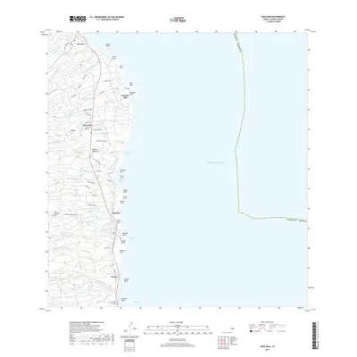
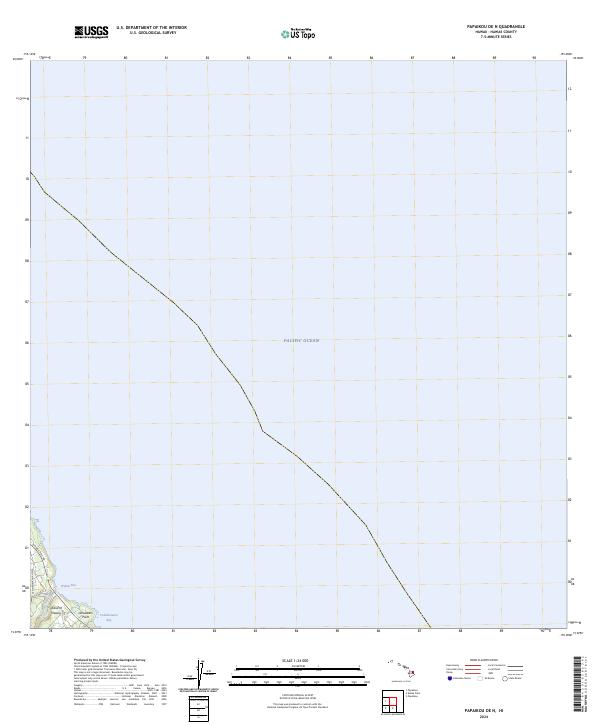 2024 Papaikou OE N2024 Print · USGSThe eastern coast of the Island of Hawai'i is captured in this modern survey of its shoreline and transit corridors. Researchers can trace the coastal route of the Old Mamalahoa Hwy as it passes Wailea Bay and the mouth of Kolekole Stream.
 - 2024 Map of Papaikou, 2024 Print
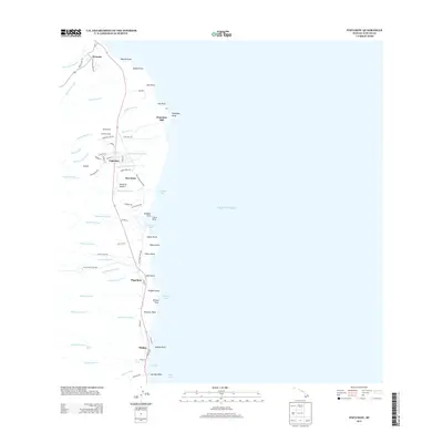
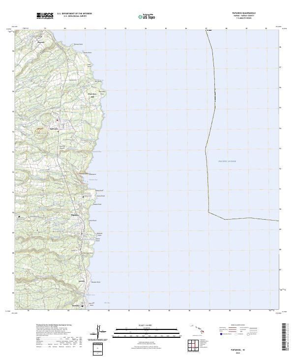 2024 Papaikou2024 Print · USGSThe Hamakua Coast comes alive in this contemporary survey, showing the transition from historic plantation centers to modern residential communities. Genealogists and local historians can trace family sites at Alae Cem, the Pepe'ekeo Mill, and Honomu.
End of results
Showing maps 1-6 of 6
Top cities near Honomu
Top neighborhoods of Honomu
Frequently asked questions
- What are the different types of historical maps available for Honomu?
- What is the oldest map of Honomu?
- Where can I purchase historical maps of Honomu for my home or office?
- Where can I download high-res historical maps of Honomu?
- Are there historical topographic maps available for Honomu?
- Is there historical aerial imagery available for Honomu?
- Where are historical maps of Honomu sourced from?