Old Maps of Keaau, Hawaii
Explore 20 old maps of Keaau, spanning from 1917 to today. These high-resolution historic maps reveal how streets, neighborhoods, landmarks, and natural features evolved over time — perfect for genealogy, metal detecting, research, and local history exploration.
What you can do with these maps:
- See how Keaau changed over time: Compare historical maps to modern-day views to trace roads, homesites, rail lines & more.
- View detailed metadata: Each map includes creators, publishers, year, scale, and archive source.
- Overlay maps with satellite & LiDAR: Visualize the past alongside modern tools to explore terrain & human change.
- Trusted historical sources: Maps sourced from the USGS, Library of Congress, and other archives.
- Access maps your way: View online, download high-res files, or order prints for personal or research use.
Start exploring old maps of Keaau to uncover forgotten places, hidden landmarks, and the deep history beneath your feet.
Keaau, HI maps
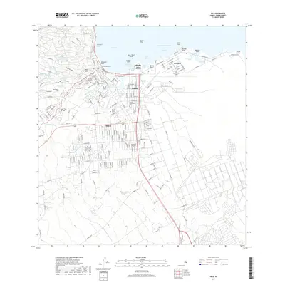
(20)- 1917 Map of Hilo
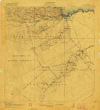 1917 Hilo1917 Print · USGSThe Hilo region during the Great War era shows a landscape shaped by sugar production and volcanic history. Researchers can trace the Hilo R. R. through plantation hubs like Olaa Plantation Mill and early settlements including Mountain View and Elevenmile Homestead.
 - 1932 Map of Hilo
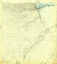 1932 Hilo1932 Print · USGSCoastal Hawaii and the Puna district appear here at the height of the plantation era, before major mid-century modernization. Researchers can trace the layout of sugar camps and early rail lines, locating the Olaa Plantation Mill, the Hilo Air Port, and the track of the Lava Flow of 1881.2 unique versions available
 - 1954 Map of Hawaii North
 1954 Hawaii North1954 Print · USGSThe Big Island in the mid-fifties shows a landscape of active volcanic history and a peak sugar-mill economy. Trace the route of the Hawaii Consolidated Railway, locate the Olaa Plantation Mill, and see the extent of the Lava flow of 1881 near Hilo.
 - 1959 Map of Hawaii North
 1959 Hawaii North1959 Print · USGSThe northern half of Hawaii Island in the late fifties shows a landscape shaped by historic volcanic activity and a thriving sugar and ranching economy. Researchers can trace historic lava flows alongside local landmarks like Upolu Point Airport, Huehue Ranch, and the Pacific Sugar Mill.
 - 1961 Map of Hawaii North
 1961 Hawaii North1961 Print · USGSThe Big Island's northern reaches are shown here in the early sixties, during the peak of the sugar era and before modern resort development. Researchers can trace the Hawaii Consolidated railroad, locate the Ahu a Umi Heiau Ruins, and explore sugar industry landmarks like the Pacific Sugar Mill.2 unique versions available
 - 1963 Map of Hilo, 1964 Print
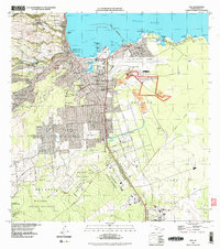
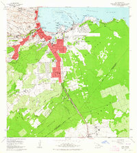 1963 Hilo1964 Print · USGSHilo and its surrounding homesteads are captured in detail during the early sixties, showing the city's expansion against the backdrop of the Panaewa Forest Reserve. Researchers can trace old family footprints in the Waiakea Homesteads, locate the Sugar Mill, or find St Josephs High Sch and Rainbow Falls.2 unique versions available
 - 1963 Map of Mountain View, 1964 Print
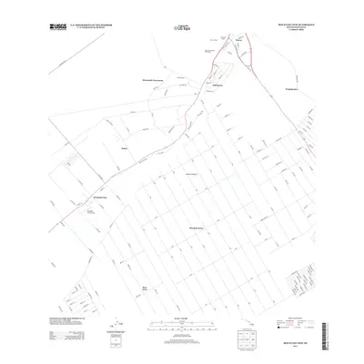
 1963 Mountain View1964 Print · USGSThe Puna District comes to life in the early sixties, showing the agricultural settlements and numbered camps that defined local life. Trace family land in Olaa Reservation Homesteads and locate historic sites like Kurtistown Sch or Olaa Dispensary.2 unique versions available
 - 1975 Map of Hawaii, 1977 Print
 1975 Hawaii1977 Print · USGSThe Big Island in the mid-seventies is captured here as a landscape of volcanic giants and coastal sugar communities. Genealogists and historians can locate former plantation sites like Pepeekeo Mill or trace the routes of the Mamalahoa Highway through Kamuela.
 - 1977 Map of Hilo, 1981 Print
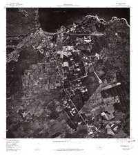 1977 Hilo1981 Print · USGSHilo at the end of the 1970s is shown in striking aerial detail, capturing the city's transition from a plantation hub to a modern urban center. Researchers can trace the development of the city grid, the industrial harbor at Hilo Bay, and the expanding footprint of Hilo.
 - 1980 Map of Hawaii County Sheet 2, 1985 Print
 1980 Hawaii County Sheet 21985 Print · USGSThe eastern coast of the Big Island is captured here in the early eighties, showcasing the intersection of active volcanic landforms and historic plantation towns. Researchers can trace family roots through settlements like Laupahoehoe and Papaikou, or explore the road networks around Kilauea Crater and General Lyman Field.
 - 1981 Map of Mountain View
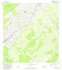 1981 Mountain View1981 Print · USGSThe Puna District comes into focus during the early 1980s as agricultural camps transitioned into established residential communities. Genealogists and historians can trace old homestead boundaries and plantation life through Ninemile Camp, Kurtistown, and the Ola A Homesteads.
 - 1981 Map of Hilo
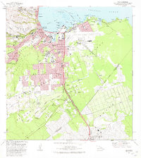 1981 Hilo1981 Print · USGSCoastal Hawaii comes into focus in the early eighties as Hilo transitions from its plantation roots to a modern regional hub. Researchers can trace family history through Homelani Memorial Park or locate industrial sites like the Puna Sugar Company Mill.2 unique versions available
 - 1994 Map of Mountain View, 2002 Print
 1994 Mountain View2002 Print · USGSThe Puna District comes into focus during the mid-nineties as traditional plantation camps transition into modern residential communities. Genealogists and local historians can trace family locations near Mountain View, Elevenmile Homestead, and the historic Kea'au Camp.
 - 1995 Map of Hilo, 1998 Print
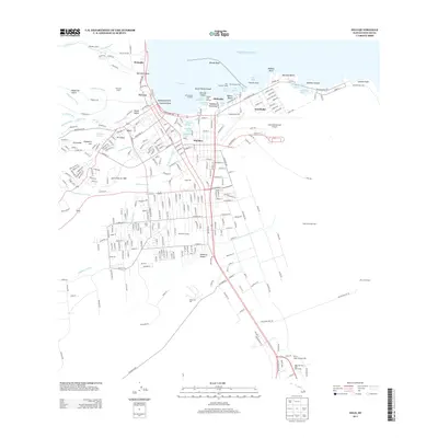
 1995 Hilo1998 Print · USGSHilo's coastal and industrial landscape comes into focus during the mid-nineties, showing the city's relationship with its volcanic history. Researchers can trace the path of the Lava Flow of 1881 or locate local landmarks like the Puna Sugar Company Mill and 8 1/2 Mile Camp.
 - 2013 Map of Mountain View, 2013 Print
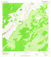
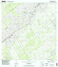
 2013 Mountain View2013 Print · USGSCovers Keaau, including Kopua Farm Lots, Kurtistown, and other nearby areas
 - 2013 Map of Hilo, 2013 Print
 2013 Hilo2013 Print · USGSCovers Keaau, including Hilo, Wainaku, and other nearby areas
 - 2017 Map of Mountain View, 2017 Print
 2017 Mountain View2017 Print · USGSCovers Keaau, including Kopua Farm Lots, Kurtistown, and other nearby areas
 - 2017 Map of Hilo, 2017 Print
 2017 Hilo2017 Print · USGSCovers Keaau, including Hilo, Wainaku, and other nearby areas
 - 2024 Map of Mountain View, 2024 Print
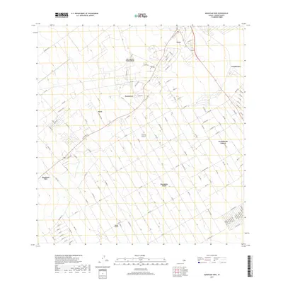
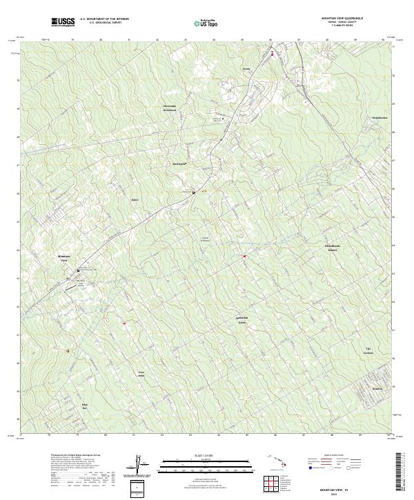 2024 Mountain View2024 Print · USGSThe Puna district of Hawaii is shown here in the mid-2020s, featuring the extensive grid-style subdivisions and agricultural homesteads that define the region. Genealogists can locate several historic burial sites like the Filipino Cem and Jodo Cem, alongside local landmarks like Uetama Camp.
 - 2024 Map of Hilo, 2024 Print
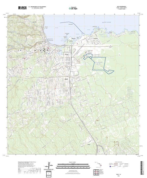 2024 Hilo2024 Print · USGSHilo's coastal landscape and urban growth are documented here in the early twenty-first century. Genealogists and historians can locate specific sites like Homelani Memorial Park, the Lava Flow of 1881, and the NG TS Keaukaha Mil Res.
End of results
Showing maps 1-20 of 20
Top cities near Keaau
Top neighborhoods of Keaau
Frequently asked questions
- What are the different types of historical maps available for Keaau?
- What is the oldest map of Keaau?
- Where can I purchase historical maps of Keaau for my home or office?
- Where can I download high-res historical maps of Keaau?
- Are there historical topographic maps available for Keaau?
- Is there historical aerial imagery available for Keaau?
- Where are historical maps of Keaau sourced from?