2020s Maps of Kukuihaele CDP, Hawaii
Explore 2 historic maps of Kukuihaele CDP from the 2020s. These maps offer a rare glimpse into what life looked like during the 2020s — showing old roads, neighborhoods, homes, and landmarks that have changed or disappeared over time.
Whether you're researching your family's past, planning a metal detecting trip, or studying how Kukuihaele CDP's landscape evolved across the 2020s, these high-resolution maps are a powerful tool for exploring the history of this region.
- Focus on a specific era: All maps on this page are from the 2020s, giving you a focused view of this time period.
- See what’s changed: Compare century-old streets, trails, and buildings to today's modern landscape using overlays and satellite layers.
- Research with precision: Use these maps for genealogy, historical research, land use analysis, or educational projects.
- View, download, or print: Maps are fully viewable online in high resolution, and can be downloaded or printed for your own records.
Start exploring Kukuihaele CDP's history through authentic maps from the 2020s. This is your window into the past.
Kukuihaele CDP, HI maps
(2)- 2024 Map of Kukuihaele, 2024 Print
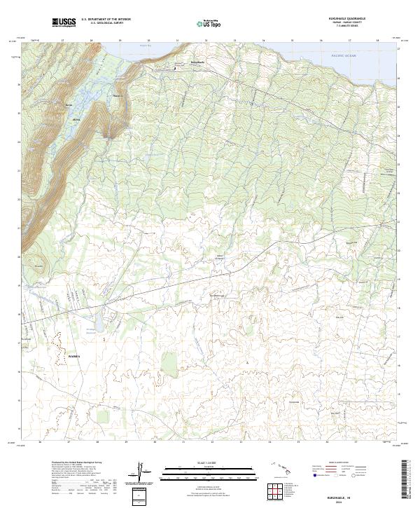 2024 Kukuihaele2024 Print · USGSCoastal Hamakua and the Waimea highlands are captured in this recent survey. Researchers can trace ancestral sites near Kukuihaele, examine the Lālākea Fishpond in Waipi‘o, and locate family markers in the Kukuihaele County Cem.
 - 2024 Map of Kukuihaele OE N, 2024 Print
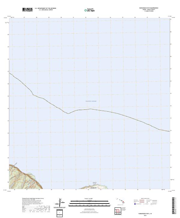 2024 Kukuihaele OE N2024 Print · USGSThe northeastern coast of the Island of Hawai'i is captured here in recent years, showing where the Hamakua cliffs meet the sea. Researchers can trace the steep drainages of Naluea Stream and Muliwai Stream or locate the settlement of Kukuihaele.
End of results
Showing maps 1-2 of 2
Top neighborhoods of Kukuihaele CDP
Frequently asked questions
- What are the different types of historical maps available for Kukuihaele CDP?
- What is the oldest map of Kukuihaele CDP?
- Where can I purchase historical maps of Kukuihaele CDP for my home or office?
- Where can I download high-res historical maps of Kukuihaele CDP?
- Are there historical topographic maps available for Kukuihaele CDP?
- Is there historical aerial imagery available for Kukuihaele CDP?
- Where are historical maps of Kukuihaele CDP sourced from?