Old Maps of Glenwood, Mountain View for Genealogy
Trace your family roots with 13 historic maps of Glenwood. These high-res maps reveal old neighborhoods, homesites, landmarks, and streets — helping you uncover where your ancestors lived and how the area evolved over time.
- Explore historic neighborhoods: Identify where your relatives may have lived in the 1800s or 1900s.
- Compare maps over time: Trace the changes in streets, buildings, and landmarks for multi-generational research.
- Perfect for genealogy & ancestry research: Used by family historians and researchers to map out lineage and migration.
These maps are an incredible resource for exploring your personal connection to Glenwood's past.
Glenwood, Mountain View maps
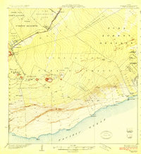
(13)- 1922 Map of Puna, 1957 Print
 1922 Puna1957 Print · USGSCovers Glenwood, including Eden Roc, Volcano, and other nearby areas
 - 1924 Map of Puna
 1924 Puna1924 Print · USGSCovers Glenwood, including Eden Roc, Volcano, and other nearby areas2 unique versions available
 - 1954 Map of Hawaii South
 1954 Hawaii South1954 Print · USGSCovers Glenwood, including Naalehu, Naalehu, and other nearby areas
 - 1959 Map of Hawaii South
 1959 Hawaii South1959 Print · USGSCovers Glenwood, including Naalehu, Naalehu, and other nearby areas
 - 1961 Map of Hawaii South
 1961 Hawaii South1961 Print · USGSCovers Glenwood, including Naalehu, Naalehu, and other nearby areas
 - 1962 Map of Hawaii South
 1962 Hawaii South1962 Print · USGSCovers Glenwood, including Naalehu, Naalehu, and other nearby areas2 unique versions available
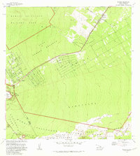
 - 1963 Map of Volcano, 1964 Print
 1963 Volcano1964 Print · USGSCovers Glenwood, including Volcano, Fern Forest, and other nearby areas
 - 1975 Map of Hawaii, 1977 Print
 1975 Hawaii1977 Print · USGSCovers Glenwood, including Hilo, Wailea, and other nearby areas
 - 1977 Map of Volcano, 1981 Print
 1977 Volcano1981 Print · USGSCovers Glenwood, including Volcano, Fern Forest, and other nearby areas
 - 1980 Map of Hawaii County Sheet 2, 1985 Print
 1980 Hawaii County Sheet 21985 Print · USGSCovers Glenwood, including Hilo, Wailea, and other nearby areas
 - 1981 Map of Volcano
 1981 Volcano1981 Print · USGSCovers Glenwood, including Volcano, Fern Forest, and other nearby areas
 - 1997 Map of Volcano, 1999 Print
 1997 Volcano1999 Print · USGSCovers Glenwood, including Volcano, Fern Forest, and other nearby areas
 - 2024 Map of Volcano, 2024 Print
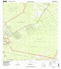
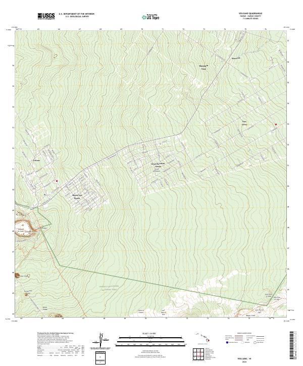 2024 Volcano2024 Print · USGSCovers Glenwood, including Fern Forest, Volcano, and other nearby areas
End of results
Showing maps 1-13 of 13
Frequently asked questions
- What are the different types of historical maps available for Glenwood?
- What is the oldest map of Glenwood?
- Where can I purchase historical maps of Glenwood for my home or office?
- Where can I download high-res historical maps of Glenwood?
- Are there historical topographic maps available for Glenwood?
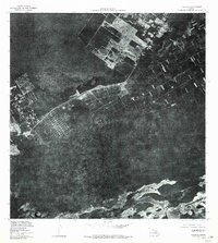
- Is there historical aerial imagery available for Glenwood?
- Where are historical maps of Glenwood sourced from?