1920s Maps of Nanawale Estates, Hawaii
Explore 2 historic maps of Nanawale Estates from the 1920s. These maps offer a rare glimpse into what life looked like during the 1920s — showing old roads, neighborhoods, homes, and landmarks that have changed or disappeared over time.
Whether you're researching your family's past, planning a metal detecting trip, or studying how Nanawale Estates's landscape evolved across the 1920s, these high-resolution maps are a powerful tool for exploring the history of this region.
- Focus on a specific era: All maps on this page are from the 1920s, giving you a focused view of this time period.
- See what’s changed: Compare century-old streets, trails, and buildings to today's modern landscape using overlays and satellite layers.
- Research with precision: Use these maps for genealogy, historical research, land use analysis, or educational projects.
- View, download, or print: Maps are fully viewable online in high resolution, and can be downloaded or printed for your own records.
Start exploring Nanawale Estates's history through authentic maps from the 1920s. This is your window into the past.
Nanawale Estates, HI maps
(2)- 1924 Map of Makuu
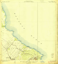 1924 Makuu1924 Print · USGSThe Puna coastline in the early twentieth century was a landscape of rail-linked plantations and volcanic terrain. You can trace the Hawaii Consolidated Railway as it services Honolulu Landing and the Nanawale Homesteads near the Lava Flow of 1840.3 unique versions available
 - 1924 Map of Kalapana
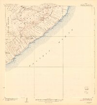 1924 Kalapana1924 Print · USGSThe Puna coastline comes to life in the early twenties, showing a landscape of volcanic craters and early homesteading tracts. Genealogists and historians can locate family lands like the Kaniahiku Homesteads or trace the Consolidated Hawaii Railway to the village of Pahoa.4 unique versions available
End of results
Showing maps 1-2 of 2
Top cities near Nanawale Estates
Top neighborhoods of Nanawale Estates
Frequently asked questions
- What are the different types of historical maps available for Nanawale Estates?
- What is the oldest map of Nanawale Estates?
- Where can I purchase historical maps of Nanawale Estates for my home or office?
- Where can I download high-res historical maps of Nanawale Estates?
- Are there historical topographic maps available for Nanawale Estates?
- Is there historical aerial imagery available for Nanawale Estates?
- Where are historical maps of Nanawale Estates sourced from?