Old Maps of Paauilo, Hawaii for Genealogy
Trace your family roots with 19 historic maps of Paauilo. These high-res maps reveal old neighborhoods, homesites, landmarks, and streets — helping you uncover where your ancestors lived and how the area evolved over time.
- Explore historic neighborhoods: Identify where your relatives may have lived in the 1800s or 1900s.
- Compare maps over time: Trace the changes in streets, buildings, and landmarks for multi-generational research.
- Perfect for genealogy & ancestry research: Used by family historians and researchers to map out lineage and migration.
These maps are an incredible resource for exploring your personal connection to Paauilo's past.
Paauilo, HI maps
(19)- 1915 Map of Hamakua
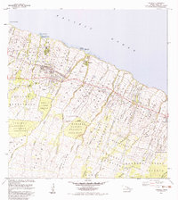
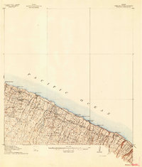 1915 Hamakua1915 Print · USGSCoastal Hawaii at the height of its plantation era shows a landscape of steep gulches and industrial mills along the Hamakua coast. Genealogists and historians can locate specific family plots in the Ahualoa Homesteads or trace the Waimanu Flume and Paauilo Mill.3 unique versions available
 - 1954 Map of Hawaii North
 1954 Hawaii North1954 Print · USGSThe Big Island in the mid-fifties shows a landscape of active volcanic history and a peak sugar-mill economy. Trace the route of the Hawaii Consolidated Railway, locate the Olaa Plantation Mill, and see the extent of the Lava flow of 1881 near Hilo.
 - 1957 Map of Kukaiau, 1959 Print
 1957 Kukaiau1959 Print · USGSThe Hamakua Coast in the late fifties shows a landscape of deep gulches and emerging coastal villages. Researchers can trace the development of the Old Railroad Grade and locate family history sites like the Paauilo Cemetery and Akasaki Camp.2 unique versions available
 - 1957 Map of Honokaa, 1959 Print
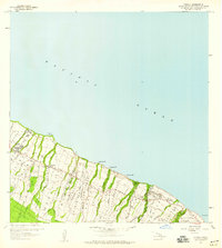
 1957 Honokaa1959 Print · USGSThe Hamakua coast in the late fifties shows a landscape of deep gulches and sugar settlements before the decline of the local plantations. Genealogists and historians can trace family locations through Honokaa, the Paauhau Landing, and several inland tracts like the Paauilo Homesteads.2 unique versions available
 - 1959 Map of Hawaii North
 1959 Hawaii North1959 Print · USGSThe northern half of Hawaii Island in the late fifties shows a landscape shaped by historic volcanic activity and a thriving sugar and ranching economy. Researchers can trace historic lava flows alongside local landmarks like Upolu Point Airport, Huehue Ranch, and the Pacific Sugar Mill.
 - 1961 Map of Hawaii North
 1961 Hawaii North1961 Print · USGSThe Big Island's northern reaches are shown here in the early sixties, during the peak of the sugar era and before modern resort development. Researchers can trace the Hawaii Consolidated railroad, locate the Ahu a Umi Heiau Ruins, and explore sugar industry landmarks like the Pacific Sugar Mill.2 unique versions available
 - 1975 Map of Hawaii, 1977 Print
 1975 Hawaii1977 Print · USGSThe Big Island in the mid-seventies is captured here as a landscape of volcanic giants and coastal sugar communities. Genealogists and historians can locate former plantation sites like Pepeekeo Mill or trace the routes of the Mamalahoa Highway through Kamuela.
 - 1980 Map of Hawaii County Sheet 1, 1984 Print
 1980 Hawaii County Sheet 11984 Print · USGSThe Big Island's diverse terrain and transition into the 1980s are shown here, from the northern coast to the high mountain saddles. Genealogists and historians can trace homesteads and local roads near Kailua, Kukuihaele, and the Ahualoa area.
 - 1980 Map of Hawaii County Sheet 2, 1985 Print
 1980 Hawaii County Sheet 21985 Print · USGSThe eastern coast of the Big Island is captured here in the early eighties, showcasing the intersection of active volcanic landforms and historic plantation towns. Researchers can trace family roots through settlements like Laupahoehoe and Papaikou, or explore the road networks around Kilauea Crater and General Lyman Field.
 - 1982 Map of Kukaiau
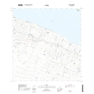
 1982 Kukaiau1982 Print · USGSThe Hamakua coast in the early eighties reveals a landscape of steep gulches and sprawling homesteads overlooking the Pacific. Genealogists and historians can trace the foundations of Akasaki Camp and find the location of the Kukui Village Cemetery or Koholaiele Landing.2 unique versions available
 - 1983 Map of Honokaa
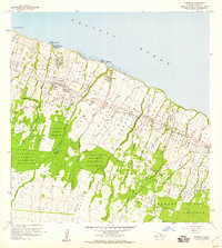
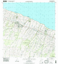
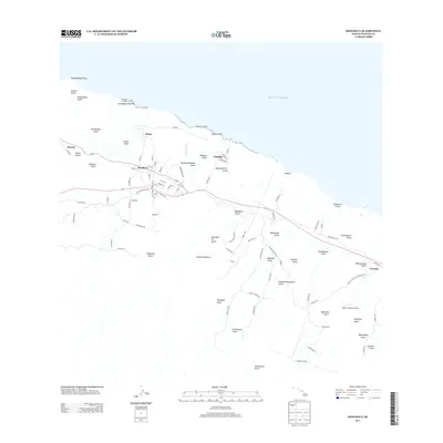
 1983 Honokaa1983 Print · USGSThe Hamakua Coast in the early eighties shows the enduring layout of sugar plantation villages and rugged coastal landings. Trace the water systems and homestead boundaries from Honokaa to Paauilo, including the Lower Hamakua Ditch and Kalopa State Park.2 unique versions available
 - 1993 Map of Kukaiau, 2001 Print
 1993 Kukaiau2001 Print · USGSThe Hamakua Coast's steep gulches and plantation-era settlements are shown in detail during the late twentieth century. Researchers can trace land divisions like Pa'auilo Homesteads or locate smaller worker communities such as Milo Village and Akasaki Camp.
 - 1995 Map of Honokaa, 1998 Print
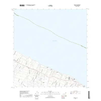
 1995 Honokaa1998 Print · USGSThe Hamakua Coast of Hawaii comes into focus in the mid-nineties, showing a landscape shaped by coastal landings and deep-cut gulches. Genealogists and historians can trace family lands in the Hamakua Homesteads or locate the former village of Haina near Honokaa.
 - 2013 Map of Kukaiau, 2013 Print
 2013 Kukaiau2013 Print · USGSCovers Paauilo, including Kūka‘iau, Pa‘auilo, and other nearby areas
 - 2013 Map of Honokaa, 2013 Print
 2013 Honokaa2013 Print · USGSCovers Paauilo, including Honokaa, Hawaiʻi County, and other nearby areas
 - 2017 Map of Kukaiau, 2017 Print
 2017 Kukaiau2017 Print · USGSCovers Paauilo, including Kūka‘iau, Pa‘auilo, and other nearby areas
 - 2017 Map of Honokaa, 2017 Print
 2017 Honokaa2017 Print · USGSCovers Paauilo, including Honokaa, Hawaiʻi County, and other nearby areas
 - 2024 Map of Kukaiau, 2024 Print
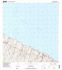
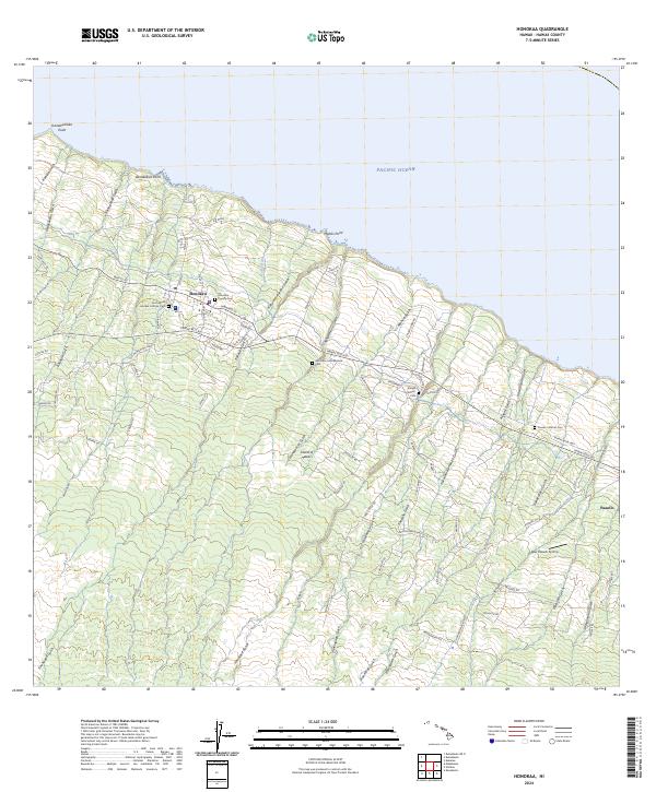
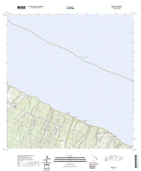 2024 Kukaiau2024 Print · USGSThe Hamakua Coast's plantation heritage and deep gulches are preserved in this recent survey of northeast Hawaii. Researchers can trace historic routes along the Old Mamalahoa Hwy and locate local landmarks like Paauilo Hui Cem and Hikiau Falls.
 - 2024 Map of Honokaa, 2024 Print
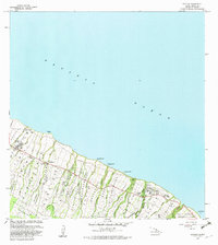
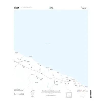
 2024 Honokaa2024 Print · USGSThe Hamakua Coast of the Island of Hawai'i is captured here in detail, showcasing the transition from coastal settlements to inland gulches. Researchers can trace local heritage at Honokaa County Cem or the Hamakua Jodo Mission Cem while following the path of the old Cane Haul Rd.
End of results
Showing maps 1-19 of 19
Top neighborhoods of Paauilo
Frequently asked questions
- What are the different types of historical maps available for Paauilo?
- What is the oldest map of Paauilo?
- Where can I purchase historical maps of Paauilo for my home or office?
- Where can I download high-res historical maps of Paauilo?
- Are there historical topographic maps available for Paauilo?
- Is there historical aerial imagery available for Paauilo?
- Where are historical maps of Paauilo sourced from?