Old Maps of Pua‘ākala, Hawaii for Hiking & Exploration
Hike through history with 11 historic maps of Pua‘ākala. Explore old trails, ghost towns, and forgotten backroads — perfect for outdoor adventurers and local explorers.
- Rediscover forgotten places: Map out old mining camps, roads, and footpaths that no longer exist on modern maps.
- Layer with modern tools: Combine with LiDAR or satellite views to plan hikes through historical terrain.
- Made for exploration: Popular among hikers, overlanders, and local history lovers.
Use these maps to find adventure and explore the hidden past of Pua‘ākala.
Pua‘ākala, HI maps
(11)- 1954 Map of Hawaii North
 1954 Hawaii North1954 Print · USGSThe Big Island in the mid-fifties shows a landscape of active volcanic history and a peak sugar-mill economy. Trace the route of the Hawaii Consolidated Railway, locate the Olaa Plantation Mill, and see the extent of the Lava flow of 1881 near Hilo.
 - 1956 Map of Pua Akala, 1957 Print
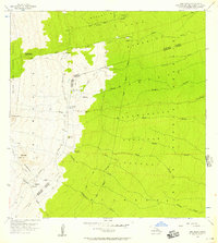 1956 Pua Akala1957 Print · USGSThe high windward slopes of the Big Island are captured here in the mid-fifties, showing the vast transition from volcanic peaks to forest reserves. Researchers can trace remote mountain outposts like Kanakaleonui Ranger Station, the Laumaia site, and Nauhi Camp.2 unique versions available
 - 1959 Map of Hawaii North
 1959 Hawaii North1959 Print · USGSThe northern half of Hawaii Island in the late fifties shows a landscape shaped by historic volcanic activity and a thriving sugar and ranching economy. Researchers can trace historic lava flows alongside local landmarks like Upolu Point Airport, Huehue Ranch, and the Pacific Sugar Mill.
 - 1961 Map of Hawaii North
 1961 Hawaii North1961 Print · USGSThe Big Island's northern reaches are shown here in the early sixties, during the peak of the sugar era and before modern resort development. Researchers can trace the Hawaii Consolidated railroad, locate the Ahu a Umi Heiau Ruins, and explore sugar industry landmarks like the Pacific Sugar Mill.2 unique versions available
 - 1975 Map of Hawaii, 1977 Print
 1975 Hawaii1977 Print · USGSThe Big Island in the mid-seventies is captured here as a landscape of volcanic giants and coastal sugar communities. Genealogists and historians can locate former plantation sites like Pepeekeo Mill or trace the routes of the Mamalahoa Highway through Kamuela.
 - 1980 Map of Hawaii County Sheet 2, 1985 Print
 1980 Hawaii County Sheet 21985 Print · USGSThe eastern coast of the Big Island is captured here in the early eighties, showcasing the intersection of active volcanic landforms and historic plantation towns. Researchers can trace family roots through settlements like Laupahoehoe and Papaikou, or explore the road networks around Kilauea Crater and General Lyman Field.
 - 1981 Map of Pua Akala
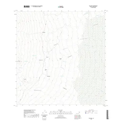
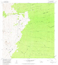 1981 Pua Akala1981 Print · USGSThe high slopes of Mauna Kea meet the windward forest reserves in the early eighties. Researchers can trace remote outposts like Kanakaleonui Cabin, the Laumaia (Site), and Spring Water Camp along the historic Keanakolu Road.
 - 1993 Map of Puaakala, 2001 Print
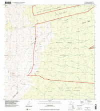 1993 Puaakala2001 Print · USGSUpper Hawaii Island in the 1990s is captured here as a sprawling network of conservation lands and high-altitude outposts. Genealogists and historians can trace isolated landmarks like the Kanakaleonui Cabin, Puaɶakala, and the unique Magnetic Hill.
 - 2013 Map of Puaakala, 2013 Print
 2013 Puaakala2013 Print · USGSCovers Pua‘ākala, including Hawaiʻi County, United States, and other nearby areas
 - 2017 Map of Puaakala, 2017 Print
 2017 Puaakala2017 Print · USGSCovers Pua‘ākala, including Hawaiʻi County, United States, and other nearby areas
 - 2024 Map of Puaakala, 2024 Print
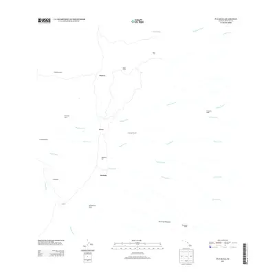
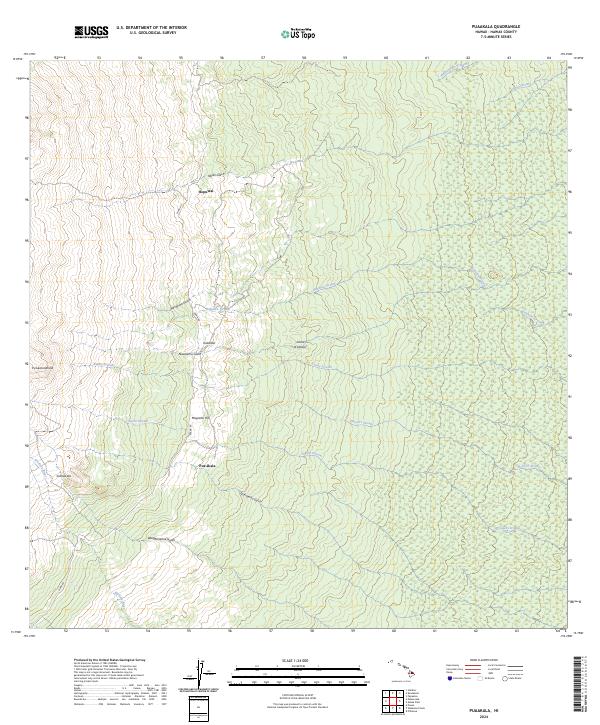 2024 Puaakala2024 Print · USGSThe windward slopes of Mauna Kea are captured here in the early twenty-first century, showing the transition from forest refuge to highland track. You can trace the path of Mana Rd past Magnetic Hill to isolated sites like Hopuwai and Pua‘akala.
End of results
Showing maps 1-11 of 11
Top cities near Pua‘ākala
Frequently asked questions
- What are the different types of historical maps available for Pua‘ākala?
- What is the oldest map of Pua‘ākala?
- Where can I purchase historical maps of Pua‘ākala for my home or office?
- Where can I download high-res historical maps of Pua‘ākala?
- Are there historical topographic maps available for Pua‘ākala?
- Is there historical aerial imagery available for Pua‘ākala?
- Where are historical maps of Pua‘ākala sourced from?