Old Maps of Mauna Loa Estates, Volcano for Academic Research
Study the evolution of Mauna Loa Estates with 15 high-resolution historic maps. Whether you're teaching, researching, or modeling changes in land use, these maps provide essential visual documentation of urban, environmental, and geographic change.
- Analyze long-term change: Track patterns in development, transportation, and natural features.
- Ideal for environmental or urban studies: Support academic projects with primary historical map data.
- Use in the classroom or lab: Educators and researchers rely on these maps to bring historical context to life.
These maps are a powerful tool for teaching, research, and visualizing how Mauna Loa Estates has changed over the decades.
Mauna Loa Estates, Volcano maps
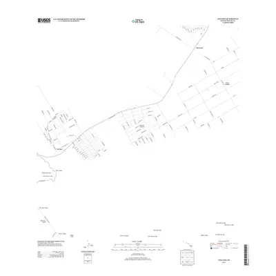
(15)- 1922 Map of Puna, 1957 Print
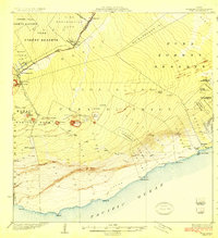
 1922 Puna1957 Print · USGSThe Puna district of Hawaii is captured here during the early twentieth century as the national park was taking shape. Researchers can locate ancient coastal sites like Wahaula Heiau and early homesteads at Kilauea Settlement Lots.
 - 1924 Map of Puna
 1924 Puna1924 Print · USGSThe Puna coastline and the volcanic highlands of Hawaii are captured here in the early twenties, during the growth of local homesteading and ranching. Genealogists and historians can locate early residents in the Kilauea Settlement Lots or trace the path of the Hawaii Consolidated Ry near Glenwood.2 unique versions available
 - 1954 Map of Hawaii South
 1954 Hawaii South1954 Print · USGSThe southern reaches of the Big Island in the mid-fifties show a landscape of volcanic peaks, coastal villages, and upland timber mills. Researchers can trace the old island infrastructure through sites like Koa Mill, Hoopuloa, and the remote Mountain House.
 - 1959 Map of Hawaii South
 1959 Hawaii South1959 Print · USGSThe southern half of the Big Island appears here in the late fifties, dominated by the active volcanic peaks and extensive forest reserves. Researchers can trace the mid-century footprints of Pahala, Waiohinu, and the agricultural grounds of Gaspard Dairy.
 - 1961 Map of Hawaii South
 1961 Hawaii South1961 Print · USGSThe southern region of the Big Island appears here in the early sixties, illustrating a landscape of volcanic craters and remote agricultural outposts. Genealogists and historians can trace the locations of Wood Valley Camp, the Koa Mill, and the ruins at Kahio.
 - 1962 Map of Hawaii South
 1962 Hawaii South1962 Print · USGSThe southern half of Hawaii Island in the early sixties showcases a landscape defined by volcanic rifts and coastal settlements. Researchers can trace the Hawaii Consolidated rail line, find the Kuee (Ruined) site, and locate remote camps like Hooper Camp.2 unique versions available
 - 1963 Map of Volcano, 1964 Print
 1963 Volcano1964 Print · USGSThe community of Volcano and the surrounding forest reserves are captured here in the early 1960s. Genealogists and researchers can trace the early layout of Volcano and Glenwood, alongside iconic landmarks like the Thurston Lava Tube.
 - 1975 Map of Hawaii, 1977 Print
 1975 Hawaii1977 Print · USGSThe Big Island in the mid-seventies is captured here as a landscape of volcanic giants and coastal sugar communities. Genealogists and historians can locate former plantation sites like Pepeekeo Mill or trace the routes of the Mamalahoa Highway through Kamuela.
 - 1977 Map of Volcano, 1981 Print
 1977 Volcano1981 Print · USGSThe Big Island's volcanic landscape is captured here in the late seventies, showing the proximity of human settlements to active rift zones. Researchers can trace the residential layouts of Volcano and Glenwood alongside Kilauea Iki Crater and Napau Crater.
 - 1980 Map of Hawaii County Sheet 2, 1985 Print
 1980 Hawaii County Sheet 21985 Print · USGSThe eastern coast of the Big Island is captured here in the early eighties, showcasing the intersection of active volcanic landforms and historic plantation towns. Researchers can trace family roots through settlements like Laupahoehoe and Papaikou, or explore the road networks around Kilauea Crater and General Lyman Field.
 - 1981 Map of Volcano
 1981 Volcano1981 Print · USGSSettlement and volcanic activity meet on the Island of Hawaii in the early eighties. Researchers can trace the grid-work of the Olaa Summer Lots and Kilauea Settlement Lots against the Crater Rim Trail and Glenwood.
 - 1997 Map of Volcano, 1999 Print
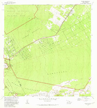
 1997 Volcano1999 Print · USGSThe village of Volcano and the active geological landscape of the Big Island are documented here in the late nineties. Researchers can trace historical eruptions like the Lava Flow of 1840 or locate residents in the Olaa Summer Lots.
 - 2013 Map of Volcano, 2013 Print
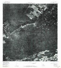
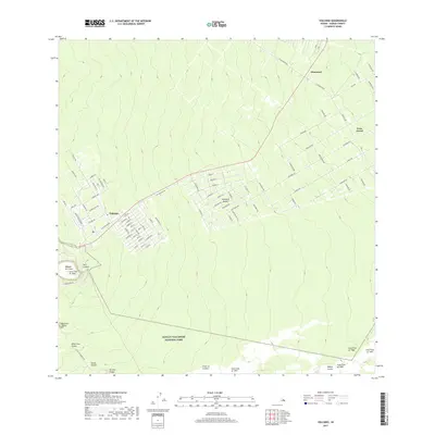
 2013 Volcano2013 Print · USGSCovers Mauna Loa Estates, including Fern Forest, Mountain View, and other nearby areas
 - 2017 Map of Volcano, 2017 Print
 2017 Volcano2017 Print · USGSCovers Mauna Loa Estates, including Fern Forest, Mountain View, and other nearby areas
 - 2024 Map of Volcano, 2024 Print
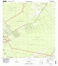
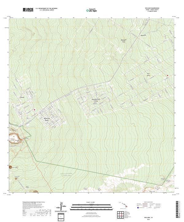 2024 Volcano2024 Print · USGSThe Big Island's volcanic landscape and residential growth meet in this contemporary survey of the area around Volcano. Researchers can trace property lines in Mauna Loa Estates and locate geologic features like Devils Throat and the Lava Flow of 1972.
End of results
Showing maps 1-15 of 15
Frequently asked questions
- What are the different types of historical maps available for Mauna Loa Estates?
- What is the oldest map of Mauna Loa Estates?
- Where can I purchase historical maps of Mauna Loa Estates for my home or office?
- Where can I download high-res historical maps of Mauna Loa Estates?
- Are there historical topographic maps available for Mauna Loa Estates?
- Is there historical aerial imagery available for Mauna Loa Estates?
- Where are historical maps of Mauna Loa Estates sourced from?