Old Maps of Payette County, Idaho
Explore 118 old maps of Payette County, spanning from 1894 to today. These high-resolution historic maps reveal how streets, neighborhoods, landmarks, and natural features evolved over time — perfect for genealogy, metal detecting, research, and local history exploration.
What you can do with these maps:
- See how Payette County changed over time: Compare historical maps to modern-day views to trace roads, homesites, rail lines & more.
- View detailed metadata: Each map includes creators, publishers, year, scale, and archive source.
- Overlay maps with satellite & LiDAR: Visualize the past alongside modern tools to explore terrain & human change.
- Trusted historical sources: Maps sourced from the USGS, Library of Congress, and other archives.
- Access maps your way: View online, download high-res files, or order prints for personal or research use.
Start exploring old maps of Payette County to uncover forgotten places, hidden landmarks, and the deep history beneath your feet.
Payette County, ID maps
(118)- 1894 Map of Squaw Creek
 1894 Squaw Creek1894 Print · USGSCentral Idaho in the 1890s was a landscape of mountain valleys and river crossings where early pioneers established remote outposts. Trace the locations of historic river access at Smith Ferry and early industry at Walker Mill or the settlement of Ola.5 unique versions available
 - 1897 Map of Weiser
 1897 Weiser1897 Print · USGSThe Idaho-Oregon borderlands come alive in the 1890s as the Oregon Short Line connects river towns along the Snake River. Researchers can trace the early footprints of Weiser, Payette, and Middle Valley alongside now-obscure points like Mosquite and Washoe.5 unique versions available
 - 1898 Map of Nampa
 1898 Nampa1898 Print · USGSThe Treasure Valley's transformation is visible in the 1890s as railroads and massive irrigation projects began to reshape the high desert. Researchers can trace the development of early rail lines like the Boise Nampa & Owyhee R. R. and early canals such as the Riverside Canal and Newman Canal.4 unique versions available
 - 1951 Map of Payette, 1953 Print
 1951 Payette1953 Print · USGSThe Snake River valley in the early fifties is captured here at the busy intersection of the Pacific Northwest's rail and river networks. Researchers can trace the Old Oregon Trail Highway or locate local landmarks like the Orchard Ave Grange Hall and Riverside Cemetery.3 unique versions available
 - 1951 Map of Weiser South, 1971 Print
 1951 Weiser South1971 Print · USGSThe borderlands of Idaho and Oregon come alive in this mid-century survey of the Snake River valley. Local historians can trace the transition of rural education and irrigation through Eastside Sch, Annex Cem, and the extensive Hyline Ditch network.2 unique versions available
 - 1952 Map of Weiser Cove, 1953 Print
 1952 Weiser Cove1953 Print · USGSThe Weiser River valley in the early fifties reveals an intricate network of irrigation canals and rural life. Genealogists and historians can trace local landmarks like Jeffreys School or the Pleasant View School (Aban'd) among the hills of Weiser Cove.2 unique versions available
 - 1952 Map of Birding Island, 1953 Print
 1952 Birding Island1953 Print · USGSPayette County at the start of the fifties shows a landscape of river-fed agriculture and frontier history. Researchers can find the Fort Wilson (Site) near the Payette River or trace water through the Diversion Dam and Forty-nine Slough.3 unique versions available
 - 1955 Map of Baker, 1964 Print
 1955 Baker1964 Print · USGSThe Oregon-Idaho borderlands are captured here in the mid-fifties as the Snake River underwent massive changes from dam construction. Trace the Oregon Trail Memorial Monument near Baker, find early mines like Virtue Mine, and follow the Union Pacific Railroad through Huntington.4 unique versions available
 - 1955 Map of Boise, 1977 Print
 1955 Boise1977 Print · USGSThe Treasure Valley and Owyhee uplands are shown in detail during the mid-fifties, capturing the region's transition into a major agricultural and urban hub. Researchers can trace the Union Pacific line through Nampa, explore the volcanic Jordan Craters, or locate the historic mining district of Silver City.
 - 1958 Map of Boise
 1958 Boise1958 Print · USGSThe Treasure Valley and Snake River Plain come alive in the mid-fifties as the rail-and-river economy transitions into a modern agricultural hub. Trace the Union Pacific lines through Nampa or locate remote landmarks like Initial Point and the Rockville settlement.2 unique versions available
 - 1959 Map of Baker
 1959 Baker1959 Print · USGSThe Oregon and Idaho borderlands come alive in the late fifties, showing the rugged corridor along the Snake River and the high peaks of the Wallowa Mountains. Researchers can trace the legacy of the Union Pacific railroad or locate historic mining sites like the Flagstaff Mine and Virtue Mine.2 unique versions available
 - 1962 Map of Boise
 1962 Boise1962 Print · USGSThe Treasure Valley at the start of the sixties reveals a landscape of expanding towns and complex irrigation networks along the Snake River. Genealogists and historians can trace the foundations of modern Idaho through markers like Initial Point, the mining history of Silver City, and the early infrastructure of Lucky Peak Dam.
 - 1965 Map of Nyssa, 1967 Print
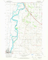 1965 Nyssa1967 Print · USGSThe borderlands of Oregon and Idaho come alive in the mid-1960s as the Snake River winds past Nyssa and its surrounding agricultural islands. Genealogists and historians can trace local landmarks like the De Lamar Grange Hall, the Union Pacific rail lines, and the extensive irrigation networks of Farmers Ditch.
 - 1965 Map of New Plymouth, 1967 Print
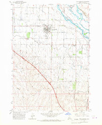 1965 New Plymouth1967 Print · USGSThe Lower Payette Valley and the distinctive horseshoe town of New Plymouth are shown here in the mid-sixties during a period of steady agricultural development. Researchers can trace the layout of the County Fairgrounds, the Union Pacific rail route, and local sites like Hamilton Corner.2 unique versions available
 - 1965 Map of Parma, 1967 Print
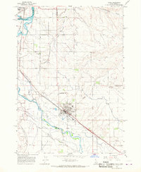 1965 Parma1967 Print · USGSWestern Idaho's river junctions and rail corridors come into focus in the mid-sixties as the irrigation network supports the growing valley. Researchers can trace family roots at Parma Cem, locate the Apple Valley Sch, or explore the grounds of the University of Idaho Agriculture Experiment Sta.2 unique versions available
 - 1965 Map of Parma SE, 1967 Print
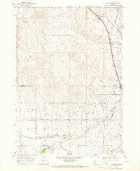 1965 Parma SE1967 Print · USGSThe agricultural border of Payette and Canyon counties comes into focus in the mid-sixties, showcasing a sophisticated network of desert irrigation. Local historians can trace the specific routes of the Black Canyon Canal, the crossing at Rookstool Corner, and the path of the Sebree Canal.2 unique versions available
 - 1970 Map of Hog Cove Butte, 1973 Print
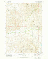 1970 Hog Cove Butte1973 Print · USGSThe high-desert ranchlands of Payette and Gem counties are captured here just as modern aerial surveying began to document the landscape in the late sixties. Researchers can trace historic water routes and stock points like French Corner, Raymer Spring, and the Flume.
 - 1970 Map of Paddock Valley Reservoir, 1973 Print
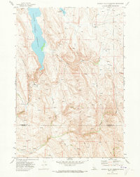 1970 Paddock Valley Reservoir1973 Print · USGSThe high-desert ranching country of western Idaho is captured here in the early 1970s, focused on the critical water management of the region. Researchers can trace historic grazing routes and water sources across Little Willow Flat or follow the drainages of Indian Creek and Rattlesnake Creek.
 - 1970 Map of Sheep Ridge, 1973 Print
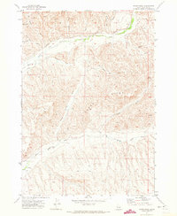 1970 Sheep Ridge1973 Print · USGSPayette County in the early 1970s shows a landscape of high ridges and intricate water management. Researchers can trace historic ranching infrastructure like the Siphon, Corral, and Flume along Little Willow Creek and Big Willow Creek.
 - 1970 Map of Squaw Butte, 1973 Print
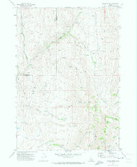 1970 Squaw Butte1973 Print · USGSThe high desert terrain of Gem and Payette counties is captured here during the 1970s, showcasing a landscape of ranching drainages and remote peaks. Trace the intricate network of water rights and range access through features like Bissel Creek, Squaw Butte, and the Gaging Station on Big Willow Creek.
 - 1970 Map of Coonrod Gulch, 1973 Print
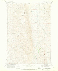 1970 Coonrod Gulch1973 Print · USGSSouthwestern Idaho ranching country is captured here in the early seventies, where Washington, Payette, and Gem counties meet. Trace the remote Butte Ranch and the network of high-country water sources like Mossman Spring and French Spring.
 - 1970 Map of Sand Hollow, 1974 Print
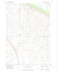 1970 Sand Hollow1974 Print · USGSThe Emmett Valley irrigation network is in full operation by the 1970s, showcasing the massive engineering used to water the Idaho desert. Researchers can trace the Union Pacific corridor near Amsco, locate the rural Cemetery, and follow the path of the Black Canyon Canal.
 - 1970 Map of Holland Gulch, 1974 Print
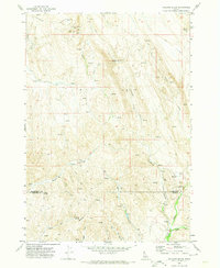 1970 Holland Gulch1974 Print · USGSThe high desert border of Washington and Payette counties comes into focus in 1970, showing a landscape defined by mining and ranching. Researchers can locate the Idaho Almaden Mine, trace the winding path of Toe Jam Creek, and find landmarks like Wilburn Butte.
 - 1971 Map of Letha, 1973 Print
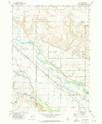 1971 Letha1973 Print · USGSThe Lower Payette Valley in the early seventies shows a complex network of irrigation and rail infrastructure supporting small Idaho river communities. Genealogists and local historians can locate Letha, trace the Union Pacific line, and find family-named sites like Falk Cem and Cooper School.
 - 1971 Map of Northwest Emmett, 1973 Print
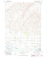 1971 Northwest Emmett1973 Print · USGSThe Payette River valley in the early seventies shows a landscape shaped by irrigation and rail. Genealogists and historians can trace rural roots at Brick Sch, Central Mesa Sch, and the Emmett Cem along the Union Pacific line.
Showing maps 1-25 of 118
Top cities of Payette County
Frequently asked questions
- What are the different types of historical maps available for Payette County?
- What is the oldest map of Payette County?
- Where can I purchase historical maps of Payette County for my home or office?
- Where can I download high-res historical maps of Payette County?
- Are there historical topographic maps available for Payette County?
- Is there historical aerial imagery available for Payette County?
- Where are historical maps of Payette County sourced from?