1970s Maps of Payette County, Idaho
Explore 11 historic maps of Payette County from the 1970s. These maps offer a rare glimpse into what life looked like during the 1970s — showing old roads, neighborhoods, homes, and landmarks that have changed or disappeared over time.
Whether you're researching your family's past, planning a metal detecting trip, or studying how Payette County's landscape evolved across the 1970s, these high-resolution maps are a powerful tool for exploring the history of this region.
- Focus on a specific era: All maps on this page are from the 1970s, giving you a focused view of this time period.
- See what’s changed: Compare century-old streets, trails, and buildings to today's modern landscape using overlays and satellite layers.
- Research with precision: Use these maps for genealogy, historical research, land use analysis, or educational projects.
- View, download, or print: Maps are fully viewable online in high resolution, and can be downloaded or printed for your own records.
Start exploring Payette County's history through authentic maps from the 1970s. This is your window into the past.
Payette County, ID maps
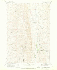
(11)- 1970 Map of Hog Cove Butte, 1973 Print
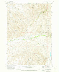 1970 Hog Cove Butte1973 Print · USGSThe high-desert ranchlands of Payette and Gem counties are captured here just as modern aerial surveying began to document the landscape in the late sixties. Researchers can trace historic water routes and stock points like French Corner, Raymer Spring, and the Flume.
 - 1970 Map of Paddock Valley Reservoir, 1973 Print
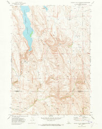 1970 Paddock Valley Reservoir1973 Print · USGSThe high-desert ranching country of western Idaho is captured here in the early 1970s, focused on the critical water management of the region. Researchers can trace historic grazing routes and water sources across Little Willow Flat or follow the drainages of Indian Creek and Rattlesnake Creek.
 - 1970 Map of Sheep Ridge, 1973 Print
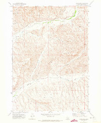 1970 Sheep Ridge1973 Print · USGSPayette County in the early 1970s shows a landscape of high ridges and intricate water management. Researchers can trace historic ranching infrastructure like the Siphon, Corral, and Flume along Little Willow Creek and Big Willow Creek.
 - 1970 Map of Squaw Butte, 1973 Print
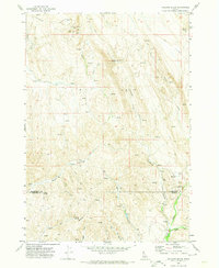
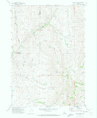 1970 Squaw Butte1973 Print · USGSThe high desert terrain of Gem and Payette counties is captured here during the 1970s, showcasing a landscape of ranching drainages and remote peaks. Trace the intricate network of water rights and range access through features like Bissel Creek, Squaw Butte, and the Gaging Station on Big Willow Creek.
 - 1970 Map of Coonrod Gulch, 1973 Print
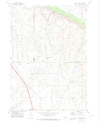
 1970 Coonrod Gulch1973 Print · USGSSouthwestern Idaho ranching country is captured here in the early seventies, where Washington, Payette, and Gem counties meet. Trace the remote Butte Ranch and the network of high-country water sources like Mossman Spring and French Spring.
 - 1970 Map of Sand Hollow, 1974 Print
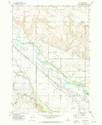
 1970 Sand Hollow1974 Print · USGSThe Emmett Valley irrigation network is in full operation by the 1970s, showcasing the massive engineering used to water the Idaho desert. Researchers can trace the Union Pacific corridor near Amsco, locate the rural Cemetery, and follow the path of the Black Canyon Canal.
 - 1970 Map of Holland Gulch, 1974 Print
 1970 Holland Gulch1974 Print · USGSThe high desert border of Washington and Payette counties comes into focus in 1970, showing a landscape defined by mining and ranching. Researchers can locate the Idaho Almaden Mine, trace the winding path of Toe Jam Creek, and find landmarks like Wilburn Butte.
 - 1971 Map of Letha, 1973 Print
 1971 Letha1973 Print · USGSThe Lower Payette Valley in the early seventies shows a complex network of irrigation and rail infrastructure supporting small Idaho river communities. Genealogists and local historians can locate Letha, trace the Union Pacific line, and find family-named sites like Falk Cem and Cooper School.
 - 1971 Map of Northwest Emmett, 1973 Print
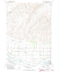 1971 Northwest Emmett1973 Print · USGSThe Payette River valley in the early seventies shows a landscape shaped by irrigation and rail. Genealogists and historians can trace rural roots at Brick Sch, Central Mesa Sch, and the Emmett Cem along the Union Pacific line.
 - 1974 Map of Weiser South, 1975 Print
 1974 Weiser South1975 Print · USGSThe borderlands of the Northwest are captured in the mid-1970s, showcasing the fertile agricultural flats along the Snake River. Researchers can study the industrial and residential development of Weiser and trace irrigation patterns across the valley floor.
 - 1974 Map of Payette, 1975 Print
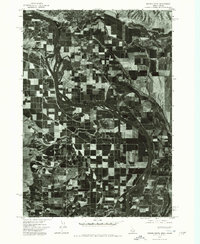
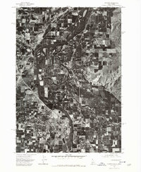 1974 Payette1975 Print · USGSThe Idaho-Oregon border comes into focus in the mid-seventies, centered on the strategic river junction of the Snake and Payette. Genealogists and researchers can trace the detailed street grids and early industrial footprints of Payette, Ontario, and Fruitland as they appeared decades ago.
End of results
Showing maps 1-11 of 11
Top cities of Payette County
Frequently asked questions
- What are the different types of historical maps available for Payette County?
- What is the oldest map of Payette County?
- Where can I purchase historical maps of Payette County for my home or office?
- Where can I download high-res historical maps of Payette County?
- Are there historical topographic maps available for Payette County?
- Is there historical aerial imagery available for Payette County?
- Where are historical maps of Payette County sourced from?