Old Maps of Kincaid, Illinois
Explore 12 old maps of Kincaid, spanning from 1923 to today. These high-resolution historic maps reveal how streets, neighborhoods, landmarks, and natural features evolved over time — perfect for genealogy, metal detecting, research, and local history exploration.
What you can do with these maps:
- See how Kincaid changed over time: Compare historical maps to modern-day views to trace roads, homesites, rail lines & more.
- View detailed metadata: Each map includes creators, publishers, year, scale, and archive source.
- Overlay maps with satellite & LiDAR: Visualize the past alongside modern tools to explore terrain & human change.
- Trusted historical sources: Maps sourced from the USGS, Library of Congress, and other archives.
- Access maps your way: View online, download high-res files, or order prints for personal or research use.
Start exploring old maps of Kincaid to uncover forgotten places, hidden landmarks, and the deep history beneath your feet.
Kincaid, IL maps
(12)- 1923 Map of Taylorville, 1961 Print
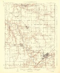
 1923 Taylorville1961 Print · USGSChristian County's rail-and-river landscape comes alive in the early twenties, showing the region's dense network of rural school districts and coal-country towns. Trace family roots at Brush College, Good Hope Church, or the mining-related tracks of the Chicago and Illinois Midland.2 unique versions available
 - 1925 Map of Taylorville
 1925 Taylorville1925 Print · USGSTaylorville and its surrounding coal-and-corn country are captured here in the mid-twenties. Genealogists can trace family roots through dozens of rural landmarks like Brush College, the rail stop at Humphrey Sta, and the mining communities of Jeisyville and Bulpitt.2 unique versions available
 - 1958 Map of Decatur, 1971 Print
 1958 Decatur1971 Print · USGSCentral Illinois in the mid-twentieth century shows a landscape defined by industrial rail hubs and the creation of large reservoirs. Researchers can trace historic corridors like the Penn Central or locate landmarks such as Lincoln Log Cabin State Park and Lake Springfield.3 unique versions available
 - 1961 Map of Decatur
 1961 Decatur1961 Print · USGSCentral Illinois in the late fifties was a bustling corridor of rail lines and prairie commerce centered on the state capital. Genealogists and historians can trace the intricate connections between Springfield, Decatur, and dozens of smaller settlements like Nokomis and Arcola.2 unique versions available
 - 1982 Map of Kincaid, 1983 Print
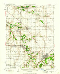
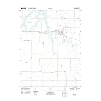
 1982 Kincaid1983 Print · USGSChristian County's coal and rail corridor is captured here in the early eighties, showcasing a cluster of industrial settlements. Genealogists and historians can trace family roots through Kincaid, Tovey, and Sicily, or locate landmarks like Bethany Cem and the Mine Shaft.
 - 1985 Map of Springfield
 1985 Springfield1985 Print · USGSCentral Illinois during the mid-eighties shows a landscape of growing state capital influence and deep historical roots. Genealogists and historians can trace family sites near Oak Ridge Cem or follow the path of the Sangamon River past Williamsville and Riverton.2 unique versions available
 - 1998 Map of Kincaid, 2002 Print
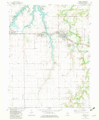
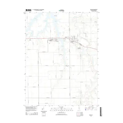
 1998 Kincaid2002 Print · USGSCoal and rail define this Christian County landscape in the late nineties as it transitions from heavy industry to lakeside recreation. Trace family roots and vanished infrastructure through Bulpitt, Bethany Cem, and the Mine Shaft near Jeisyville.
 - 2012 Map of Kincaid, 2012 Print
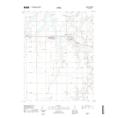
 2012 Kincaid2012 Print · USGSCovers Kincaid, including Tovey, Bulpitt, and other nearby areas
 - 2015 Map of Kincaid, 2015 Print
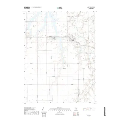
 2015 Kincaid2015 Print · USGSCovers Kincaid, including Tovey, Bulpitt, and other nearby areas
 - 2018 Map of Kincaid, 2018 Print
 2018 Kincaid2018 Print · USGSCovers Kincaid, including Tovey, Bulpitt, and other nearby areas
 - 2021 Map of Kincaid, 2021 Print
 2021 Kincaid2021 Print · USGSCovers Kincaid, including Tovey, Bulpitt, and other nearby areas
 - 2024 Map of Kincaid, 2024 Print
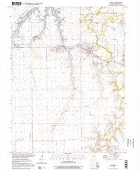
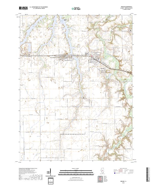 2024 Kincaid2024 Print · USGSChristian County's coal-belt communities are preserved in this modern survey of the central Illinois plains. Genealogists and local researchers can trace the grids of Kincaid and Tovey or locate ancestral sites like Achenback Cem and Tovey Humphrey Station.
End of results
Showing maps 1-12 of 12
Top cities near Kincaid
- Springfield historical maps
- Taylorville historical maps
- Rochester historical maps
- Pawnee historical maps
- Southern View historical maps
- Divernon historical maps
See more
Frequently asked questions
- What are the different types of historical maps available for Kincaid?
- What is the oldest map of Kincaid?
- Where can I purchase historical maps of Kincaid for my home or office?
- Where can I download high-res historical maps of Kincaid?
- Are there historical topographic maps available for Kincaid?
- Is there historical aerial imagery available for Kincaid?
- Where are historical maps of Kincaid sourced from?