Old Maps of Logan County, Illinois
Explore 120 old maps of Logan County, spanning from 1907 to today. These high-resolution historic maps reveal how streets, neighborhoods, landmarks, and natural features evolved over time — perfect for genealogy, metal detecting, research, and local history exploration.
What you can do with these maps:
- See how Logan County changed over time: Compare historical maps to modern-day views to trace roads, homesites, rail lines & more.
- View detailed metadata: Each map includes creators, publishers, year, scale, and archive source.
- Overlay maps with satellite & LiDAR: Visualize the past alongside modern tools to explore terrain & human change.
- Trusted historical sources: Maps sourced from the USGS, Library of Congress, and other archives.
- Access maps your way: View online, download high-res files, or order prints for personal or research use.
Start exploring old maps of Logan County to uncover forgotten places, hidden landmarks, and the deep history beneath your feet.
Logan County, IL maps
(120)- 1907 Map of Springfield
 1907 Springfield1907 Print · USGSSpringfield and the Sangamon River valley are captured here in the early twentieth century as the region thrived on coal, rail, and state government. Researchers can locate ancestral sites at Camp Lincoln, Calvary Cemetery, and the State Fair Grounds.2 unique versions available
 - 1911 Map of Lincoln, 1967 Print
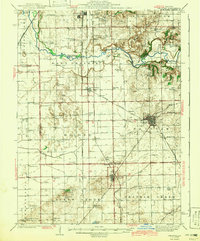
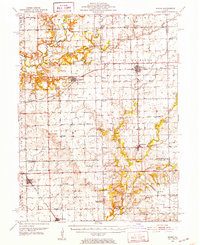
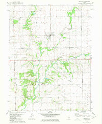
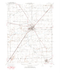 1911 Lincoln1967 Print · USGSLogan County at the dawn of the automotive age shows a landscape defined by rail lines and one-room schoolhouses. Genealogists can trace family footprints at Rose Hill Cemetery or locate ancestral farm sites near Hartsburg, Broadwell, and Mount Pulaski.
 - 1913 Map of Lincoln
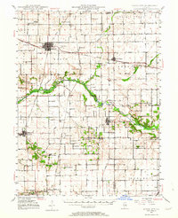
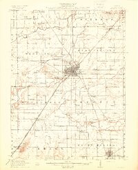 1913 Lincoln1913 Print · USGSLogan County’s agricultural and rail heartland is captured here just before the Great War. Genealogists can locate family lands near dozens of rural schools like Sigg School or trace the early electric ILLINOIS TRACTION SYSTEM through Broadwell.3 unique versions available
 - 1930 Map of Springfield
 1930 Springfield1930 Print · USGSSpringfield and its surrounding farming townships are seen here in the late twenties, captured as a vital crossroads of rail and road. Genealogists can locate family-named landmarks like Derry Farm and over two dozen country schools, including Crankneck Sch and American Hill Sch.3 unique versions available
 - 1940 Map of Springfield, 1959 Print
 1940 Springfield1959 Print · USGSSpringfield and its surrounding townships appear here as a bustling pre-war rail and aviation center. Researchers can trace family roots through numerous rural schools like Locate Lane Sch or historical sites like Lindbergh Air Mail Field and Camp Butler Cem.2 unique versions available
 - 1942 Map of Delavan
 1942 Delavan1942 Print · USGSTazewell County's fertile plains are captured in the early 1940s, showing a landscape defined by busy rail junctions and a dense grid of country schoolhouses. Researchers can trace family roots through landmarks like St Lukes Ch, South Pekin, and rural schools such as Oak Hill Sch.3 unique versions available
 - 1948 Map of Mason City, 1963 Print
 1948 Mason City1963 Print · USGSCentral Illinois farming and rail life are at the forefront of this late 1940s survey. Genealogists and local historians can trace family-named sites like Johnson Valley Mine and North Sangamon Ch, alongside a dense network of rural schools.2 unique versions available
 - 1949 Map of Mason City
 1949 Mason City1949 Print · USGSCentral Illinois rail hubs and prairie farmsteads are captured here just after the war, showing the intersection of three major railroads. Genealogists can locate family landmarks like Honey Heart School, Johnson Valley Mine, and the Irish Grove Church.2 unique versions available
 - 1949 Map of Mc Lean, 1972 Print
 1949 Mc Lean1972 Print · USGSMid-century McLean County is captured here at a time when small rural schools and parish churches still dotted the prairie landscape. Genealogists and historians can trace family roots through numerous sites like Mount Hope Cem, Alexander Sch, and the Ebenezer Ch.
 - 1951 Map of McLean
 1951 McLean1951 Print · USGSCentral Illinois during the early fifties reveals a landscape of thriving rail towns and rural school districts. Genealogists and historians can trace the foundations of Bloomington or find local landmarks like Forks Grove Ch and Sunny Point Sch.2 unique versions available
 - 1951 Map of Minier, 1952 Print
 1951 Minier1952 Print · USGSTazewell and Logan Counties thrive as a rail-and-river agricultural hub during the mid-twentieth century. Family historians can trace local roots through numerous country landmarks like Mennonite Cem, the settlement at Mindale, and Hittle Grove Cem.3 unique versions available
 - 1954 Map of Niantic, 1955 Print
 1954 Niantic1955 Print · USGSMid-century Macon County is defined here by its bustling rail corridors and the winding Sangamon River. Researchers can trace old family names at Lake Bank Cem or locate forgotten stops like Wyckles Corners and Bulldog Crossing.3 unique versions available
 - 1954 Map of Mechanicsburg, 1955 Print
 1954 Mechanicsburg1955 Print · USGSSangamon and Logan counties are shown here during the mid-fifties as the railroad era began to give way to modern highways. Genealogists can trace family names at Pickrell Cem and Steenbergen Cem or locate the North Side Sch (Abandoned).2 unique versions available
 - 1957 Map of Kenney, 1958 Print
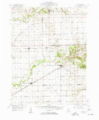 1957 Kenney1958 Print · USGSDe Witt and Logan Counties are captured in the late 1950s as the rail-and-river network shaped the prairie landscape. Genealogists can trace rural family plots at McClimans Cem or locate former landmarks like Mt Zion Sch.2 unique versions available
 - 1958 Map of Peoria, 1969 Print
 1958 Peoria1969 Print · USGSCentral Illinois thrived as a hub of education and transport during the late sixties, as the new interstate system began to reshape the prairie. Genealogists and historians can trace local landmarks like Springdale Cem, Bradley University, and the sprawling grounds of Chanute AFB.4 unique versions available
 - 1958 Map of Decatur, 1971 Print
 1958 Decatur1971 Print · USGSCentral Illinois in the mid-twentieth century shows a landscape defined by industrial rail hubs and the creation of large reservoirs. Researchers can trace historic corridors like the Penn Central or locate landmarks such as Lincoln Log Cabin State Park and Lake Springfield.3 unique versions available
 - 1961 Map of Peoria
 1961 Peoria1961 Print · USGSCentral Illinois thrived at the intersection of river trade and rail power during the late fifties. Genealogists and local historians can trace the rail networks of the Illinois Central and Wabash, alongside landmarks like Chanute AFB and Weldon Springs State Park.
 - 1961 Map of Decatur
 1961 Decatur1961 Print · USGSCentral Illinois in the late fifties was a bustling corridor of rail lines and prairie commerce centered on the state capital. Genealogists and historians can trace the intricate connections between Springfield, Decatur, and dozens of smaller settlements like Nokomis and Arcola.2 unique versions available
 - 1963 Map of Peoria
 1963 Peoria1963 Print · USGSCentral Illinois thrived as a rail and highway crossroads during the early sixties, centered on the bustling Illinois River valley. Genealogists and historians can trace the mid-century layout of Peoria, locate the grounds of Chanute Air Force Base, and follow historic lines like the Toledo Peoria and Western Railway.
 - 1966 Map of Williamsville, 1967 Print
 1966 Williamsville1967 Print · USGSCentral Illinois farmland in the mid-sixties shows a landscape defined by rail corridors and creek bottoms. Trace family sites near Williamsville and Sherman, including several old burial grounds like Wolf Creek Cem and Stewart Cem.3 unique versions available
 - 1980 Map of Armington
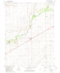
 1980 Armington1980 Print · USGSThe rural borderlands of Tazewell and Logan counties are captured here in the late seventies. Family historians can trace several pioneer burial sites, including Oak View Cem and Miller Cem, alongside the Illinois Terminal rail line.
 - 1980 Map of Lincoln East
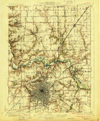
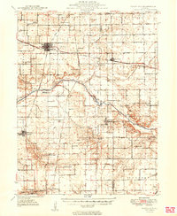
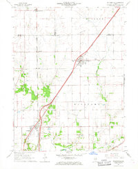
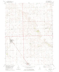
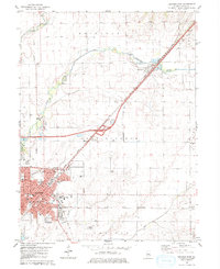 1980 Lincoln East1980 Print · USGSThe Logan County seat at the start of the 1980s reveals a thriving hub of education and transport in the heart of Illinois corn country. Genealogists and local historians can trace the development of Lincoln College, locate family sites near Lawndale Union Cem, or find old rail stops like Kruger Siding.
 - 1980 Map of Chestnut
 1980 Chestnut1980 Print · USGSThe rural landscape of central Illinois is captured here in the early 1980s, centered on the village of Chestnut. Family historians can locate numerous burial grounds like Donnan Cem and Hays Cem or trace the route of the Illinois Central Gulf railroad.
 - 1980 Map of Lincoln West
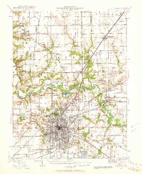
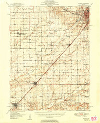
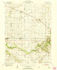
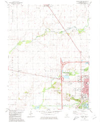 1980 Lincoln West1980 Print · USGSWestern Logan County and the city of Lincoln are shown here in the 1970s, as the community expanded alongside the Illinois Central Gulf rail corridor. Genealogists can locate several rural burial sites like St Marys Cem and Reed Cem, or trace the development of Railsplitter State Park.
 - 1980 Map of Emden
 1980 Emden1980 Print · USGSThe Logan County agricultural corridor is captured here in the late 1970s, showcasing the rail-dependent layout of the Illinois prairie. Trace the historic route of the Illinois Central Gulf through Emden and Hartsburg, or find ancestral markers at Patterson Cemetery.
Showing maps 1-25 of 120
Top cities of Logan County
- Lincoln historical maps
- Atlanta historical maps
- Mount Pulaski historical maps
- Emden historical maps
- Middletown historical maps
- Elkhart historical maps
See more
Frequently asked questions
- What are the different types of historical maps available for Logan County?
- What is the oldest map of Logan County?
- Where can I purchase historical maps of Logan County for my home or office?
- Where can I download high-res historical maps of Logan County?
- Are there historical topographic maps available for Logan County?
- Is there historical aerial imagery available for Logan County?
- Where are historical maps of Logan County sourced from?