1900s (20th Century) Maps of Monroe, Indiana
Explore 7 historic maps of Monroe from the 1900s (20th Century). These maps offer a rare glimpse into what life looked like during the 1900s — showing old roads, neighborhoods, homes, and landmarks that have changed or disappeared over time.
Whether you're researching your family's past, planning a metal detecting trip, or studying how Monroe's landscape evolved across the 1900s, these high-resolution maps are a powerful tool for exploring the history of this region.
- Focus on a specific era: All maps on this page are from the 1900s, giving you a focused view of this time period.
- See what’s changed: Compare century-old streets, trails, and buildings to today's modern landscape using overlays and satellite layers.
- Research with precision: Use these maps for genealogy, historical research, land use analysis, or educational projects.
- View, download, or print: Maps are fully viewable online in high resolution, and can be downloaded or printed for your own records.
Start exploring Monroe's history through authentic maps from the 1900s. This is your window into the past.
Monroe, IN maps
(7)- 1911 Map of Berne
 1911 Berne1911 Print · USGSThe Ohio-Indiana borderlands come to life in this pre-war survey of the rural landscape between the St. Marys and Wabash rivers. Genealogists can trace family footprints through numerous district sites like Duck Creek School No 4, St Anthony, and Zion Church.
 - 1953 Map of Muncie, 1966 Print
 1953 Muncie1966 Print · USGSIndiana and Ohio borderlands thrive in the early fifties, showing a landscape defined by manufacturing cities and an intensive railroad network. Genealogists can trace family roots across the Indiana-Ohio line through Muncie, Celina, and Portland via the Pennsylvania railroad.5 unique versions available
 - 1956 Map of Muncie
 1956 Muncie1956 Print · USGSEastern Indiana and western Ohio are shown at a peak of rail-driven industry in the mid-fifties. Genealogists and rail historians can trace the paths of the Pennsylvania RR through Muncie or locate landmarks like Lake Saint Marys (Grand Lake Reservoir) and Frances Slocum State Forest.
 - 1962 Map of Berne, 1964 Print
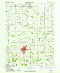 1962 Berne1964 Print · USGSLife in central Adams County during the early sixties revolved around the agricultural centers of Berne and Monroe. Researchers can find numerous family-named landmarks like Graber Cem and Smith Cem, alongside the Pennsylvania RR corridor.3 unique versions available
 - 1962 Map of Decatur, 1964 Print
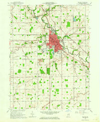 1962 Decatur1964 Print · USGSDecatur and the surrounding Adams County townships are captured here in the early sixties as a thriving rail and agricultural hub. Researchers can trace family roots at Reynolds Cem, Mt Pleasant Ch, or the rural junction at Elm Tree Crossroads.3 unique versions available
 - 1986 Map of Lima
 1986 Lima1986 Print · USGSWest Ohio and East Indiana are captured here in the mid-1980s, showcasing a landscape of productive farmland and industrial transit hubs. Genealogists and historians can trace the development of Lima and Van Wert or locate landmarks like Woodland Chapel and the Lima Ordnance Modification Center.3 unique versions available
 - 1992 Map of Decatur, 1995 Print
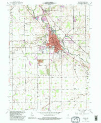 1992 Decatur1995 Print · USGSDecatur and the surrounding Adams County farmlands are captured in the early nineties, centered on the St Marys River and rail corridors. Researchers can trace family roots at Reynolds Cem or locate community landmarks like Elm Tree Crossroads and the Antioch Ch.
End of results
Showing maps 1-7 of 7
Top cities near Monroe
- Fort Wayne historical maps
- Bluffton historical maps
- Decatur historical maps
- Berne historical maps
- Ossian historical maps
- Geneva historical maps
See more
Frequently asked questions
- What are the different types of historical maps available for Monroe?
- What is the oldest map of Monroe?
- Where can I purchase historical maps of Monroe for my home or office?
- Where can I download high-res historical maps of Monroe?
- Are there historical topographic maps available for Monroe?
- Is there historical aerial imagery available for Monroe?
- Where are historical maps of Monroe sourced from?