Old Maps of Downtown Fishers, Fishers
Explore 14 old maps of Downtown Fishers, spanning from 1952 to today. These high-resolution historic maps reveal how streets, neighborhoods, landmarks, and natural features evolved over time — perfect for genealogy, metal detecting, research, and local history exploration.
What you can do with these maps:
- See how Downtown Fishers changed over time: Compare historical maps to modern-day views to trace roads, homesites, rail lines & more.
- View detailed metadata: Each map includes creators, publishers, year, scale, and archive source.
- Overlay maps with satellite & LiDAR: Visualize the past alongside modern tools to explore terrain & human change.
- Trusted historical sources: Maps sourced from the USGS, Library of Congress, and other archives.
- Access maps your way: View online, download high-res files, or order prints for personal or research use.
Start exploring old maps of Downtown Fishers to uncover forgotten places, hidden landmarks, and the deep history beneath your feet.
Downtown Fishers, Fishers maps
(14)- 1952 Map of Fishers, 1953 Print
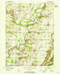 1952 Fishers1953 Print · USGSCentral Indiana in the early fifties shows a patchwork of fertile farmland and growing river towns along the White River. Genealogists and local historians can locate several family cemeteries like Eller Cem and early landmarks including White Chapel and the Township Sch.
 - 1953 Map of Indianapolis, 1965 Print
 1953 Indianapolis1965 Print · USGSCentral Indiana and the Illinois borderlands are captured in the mid-sixties, showing the growth of Indianapolis and its industrial rail corridors. Genealogists and historians can trace the development of outlying towns like Zionsville or Beech Grove and find landmarks such as Atterbury AAF and Turkey Run State Park.4 unique versions available
 - 1956 Map of Indianapolis
 1956 Indianapolis1956 Print · USGSCentral Indiana in the mid-fifties is captured during a period of industrial growth and military presence. Genealogists and historians can trace the rail networks of the New York Central or locate regional landmarks like Fort Benjamin Harrison and Camp Atterbury.
 - 1957 Map of Indianapolis
 1957 Indianapolis1957 Print · USGSCentral Indiana in the mid-fifties is captured here as a crossroads of major rail lines and nascent federal highways. Genealogists and historians can trace family-named ridges like Poplar Ridge or locate strategic sites like Camp Atterbury and Speedway.2 unique versions available
 - 1959 Map of Fishers, 1960 Print
 1959 Fishers1960 Print · USGSSuburban Indianapolis and rural Hamilton County meet here in the late fifties as residential growth begins to reshape the landscape. Genealogists and historians can trace the foundations of Fishers and New Britton or locate old burial grounds like Heady Cem.2 unique versions available
 - 1962 Map of Indianapolis
 1962 Indianapolis1962 Print · USGSCentral Indiana and the Illinois borderlands are captured here in the early sixties, showing the region's dense rail networks and growing urban centers. Genealogists and historians can locate family-named landmarks and institutions like Crown Hill Cem, Indiana University, and the Indianapolis Motor Speedway.
 - 1967 Map of Fishers, 1969 Print
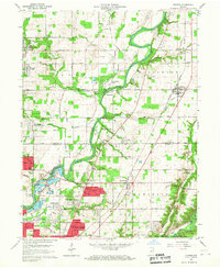
 1967 Fishers1969 Print · USGSNortheast of Indianapolis in the late sixties, this area shows the early pulse of suburban expansion along the White River. Genealogists and local historians can trace the foundations of Fishers, locate the Farley Cem, and see the early layout of New Britton and Allisonville.5 unique versions available
 - 1986 Map of Indianapolis
 1986 Indianapolis1986 Print · USGSThe Indiana capital and its surrounding counties are captured here in the mid-1980s, showcasing the height of its orbital highway development and suburban growth. Researchers can trace the legacy of the Fort Benjamin Harrison Military Reservation, follow the Conrail lines, or locate family roots in Beech Grove, Greencastle, and Zionsville.2 unique versions available
 - 1998 Map of Fishers, 2000 Print
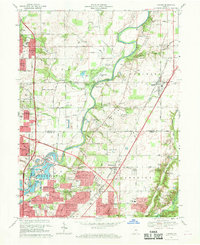
 1998 Fishers2000 Print · USGSThe northern edge of the Indianapolis metro area is shown here in the late nineties as residential growth transforms the White River valley. Genealogists and local historians can locate legacy sites like New Britton, White Chapel, and the historic Heady Cem alongside modern landmarks.
 - 2010 Map of Fishers, 2010 Print
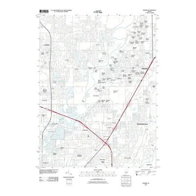 2010 Fishers2010 Print · USGSCovers Downtown Fishers, including Indianapolis, Carmel, and other nearby areas
 - 2013 Map of Fishers, 2013 Print
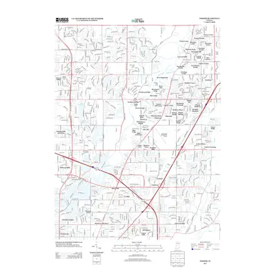 2013 Fishers2013 Print · USGSCovers Downtown Fishers, including Indianapolis, Carmel, and other nearby areas
 - 2016 Map of Fishers, 2016 Print
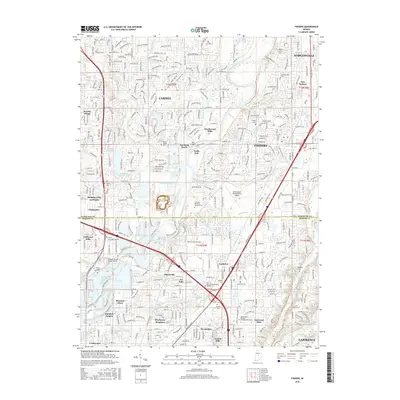 2016 Fishers2016 Print · USGSCovers Downtown Fishers, including Indianapolis, Carmel, and other nearby areas
 - 2019 Map of Fishers, 2019 Print
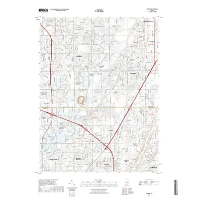 2019 Fishers2019 Print · USGSCovers Downtown Fishers, including Indianapolis, Carmel, and other nearby areas
 - 2023 Map of Fishers, 2023 Print
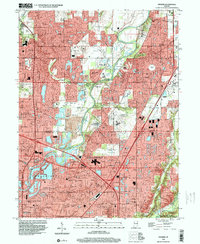
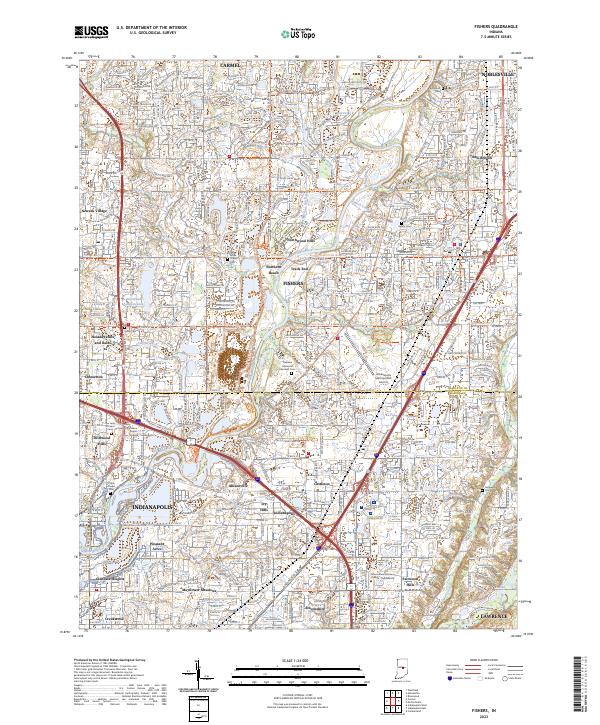 2023 Fishers2023 Print · USGSThe northern suburbs of Indianapolis are captured in this modern survey during a period of intense growth. Local researchers can trace the suburban evolution of Fishers and Carmel, identifying landmarks like Oaklawn Memorial Gardens Cem and the Indianapolis Metropolitan Airport.
End of results
Showing maps 1-14 of 14
Frequently asked questions
- What are the different types of historical maps available for Downtown Fishers?
- What is the oldest map of Downtown Fishers?
- Where can I purchase historical maps of Downtown Fishers for my home or office?
- Where can I download high-res historical maps of Downtown Fishers?
- Are there historical topographic maps available for Downtown Fishers?
- Is there historical aerial imagery available for Downtown Fishers?
- Where are historical maps of Downtown Fishers sourced from?