2020s Maps of Bargersville, Indiana
Explore 2 historic maps of Bargersville from the 2020s. These maps offer a rare glimpse into what life looked like during the 2020s — showing old roads, neighborhoods, homes, and landmarks that have changed or disappeared over time.
Whether you're researching your family's past, planning a metal detecting trip, or studying how Bargersville's landscape evolved across the 2020s, these high-resolution maps are a powerful tool for exploring the history of this region.
- Focus on a specific era: All maps on this page are from the 2020s, giving you a focused view of this time period.
- See what’s changed: Compare century-old streets, trails, and buildings to today's modern landscape using overlays and satellite layers.
- Research with precision: Use these maps for genealogy, historical research, land use analysis, or educational projects.
- View, download, or print: Maps are fully viewable online in high resolution, and can be downloaded or printed for your own records.
Start exploring Bargersville's history through authentic maps from the 2020s. This is your window into the past.
Bargersville, IN maps
(2)- 2022 Map of Mooresville East, 2022 Print
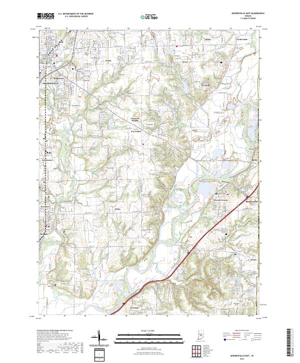 2022 Mooresville East2022 Print · USGSMorgan County in the early twenty-first century is a landscape shaped by the White River and its many tributaries. Genealogists and local historians can trace family roots through numerous sites like Whetzel Cem, Brooklyn Cem, and the Old Butterfield Cem.
 - 2022 Map of Bargersville, 2022 Print
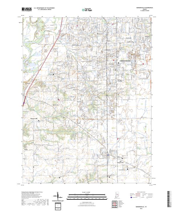 2022 Bargersville2022 Print · USGSBargersville and the western edge of Greenwood are shown here in the early 2020s as residential expansion reaches into traditional farmland. Local historians can trace family roots through numerous pioneer burial grounds like Salem Cem and Utterback Cem or locate the site of Old Bargersville.
End of results
Showing maps 1-2 of 2
Top cities near Bargersville
- Indianapolis historical maps
- Greenwood historical maps
- Plainfield historical maps
- Franklin historical maps
- Beech Grove historical maps
- Avon historical maps
See more
Top neighborhoods of Bargersville
- Bluff Creek historical maps
- Banta historical maps
- Kinder historical maps
- Old Bargersville historical maps
Frequently asked questions
- What are the different types of historical maps available for Bargersville?
- What is the oldest map of Bargersville?
- Where can I purchase historical maps of Bargersville for my home or office?
- Where can I download high-res historical maps of Bargersville?
- Are there historical topographic maps available for Bargersville?
- Is there historical aerial imagery available for Bargersville?
- Where are historical maps of Bargersville sourced from?